Yesmowit Canyon Topo Map Washington
To zoom in, hover over the map of Yesmowit Canyon
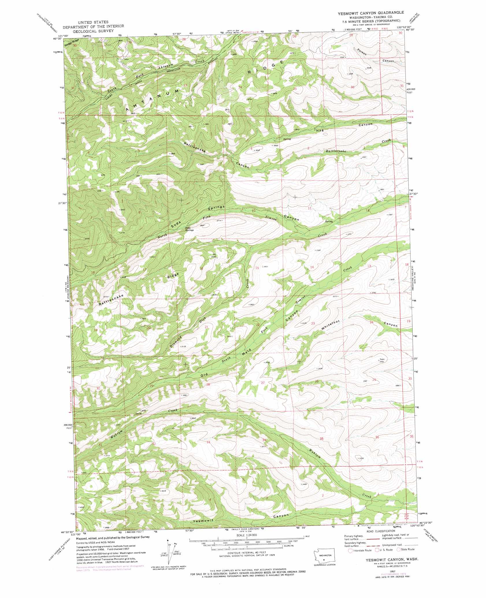
USGS Topo Quad 46120d8 - 1:24,000 scale
| Topo Map Name: | Yesmowit Canyon |
| USGS Topo Quad ID: | 46120d8 |
| Print Size: | ca. 21 1/4" wide x 27" high |
| Southeast Coordinates: | 46.375° N latitude / 120.875° W longitude |
| Map Center Coordinates: | 46.4375° N latitude / 120.9375° W longitude |
| U.S. State: | WA |
| Filename: | o46120d8.jpg |
| Download Map JPG Image: | Yesmowit Canyon topo map 1:24,000 scale |
| Map Type: | Topographic |
| Topo Series: | 7.5´ |
| Map Scale: | 1:24,000 |
| Source of Map Images: | United States Geological Survey (USGS) |
| Alternate Map Versions: |
Yesmowit Canyon WA 1957, updated 1977 Download PDF Buy paper map Yesmowit Canyon WA 2011 Download PDF Buy paper map Yesmowit Canyon WA 2013 Download PDF Buy paper map |
1:24,000 Topo Quads surrounding Yesmowit Canyon
Rimrock Lake |
Tieton Basin |
Weddle Canyon |
Tieton |
Naches |
Darland Mountain |
Foundation Ridge |
Pine Mountain |
Tampico |
Wiley City |
Fairview Ridge |
Piscoe Meadow |
Yesmowit Canyon |
Medicine Valley |
White Swan |
Castile Falls |
Lost Horse Plateau |
Willy Dick Canyon |
Fort Simcoe |
Toppenish Mountain |
Signal Peak |
Poland Butte |
Mckays Butte |
Camas Patch |
Logy Creek Falls |
> Back to 46120a1 at 1:100,000 scale
> Back to 46120a1 at 1:250,000 scale
> Back to U.S. Topo Maps home
Yesmowit Canyon topo map: Gazetteer
Yesmowit Canyon: Springs
Soda Springs elevation 735m 2411′Yesmowit Canyon: Streams
Diamond Dick Creek elevation 600m 1968′Spencer Creek elevation 657m 2155′
Yesmowit Canyon: Valleys
Rattlesnake Canyon elevation 721m 2365′Yesmowit Canyon elevation 487m 1597′
Yesmowit Canyon digital topo map on disk
Buy this Yesmowit Canyon topo map showing relief, roads, GPS coordinates and other geographical features, as a high-resolution digital map file on DVD: