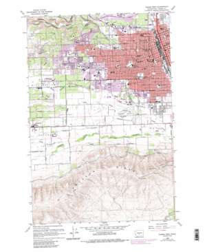
Yakima West Topo Map Washington
To zoom in, hover over the map of Yakima West
USGS Topo Quad 46120e5 - 1:24,000 scale
| Topo Map Name: | Yakima West |
| USGS Topo Quad ID: | 46120e5 |
| Print Size: | ca. 21 1/4" wide x 27" high |
| Southeast Coordinates: | 46.5° N latitude / 120.5° W longitude |
| Map Center Coordinates: | 46.5625° N latitude / 120.5625° W longitude |
| U.S. State: | WA |
| Filename: | o46120e5.jpg |
| Download Map JPG Image: | Yakima West topo map 1:24,000 scale |
| Map Type: | Topographic |
| Topo Series: | 7.5´ |
| Map Scale: | 1:24,000 |
| Source of Map Images: | United States Geological Survey (USGS) |
| Alternate Map Versions: |
Yakima West WA 1958, updated 1960 Download PDF Buy paper map Yakima West WA 1958, updated 1976 Download PDF Buy paper map Yakima West WA 1958, updated 1976 Download PDF Buy paper map Yakima West WA 1958, updated 1985 Download PDF Buy paper map Yakima West WA 1958, updated 1985 Download PDF Buy paper map Yakima West WA 2011 Download PDF Buy paper map Yakima West WA 2013 Download PDF Buy paper map |
1:24,000 Topo Quads surrounding Yakima West
> Back to 46120e1 at 1:100,000 scale
> Back to 46120a1 at 1:250,000 scale
> Back to U.S. Topo Maps home
Yakima West topo map: Gazetteer
Yakima West: Airports
Apple Valley Airport elevation 338m 1108′Don Williams Private Heliport elevation 477m 1564′
Saint Elizabeth Hospital Heliport elevation 332m 1089′
Yakima Air Terminal Airport elevation 326m 1069′
Yakima Valley Memorial Hospital Heliport elevation 372m 1220′
Yakima West: Canals
Congdon Canal elevation 382m 1253′East Unit 1 Highline Canal elevation 308m 1010′
Lateral L elevation 433m 1420′
Naches and Cowiche Ditch elevation 350m 1148′
Union Canal elevation 340m 1115′
Yakima West: Lakes
Lake Myron elevation 343m 1125′Yakima West: Parks
Ahtanum Youth County Park elevation 310m 1017′Broadway Park elevation 316m 1036′
Elks Memorial Park elevation 335m 1099′
Franklin Park elevation 341m 1118′
Gilbert Park elevation 392m 1286′
Larson Park elevation 325m 1066′
Lions Park elevation 326m 1069′
Miller Park elevation 327m 1072′
Milroy Park elevation 337m 1105′
Yakima West: Populated Places
Ahtanum elevation 380m 1246′Fruitvale elevation 345m 1131′
South Broadway elevation 314m 1030′
West Valley elevation 364m 1194′
Yakima elevation 326m 1069′
Yakima West: Streams
Bachelor Creek elevation 304m 997′Hatton Creek elevation 360m 1181′
Spring Creek elevation 317m 1040′
Yakima West: Valleys
Ahtanum Valley elevation 342m 1122′Pecks Canyon elevation 354m 1161′
Wide Hollow elevation 345m 1131′
Yakima West digital topo map on disk
Buy this Yakima West topo map showing relief, roads, GPS coordinates and other geographical features, as a high-resolution digital map file on DVD:


