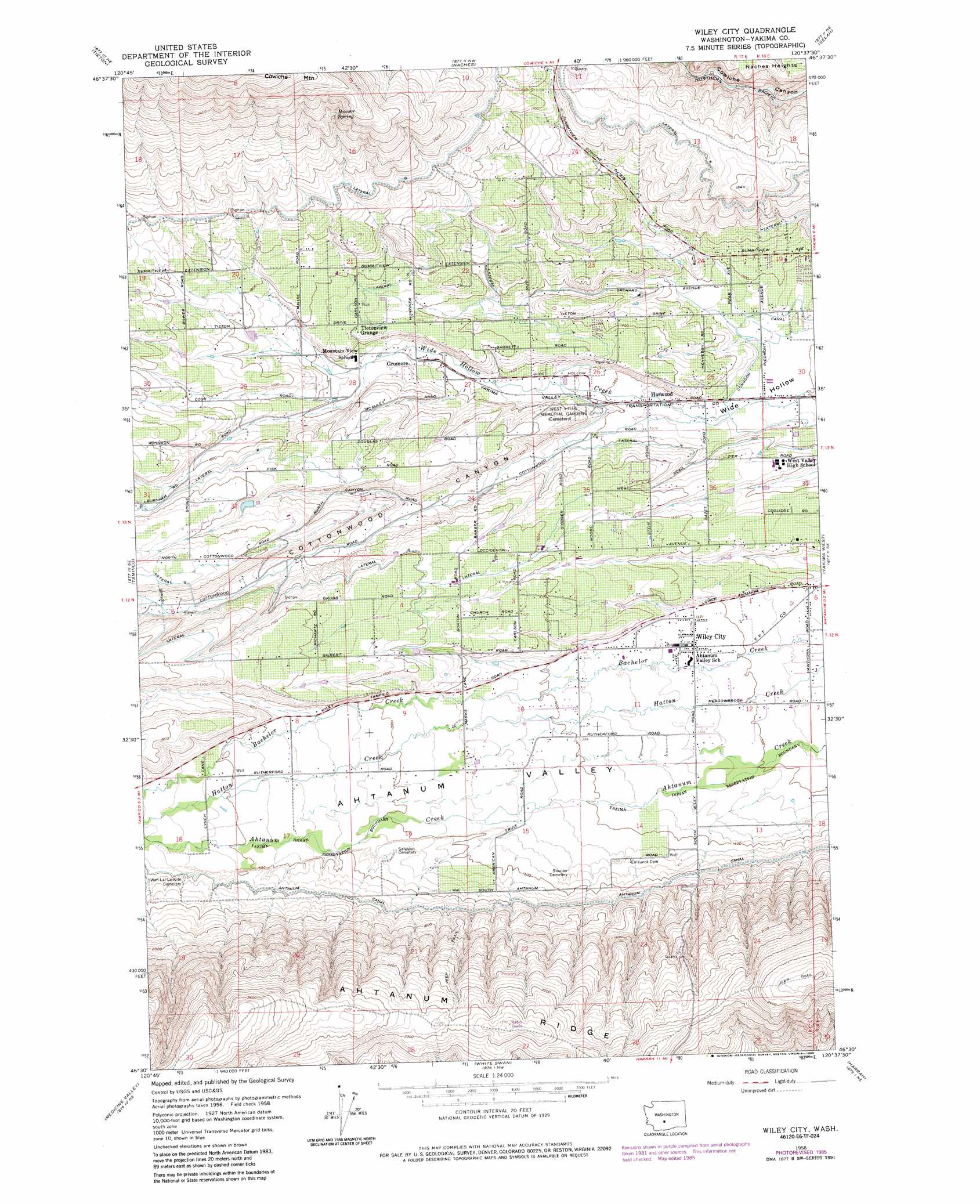
Wiley City Topo Map Washington
To zoom in, hover over the map of Wiley City
USGS Topo Quad 46120e6 - 1:24,000 scale
| Topo Map Name: | Wiley City |
| USGS Topo Quad ID: | 46120e6 |
| Print Size: | ca. 21 1/4" wide x 27" high |
| Southeast Coordinates: | 46.5° N latitude / 120.625° W longitude |
| Map Center Coordinates: | 46.5625° N latitude / 120.6875° W longitude |
| U.S. State: | WA |
| Filename: | o46120e6.jpg |
| Download Map JPG Image: | Wiley City topo map 1:24,000 scale |
| Map Type: | Topographic |
| Topo Series: | 7.5´ |
| Map Scale: | 1:24,000 |
| Source of Map Images: | United States Geological Survey (USGS) |
| Alternate Map Versions: |
Wiley City WA 1958, updated 1960 Download PDF Buy paper map Wiley City WA 1958, updated 1976 Download PDF Buy paper map Wiley City WA 1958, updated 1985 Download PDF Buy paper map Wiley City WA 2011 Download PDF Buy paper map Wiley City WA 2013 Download PDF Buy paper map |
1:24,000 Topo Quads surrounding Wiley City
Nile |
Milk Canyon |
Wenas Lake |
The Cottonwoods |
Wymer |
Weddle Canyon |
Tieton |
Naches |
Selah |
Pomona |
Pine Mountain |
Tampico |
Wiley City |
Yakima West |
Yakima East |
Yesmowit Canyon |
Medicine Valley |
White Swan |
Harrah |
Wapato |
Willy Dick Canyon |
Fort Simcoe |
Toppenish Mountain |
Harrah Se |
Toppenish Sw |
> Back to 46120e1 at 1:100,000 scale
> Back to 46120a1 at 1:250,000 scale
> Back to U.S. Topo Maps home
Wiley City topo map: Gazetteer
Wiley City: Canals
Ahtanum Canal elevation 491m 1610′Lateral K elevation 522m 1712′
Lateral N elevation 397m 1302′
Lateral P elevation 482m 1581′
Lateral R elevation 500m 1640′
Lateral S elevation 539m 1768′
Lateral T elevation 468m 1535′
Wiley City: Dams
Parker Reservoir Dam elevation 514m 1686′Wiley City: Populated Places
Elliott Ave elevation 428m 1404′Gromore elevation 432m 1417′
Harwood elevation 389m 1276′
Summitview elevation 389m 1276′
Tietonview Grange elevation 476m 1561′
Wiley City elevation 403m 1322′
Wiley City: Reservoirs
Parker Reservoir elevation 514m 1686′Wiley City: Springs
Bowser Spring elevation 677m 2221′Wiley City: Valleys
Cottonwood Canyon elevation 396m 1299′Wiley City digital topo map on disk
Buy this Wiley City topo map showing relief, roads, GPS coordinates and other geographical features, as a high-resolution digital map file on DVD: