Weddle Canyon Topo Map Washington
To zoom in, hover over the map of Weddle Canyon
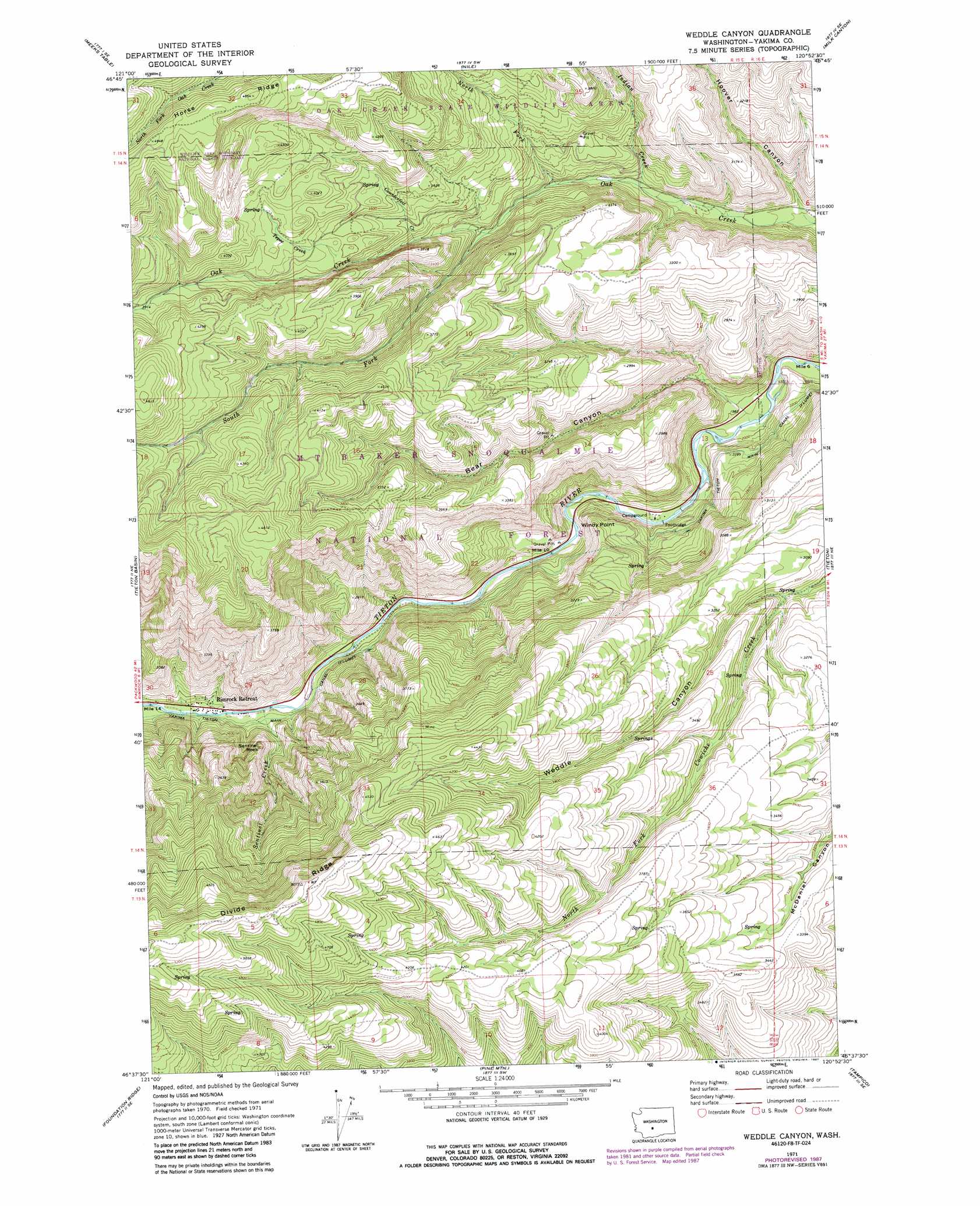
USGS Topo Quad 46120f8 - 1:24,000 scale
| Topo Map Name: | Weddle Canyon |
| USGS Topo Quad ID: | 46120f8 |
| Print Size: | ca. 21 1/4" wide x 27" high |
| Southeast Coordinates: | 46.625° N latitude / 120.875° W longitude |
| Map Center Coordinates: | 46.6875° N latitude / 120.9375° W longitude |
| U.S. State: | WA |
| Filename: | o46120f8.jpg |
| Download Map JPG Image: | Weddle Canyon topo map 1:24,000 scale |
| Map Type: | Topographic |
| Topo Series: | 7.5´ |
| Map Scale: | 1:24,000 |
| Source of Map Images: | United States Geological Survey (USGS) |
| Alternate Map Versions: |
Weddle Canyon WA 1971, updated 1974 Download PDF Buy paper map Weddle Canyon WA 1971, updated 1987 Download PDF Buy paper map Weddle Canyon WA 2000, updated 2001 Download PDF Buy paper map Weddle Canyon WA 2011 Download PDF Buy paper map Weddle Canyon WA 2014 Download PDF Buy paper map |
| FStopo: | US Forest Service topo Weddle Canyon is available: Download FStopo PDF Download FStopo TIF |
1:24,000 Topo Quads surrounding Weddle Canyon
Old Scab Mountain |
Cliffdell |
Manastash Lake |
Hudson Creek |
Manastash Creek |
Timberwolf Mountain |
Meeks Table |
Nile |
Milk Canyon |
Wenas Lake |
Rimrock Lake |
Tieton Basin |
Weddle Canyon |
Tieton |
Naches |
Darland Mountain |
Foundation Ridge |
Pine Mountain |
Tampico |
Wiley City |
Fairview Ridge |
Piscoe Meadow |
Yesmowit Canyon |
Medicine Valley |
White Swan |
> Back to 46120e1 at 1:100,000 scale
> Back to 46120a1 at 1:250,000 scale
> Back to U.S. Topo Maps home
Weddle Canyon topo map: Gazetteer
Weddle Canyon: Canals
Yakima Tieton Main Canal elevation 712m 2335′Weddle Canyon: Cliffs
Windy Point elevation 733m 2404′Weddle Canyon: Pillars
Sentinel Rock elevation 906m 2972′Weddle Canyon: Ridges
Horse Ridge elevation 1477m 4845′Weddle Canyon: Streams
Counterfeit Creek elevation 987m 3238′Indian Creek elevation 795m 2608′
North Fork Oak Creek elevation 842m 2762′
Sentinel Creek elevation 678m 2224′
South Fork Oak Creek elevation 907m 2975′
Tepee Creek elevation 1105m 3625′
Weddle Canyon: Valleys
Bear Canyon elevation 619m 2030′Hoover Canyon elevation 717m 2352′
Weddle Canyon elevation 874m 2867′
Weddle Canyon digital topo map on disk
Buy this Weddle Canyon topo map showing relief, roads, GPS coordinates and other geographical features, as a high-resolution digital map file on DVD: