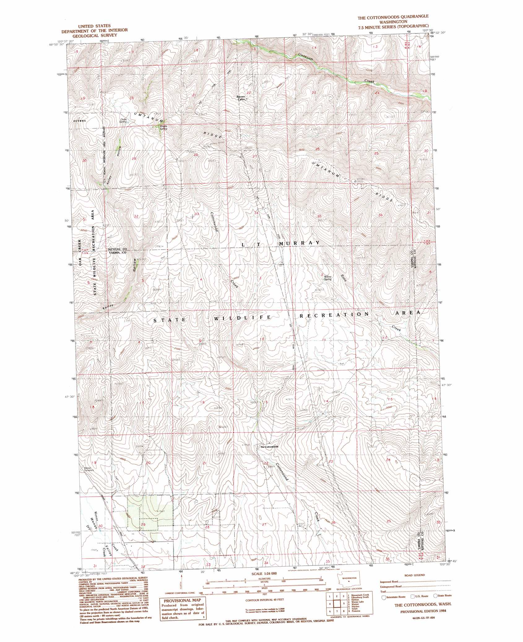
The Cottonwoods Topo Map Washington
To zoom in, hover over the map of The Cottonwoods
USGS Topo Quad 46120g5 - 1:24,000 scale
| Topo Map Name: | The Cottonwoods |
| USGS Topo Quad ID: | 46120g5 |
| Print Size: | ca. 21 1/4" wide x 27" high |
| Southeast Coordinates: | 46.75° N latitude / 120.5° W longitude |
| Map Center Coordinates: | 46.8125° N latitude / 120.5625° W longitude |
| U.S. State: | WA |
| Filename: | o46120g5.jpg |
| Download Map JPG Image: | The Cottonwoods topo map 1:24,000 scale |
| Map Type: | Topographic |
| Topo Series: | 7.5´ |
| Map Scale: | 1:24,000 |
| Source of Map Images: | United States Geological Survey (USGS) |
| Alternate Map Versions: |
The Cottonwoods WA 1984, updated 1985 Download PDF Buy paper map The Cottonwoods WA 2011 Download PDF Buy paper map The Cottonwoods WA 2013 Download PDF Buy paper map |
1:24,000 Topo Quads surrounding The Cottonwoods
Taneum Canyon |
Thorp |
Ellensburg North |
Colockum Pass Sw |
Colockum Pass Se |
Hudson Creek |
Manastash Creek |
Ellensburg South |
Kittitas |
East Kittitas |
Milk Canyon |
Wenas Lake |
The Cottonwoods |
Wymer |
Badger Gap |
Tieton |
Naches |
Selah |
Pomona |
Selah Springs |
Tampico |
Wiley City |
Yakima West |
Yakima East |
Elephant Mountain |
> Back to 46120e1 at 1:100,000 scale
> Back to 46120a1 at 1:250,000 scale
> Back to U.S. Topo Maps home
The Cottonwoods topo map: Gazetteer
The Cottonwoods: Canals
Longmire Wenas Canal elevation 482m 1581′The Cottonwoods: Parks
L T Murray State Wildlife Recreation Area elevation 713m 2339′The Cottonwoods: Springs
Oasis Spring elevation 1035m 3395′Willow Spring elevation 699m 2293′
Wright Spring elevation 1005m 3297′
The Cottonwoods digital topo map on disk
Buy this The Cottonwoods topo map showing relief, roads, GPS coordinates and other geographical features, as a high-resolution digital map file on DVD: