Outlet Falls Topo Map Washington
To zoom in, hover over the map of Outlet Falls
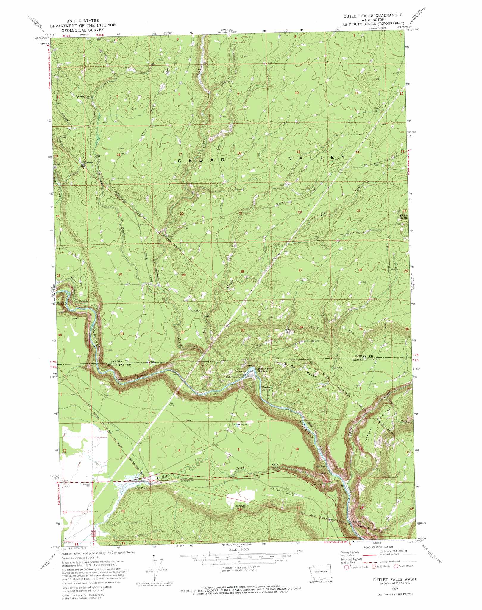
USGS Topo Quad 46121a2 - 1:24,000 scale
| Topo Map Name: | Outlet Falls |
| USGS Topo Quad ID: | 46121a2 |
| Print Size: | ca. 21 1/4" wide x 27" high |
| Southeast Coordinates: | 46° N latitude / 121.125° W longitude |
| Map Center Coordinates: | 46.0625° N latitude / 121.1875° W longitude |
| U.S. State: | WA |
| Filename: | o46121a2.jpg |
| Download Map JPG Image: | Outlet Falls topo map 1:24,000 scale |
| Map Type: | Topographic |
| Topo Series: | 7.5´ |
| Map Scale: | 1:24,000 |
| Source of Map Images: | United States Geological Survey (USGS) |
| Alternate Map Versions: |
Outlet Falls WA 1970, updated 1973 Download PDF Buy paper map Outlet Falls WA 2011 Download PDF Buy paper map Outlet Falls WA 2014 Download PDF Buy paper map |
1:24,000 Topo Quads surrounding Outlet Falls
Glaciate Butte |
Windy Point |
Castile Falls |
Lost Horse Plateau |
Willy Dick Canyon |
Mount Adams East |
Jungle Butte |
Signal Peak |
Poland Butte |
Mckays Butte |
King Mountain |
Glenwood |
Outlet Falls |
Twin Buttes |
Hagerty Butte |
Quigley Butte |
Camas Prairie |
Dead Canyon |
Grayback Mountain |
White Pine Buttes |
Husum |
Appleton |
Klickitat |
Wahkiacus |
Centerville |
> Back to 46121a1 at 1:100,000 scale
> Back to 46120a1 at 1:250,000 scale
> Back to U.S. Topo Maps home
Outlet Falls topo map: Gazetteer
Outlet Falls: Basins
Cedar Valley elevation 750m 2460′Schafer Pocket elevation 550m 1804′
Outlet Falls: Dams
Mill Pond Dam elevation 550m 1804′Outlet Falls: Falls
Outlet Falls elevation 476m 1561′Outlet Falls: Flats
Borde Flats elevation 477m 1564′Outlet Falls: Reservoirs
Mill Pond elevation 550m 1804′Outlet Falls: Springs
Indian Ford Springs elevation 375m 1230′Wonder Spring elevation 407m 1335′
Outlet Falls: Streams
Bear Creek elevation 564m 1850′Deer Creek elevation 440m 1443′
Elk Creek elevation 377m 1236′
Outlet Creek elevation 348m 1141′
Schafer Creek elevation 460m 1509′
Skunk Creek elevation 450m 1476′
Trout Creek elevation 382m 1253′
White Creek elevation 343m 1125′
Outlet Falls digital topo map on disk
Buy this Outlet Falls topo map showing relief, roads, GPS coordinates and other geographical features, as a high-resolution digital map file on DVD: