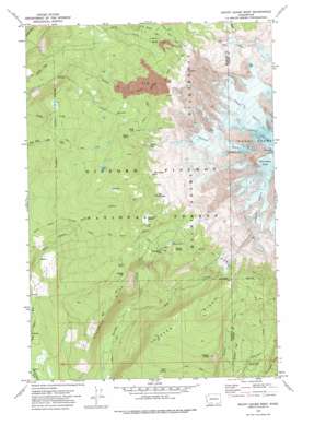
Mount Adams West Topo Map Washington
To zoom in, hover over the map of Mount Adams West
USGS Topo Quad 46121b5 - 1:24,000 scale
| Topo Map Name: | Mount Adams West |
| USGS Topo Quad ID: | 46121b5 |
| Print Size: | ca. 21 1/4" wide x 27" high |
| Southeast Coordinates: | 46.125° N latitude / 121.5° W longitude |
| Map Center Coordinates: | 46.1875° N latitude / 121.5625° W longitude |
| U.S. State: | WA |
| Filename: | o46121b5.jpg |
| Download Map JPG Image: | Mount Adams West topo map 1:24,000 scale |
| Map Type: | Topographic |
| Topo Series: | 7.5´ |
| Map Scale: | 1:24,000 |
| Source of Map Images: | United States Geological Survey (USGS) |
| Alternate Map Versions: |
Mount Adams West WA 1970, updated 1974 Download PDF Buy paper map Mount Adams West WA 1970, updated 1978 Download PDF Buy paper map Mount Adams West WA 1970, updated 1978 Download PDF Buy paper map Mount Adams West WA 1998, updated 2003 Download PDF Buy paper map Mount Adams West WA 2011 Download PDF Buy paper map Mount Adams West WA 2014 Download PDF Buy paper map |
| FStopo: | US Forest Service topo Mount Adams West is available: Download FStopo PDF Download FStopo TIF |
1:24,000 Topo Quads surrounding Mount Adams West
> Back to 46121a1 at 1:100,000 scale
> Back to 46120a1 at 1:250,000 scale
> Back to U.S. Topo Maps home
Mount Adams West topo map: Gazetteer
Mount Adams West: Flats
Horseshoe Meadow elevation 1803m 5915′Madcat Meadow elevation 1764m 5787′
Mount Adams West: Glaciers
Adams Glacier elevation 2640m 8661′Avalanche Glacier elevation 2532m 8307′
Pinnacle Glacier elevation 2440m 8005′
White Salmon Glacier elevation 3344m 10971′
Mount Adams West: Lakes
Crystal Lake elevation 1911m 6269′Lookingglass Lake elevation 1709m 5606′
Sheep Lake elevation 1759m 5770′
Mount Adams West: Pillars
Burnt Rock elevation 1807m 5928′The Pinnacle elevation 3678m 12066′
Mount Adams West: Ridges
Crofton Ridge elevation 1799m 5902′Stagman Ridge elevation 1373m 4504′
Mount Adams West: Springs
Rock Spring elevation 1397m 4583′Mount Adams West: Streams
Mutton Creek elevation 1209m 3966′Salt Creek elevation 1135m 3723′
Shorthorn Creek elevation 1328m 4356′
Mount Adams West: Summits
Crofton Butte elevation 1601m 5252′Grassy Hill elevation 1597m 5239′
The Bumper elevation 1951m 6400′
The Hump elevation 2001m 6564′
Mount Adams West: Trails
Round the Mountain Trail elevation 1858m 6095′Mount Adams West digital topo map on disk
Buy this Mount Adams West topo map showing relief, roads, GPS coordinates and other geographical features, as a high-resolution digital map file on DVD:


