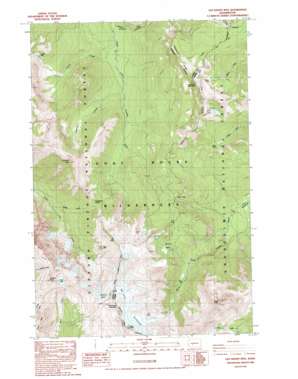
Old Snowy Mountain Topo Map Washington
To zoom in, hover over the map of Old Snowy Mountain
USGS Topo Quad 46121e4 - 1:24,000 scale
| Topo Map Name: | Old Snowy Mountain |
| USGS Topo Quad ID: | 46121e4 |
| Print Size: | ca. 21 1/4" wide x 27" high |
| Southeast Coordinates: | 46.5° N latitude / 121.375° W longitude |
| Map Center Coordinates: | 46.5625° N latitude / 121.4375° W longitude |
| U.S. State: | WA |
| Filename: | o46121e4.jpg |
| Download Map JPG Image: | Old Snowy Mountain topo map 1:24,000 scale |
| Map Type: | Topographic |
| Topo Series: | 7.5´ |
| Map Scale: | 1:24,000 |
| Source of Map Images: | United States Geological Survey (USGS) |
| Alternate Map Versions: |
Old Snowy Mtn. WA 1988, updated 1989 Download PDF Buy paper map Old Snowy Mountain WA 2011 Download PDF Buy paper map Old Snowy Mountain WA 2014 Download PDF Buy paper map |
| FStopo: | US Forest Service topo Old Snowy Mountain is available: Download FStopo PDF Download FStopo TIF |
1:24,000 Topo Quads surrounding Old Snowy Mountain
> Back to 46121e1 at 1:100,000 scale
> Back to 46120a1 at 1:250,000 scale
> Back to U.S. Topo Maps home
Old Snowy Mountain topo map: Gazetteer
Old Snowy Mountain: Basins
McCall Basin elevation 1526m 5006′Old Snowy Mountain: Capes
Hawkeye Point elevation 2236m 7335′Old Snowy Mountain: Gaps
Elk Pass elevation 2039m 6689′Packwood Saddle elevation 1679m 5508′
Tieton Pass elevation 1458m 4783′
Old Snowy Mountain: Glaciers
McCall Glacier elevation 2163m 7096′Packwood Glacier elevation 2106m 6909′
Old Snowy Mountain: Lakes
Coyote Lake elevation 1572m 5157′Goat Lake elevation 1957m 6420′
Lutz Lake elevation 1555m 5101′
Miriam Lake elevation 1765m 5790′
Shoe Lake elevation 1864m 6115′
Old Snowy Mountain: Ridges
Hogback Ridge elevation 1903m 6243′Old Snowy Mountain: Springs
Hidden Spring elevation 1650m 5413′Old Snowy Mountain: Streams
Chimney Creek elevation 1040m 3412′Coyote Creek elevation 989m 3244′
Saddle Creek elevation 1084m 3556′
Old Snowy Mountain: Summits
Chimney Rock elevation 2032m 6666′Egg Butte elevation 1832m 6010′
Hogback Mountain elevation 2052m 6732′
Ives Peak elevation 2353m 7719′
Old Snowy Mountain elevation 2389m 7837′
Pigtail Peak elevation 1804m 5918′
Tieton Peak elevation 2355m 7726′
Old Snowy Mountain: Trails
Clear Lost Trail elevation 1416m 4645′Coyote Trail elevation 1838m 6030′
Lily Basin Trail elevation 1956m 6417′
Shoe Lake Trail elevation 1469m 4819′
Old Snowy Mountain digital topo map on disk
Buy this Old Snowy Mountain topo map showing relief, roads, GPS coordinates and other geographical features, as a high-resolution digital map file on DVD:


