Sawtooth Ridge Topo Map Washington
To zoom in, hover over the map of Sawtooth Ridge
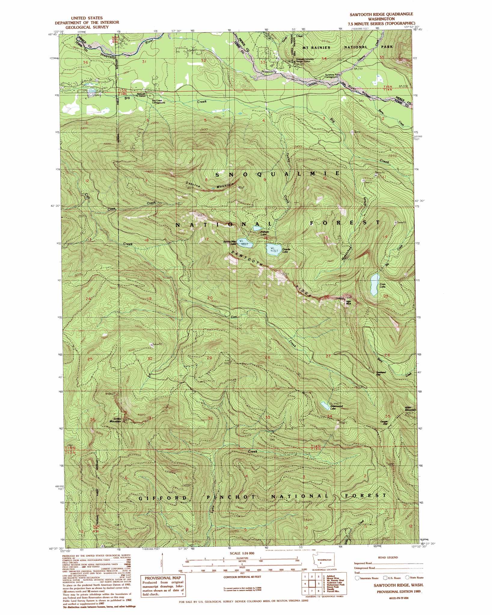
USGS Topo Quad 46121f8 - 1:24,000 scale
| Topo Map Name: | Sawtooth Ridge |
| USGS Topo Quad ID: | 46121f8 |
| Print Size: | ca. 21 1/4" wide x 27" high |
| Southeast Coordinates: | 46.625° N latitude / 121.875° W longitude |
| Map Center Coordinates: | 46.6875° N latitude / 121.9375° W longitude |
| U.S. State: | WA |
| Filename: | o46121f8.jpg |
| Download Map JPG Image: | Sawtooth Ridge topo map 1:24,000 scale |
| Map Type: | Topographic |
| Topo Series: | 7.5´ |
| Map Scale: | 1:24,000 |
| Source of Map Images: | United States Geological Survey (USGS) |
| Alternate Map Versions: |
Sawtooth Ridge WA 1989, updated 1989 Download PDF Buy paper map Sawtooth Ridge WA 1998, updated 2003 Download PDF Buy paper map Sawtooth Ridge WA 2011 Download PDF Buy paper map Sawtooth Ridge WA 2014 Download PDF Buy paper map |
| FStopo: | US Forest Service topo Sawtooth Ridge is available: Download FStopo PDF Download FStopo TIF |
1:24,000 Topo Quads surrounding Sawtooth Ridge
Lake Kapowsin |
Le Dout Creek |
Golden Lakes |
Mowich Lake |
Sunrise |
Elbe |
Ashford |
Mount Wow |
Mount Rainier West |
Mt Rainier East |
Mineral |
Anderson Lake |
Sawtooth Ridge |
Wahpenayo Peak |
Tatoosh Lakes |
Glenoma |
Kiona Peak |
Randle |
Purcell Mountain |
Packwood |
Vanson Peak |
Cowlitz Falls |
Greenhorn Buttes |
Tower Rock |
Blue Lake |
> Back to 46121e1 at 1:100,000 scale
> Back to 46120a1 at 1:250,000 scale
> Back to U.S. Topo Maps home
Sawtooth Ridge topo map: Gazetteer
Sawtooth Ridge: Gaps
Cougar Gap elevation 1354m 4442′Towhead Gap elevation 1314m 4311′
Sawtooth Ridge: Lakes
Bertha May Lake elevation 1237m 4058′Cora Lake elevation 1169m 3835′
Granite Lake elevation 1274m 4179′
Greenwood Lake elevation 1361m 4465′
Pothole Lake elevation 1120m 3674′
Sawtooth Ridge: Pillars
High Rock elevation 1571m 5154′Sawtooth Ridge: Ridges
Sawtooth Ridge elevation 1571m 5154′Sawtooth Ridge: Streams
Berry Creek elevation 647m 2122′Cave Creek elevation 641m 2103′
Mesatchee Creek elevation 694m 2276′
Tahoma Creek elevation 629m 2063′
Teeley Creek elevation 602m 1975′
Tenas Creek elevation 584m 1916′
Sawtooth Ridge: Summits
Griffin Mountain elevation 1568m 5144′Osborne Mountain elevation 1480m 4855′
Sawtooth Ridge: Trails
Big Creek Trail elevation 1235m 4051′Osborne Mountain Trail elevation 1413m 4635′
Sawtooth Ridge digital topo map on disk
Buy this Sawtooth Ridge topo map showing relief, roads, GPS coordinates and other geographical features, as a high-resolution digital map file on DVD: