Mount Mitchell Topo Map Washington
To zoom in, hover over the map of Mount Mitchell
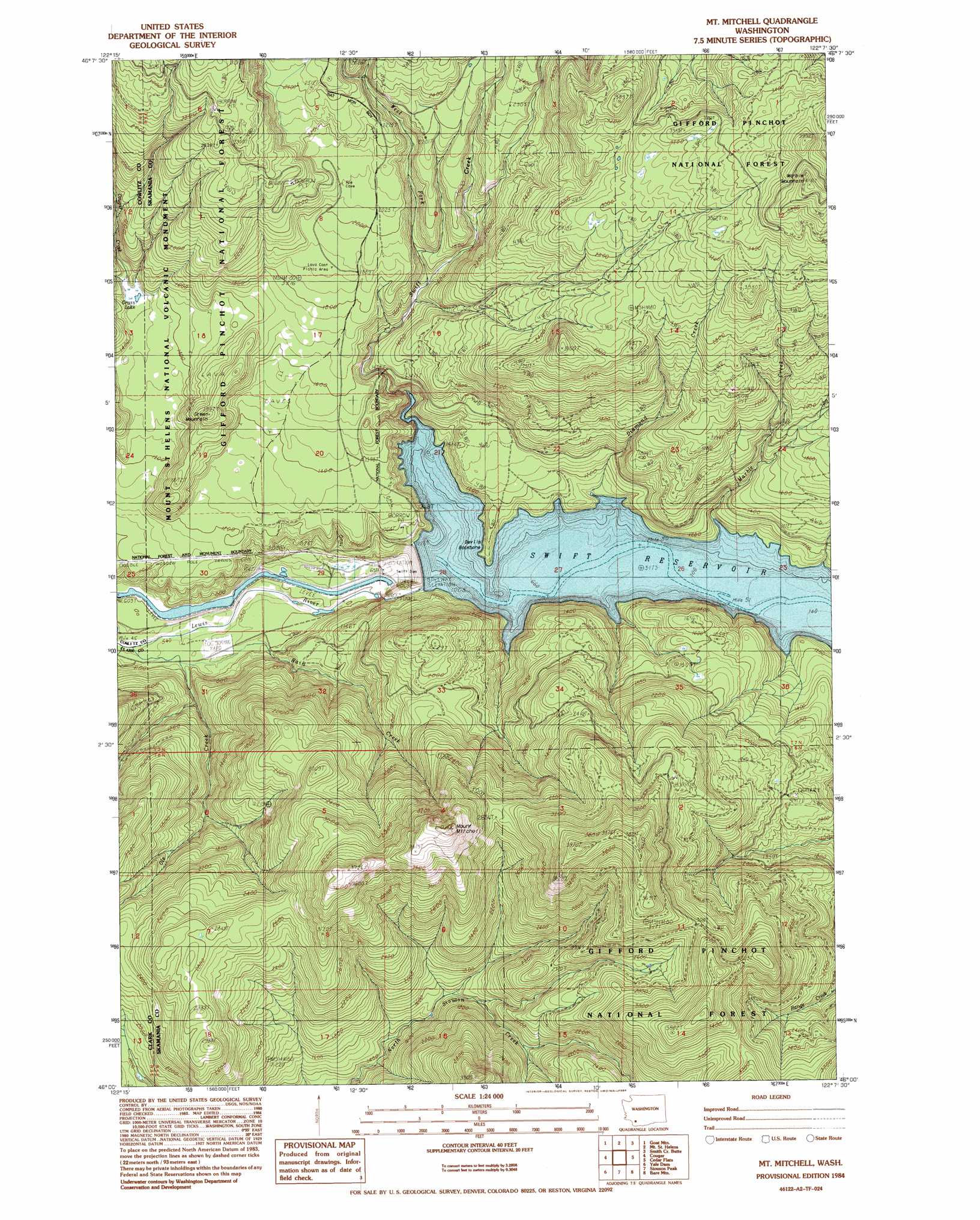
USGS Topo Quad 46122a2 - 1:24,000 scale
| Topo Map Name: | Mount Mitchell |
| USGS Topo Quad ID: | 46122a2 |
| Print Size: | ca. 21 1/4" wide x 27" high |
| Southeast Coordinates: | 46° N latitude / 122.125° W longitude |
| Map Center Coordinates: | 46.0625° N latitude / 122.1875° W longitude |
| U.S. State: | WA |
| Filename: | o46122a2.jpg |
| Download Map JPG Image: | Mount Mitchell topo map 1:24,000 scale |
| Map Type: | Topographic |
| Topo Series: | 7.5´ |
| Map Scale: | 1:24,000 |
| Source of Map Images: | United States Geological Survey (USGS) |
| Alternate Map Versions: |
Mt Mitchell WA 1984, updated 1984 Download PDF Buy paper map Mt Mitchell WA 1998, updated 2003 Download PDF Buy paper map Mount Mitchell WA 2011 Download PDF Buy paper map Mount Mitchell WA 2013 Download PDF Buy paper map |
| FStopo: | US Forest Service topo Mount Mitchell is available: Download FStopo PDF Download FStopo TIF |
1:24,000 Topo Quads surrounding Mount Mitchell
Huffstadt Mountain |
Elk Rock |
Spirit Lake West |
Spirit Lake East |
French Butte |
Elk Mountain |
Goat Mountain |
Mount Sainte Helens |
Smith Creek Butte |
Spencer Butte |
Lakeview Peak |
Cougar |
Mount Mitchell |
Cedar Flats |
Burnt Peak |
Amboy |
Yale Dam |
Siouxon Peak |
Bare Mountain |
Termination Point |
Yacolt |
Dole |
Gumboot Mountain |
Lookout Mountain |
Stabler |
> Back to 46122a1 at 1:100,000 scale
> Back to 46122a1 at 1:250,000 scale
> Back to U.S. Topo Maps home
Mount Mitchell topo map: Gazetteer
Mount Mitchell: Dams
Swift Dam elevation 308m 1010′Mount Mitchell: Lakes
Grass Lake elevation 409m 1341′Mount Mitchell: Reservoirs
Swift Reservoir elevation 308m 1010′Mount Mitchell: Ridges
Devils Backbone elevation 368m 1207′Mount Mitchell: Streams
Cougar Creek elevation 424m 1391′Diamond Creek elevation 316m 1036′
Marble Creek elevation 310m 1017′
Ole Creek elevation 165m 541′
Rain Creek elevation 171m 561′
Swift Creek elevation 308m 1010′
West Fork Swift Creek elevation 442m 1450′
Mount Mitchell: Summits
Green Mountain elevation 601m 1971′Marble Mountain elevation 1247m 4091′
Mount Mitchell elevation 1187m 3894′
Mount Mitchell digital topo map on disk
Buy this Mount Mitchell topo map showing relief, roads, GPS coordinates and other geographical features, as a high-resolution digital map file on DVD: