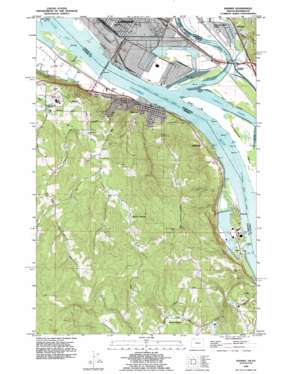
Rainier Topo Map Oregon
To zoom in, hover over the map of Rainier
USGS Topo Quad 46122a8 - 1:24,000 scale
| Topo Map Name: | Rainier |
| USGS Topo Quad ID: | 46122a8 |
| Print Size: | ca. 21 1/4" wide x 27" high |
| Southeast Coordinates: | 46° N latitude / 122.875° W longitude |
| Map Center Coordinates: | 46.0625° N latitude / 122.9375° W longitude |
| U.S. States: | OR, WA |
| Filename: | o46122a8.jpg |
| Download Map JPG Image: | Rainier topo map 1:24,000 scale |
| Map Type: | Topographic |
| Topo Series: | 7.5´ |
| Map Scale: | 1:24,000 |
| Source of Map Images: | United States Geological Survey (USGS) |
| Alternate Map Versions: |
Rainier OR 1953, updated 1955 Download PDF Buy paper map Rainier OR 1953, updated 1965 Download PDF Buy paper map Rainier OR 1953, updated 1971 Download PDF Buy paper map Rainier OR 1953, updated 1981 Download PDF Buy paper map Rainier OR 1990, updated 1995 Download PDF Buy paper map Rainier OR 2011 Download PDF Buy paper map Rainier OR 2014 Download PDF Buy paper map |
1:24,000 Topo Quads surrounding Rainier
> Back to 46122a1 at 1:100,000 scale
> Back to 46122a1 at 1:250,000 scale
> Back to U.S. Topo Maps home
Rainier topo map: Gazetteer
Rainier: Airports
Kelso-Longview Airport elevation 4m 13′Rainier: Bars
Prescott Bar elevation 0m 0′Rainier Bar elevation 3m 9′
Slaughters Bar elevation 1m 3′
Rainier: Beaches
Cottonwood Beach elevation 0m 0′Dibblees Beach elevation 0m 0′
Red Mill Beach elevation 0m 0′
Rainier: Bends
Cottonwood Island Turn elevation 2m 6′Rainier: Bridges
Lewis and Clark Bridge elevation 1m 3′Rainier: Channels
Carrolls Channel elevation 0m 0′Cottonwood Island Lower Range elevation 0m 0′
Cottonwood Island Lower Range elevation 1m 3′
Cottonwood Island Upper Range elevation 0m 0′
Cottonwood Island Upper Range elevation 2m 6′
Slaughters Channel elevation 1m 3′
Rainier: Guts
Ditch Number Three elevation 4m 13′Marys Slough elevation 6m 19′
Rainier: Islands
Cottonwood Island elevation 4m 13′Rainier: Lakes
Log Pond elevation 0m 0′Rainier: Levees
Dribblee Dike elevation 5m 16′Slaughters Dike elevation 1m 3′
Rainier: Parks
Highlands Park elevation 4m 13′Hudson Country Park elevation 152m 498′
Laurel Beach County Park elevation 13m 42′
Prescott Beach County Park elevation 2m 6′
Rainier: Pillars
Coffin Rock elevation 17m 55′Rainier: Populated Places
Beaver Homes elevation 71m 232′Beaver Springs elevation 192m 629′
Goble elevation 12m 39′
Lindbergh elevation 44m 144′
Longview Junction elevation 3m 9′
Prescott elevation 15m 49′
Rainier elevation 15m 49′
Reuben elevation 23m 75′
Rainier: Post Offices
Goble Post Office (historical) elevation 12m 39′Neer Post Office (historical) elevation 7m 22′
Prescott Post Office (historical) elevation 15m 49′
Rainier Post Office elevation 15m 49′
Reuben Post Office (historical) elevation 23m 75′
Rainier: Reservoirs
Pruitt Reservoir elevation 238m 780′Rainier Reservoir elevation 107m 351′
Rainier: Springs
Winters Spring elevation 180m 590′Rainier: Streams
Carr Slough elevation 2m 6′Coweeman River elevation 2m 6′
Cowlitz River elevation 1m 3′
East Branch Fox Creek elevation 116m 380′
Fox Creek elevation 3m 9′
Girt Creek elevation 171m 561′
Goble Creek elevation 2m 6′
Harding Creek elevation 6m 19′
Jack Falls elevation 7m 22′
Little Jack Falls elevation 7m 22′
Neer Creek elevation 7m 22′
Nice Creek elevation 3m 9′
Oasis Creek elevation 6m 19′
Owl Creek elevation 12m 39′
Piedmont Creek elevation 5m 16′
South Fork Goble Creek elevation 42m 137′
Weller Creek elevation 142m 465′
Rainier: Valleys
Beaver Valley elevation 152m 498′Rainier digital topo map on disk
Buy this Rainier topo map showing relief, roads, GPS coordinates and other geographical features, as a high-resolution digital map file on DVD:


