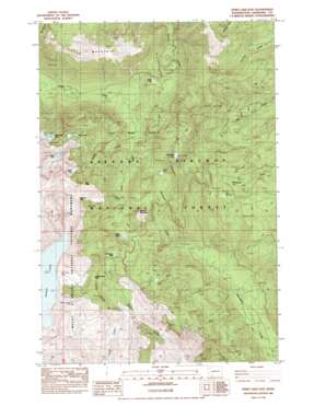
Spirit Lake East Topo Map Washington
To zoom in, hover over the map of Spirit Lake East
USGS Topo Quad 46122c1 - 1:24,000 scale
| Topo Map Name: | Spirit Lake East |
| USGS Topo Quad ID: | 46122c1 |
| Print Size: | ca. 21 1/4" wide x 27" high |
| Southeast Coordinates: | 46.25° N latitude / 122° W longitude |
| Map Center Coordinates: | 46.3125° N latitude / 122.0625° W longitude |
| U.S. State: | WA |
| Filename: | o46122c1.jpg |
| Download Map JPG Image: | Spirit Lake East topo map 1:24,000 scale |
| Map Type: | Topographic |
| Topo Series: | 7.5´ |
| Map Scale: | 1:24,000 |
| Source of Map Images: | United States Geological Survey (USGS) |
| Alternate Map Versions: |
Spirit Lake SE WA 1975, updated 1980 Download PDF Buy paper map Spirit Lake East WA 1984, updated 1984 Download PDF Buy paper map Spirit Lake East WA 1994, updated 1996 Download PDF Buy paper map Spirit Lake East WA 2011 Download PDF Buy paper map Spirit Lake East WA 2013 Download PDF Buy paper map |
| FStopo: | US Forest Service topo Spirit Lake East is available: Download FStopo PDF Download FStopo TIF |
1:24,000 Topo Quads surrounding Spirit Lake East
> Back to 46122a1 at 1:100,000 scale
> Back to 46122a1 at 1:250,000 scale
> Back to U.S. Topo Maps home
Spirit Lake East topo map: Gazetteer
Spirit Lake East: Falls
Harmony Falls elevation 1169m 3835′Spirit Lake East: Flats
Bear Meadow elevation 1205m 3953′Spirit Lake East: Gaps
Bear Pass elevation 1496m 4908′Cedar Creek Pass elevation 1253m 4110′
Independence Pass elevation 1275m 4183′
Norway Pass elevation 1373m 4504′
Spirit Lake East: Lakes
Boot Lake elevation 1375m 4511′Curtis Lake elevation 1109m 3638′
Ghost Lake elevation 1152m 3779′
Grizzly Lake elevation 1310m 4297′
Meta Lake elevation 1100m 3608′
Obscurity Lake elevation 1328m 4356′
Panhandle Lake elevation 1375m 4511′
Ryan Lake elevation 1005m 3297′
Saint Charles Lake elevation 1207m 3959′
Strawberry Lake elevation 1448m 4750′
Spirit Lake East: Mines
Chicago Mine elevation 1172m 3845′Commonwealth Mine elevation 1049m 3441′
Golconda Mine elevation 904m 2965′
Last Hope Mine elevation 846m 2775′
Polar Star Mine elevation 899m 2949′
Sweden Mine elevation 1050m 3444′
Spirit Lake East: Streams
Grizzly Creek elevation 888m 2913′Spirit Lake East: Summits
Bismark Mountain elevation 1400m 4593′Goat Mountain elevation 1634m 5360′
Spirit Lake East: Trails
Independence Pass Interpretive Trail elevation 1237m 4058′Spirit Lake East digital topo map on disk
Buy this Spirit Lake East topo map showing relief, roads, GPS coordinates and other geographical features, as a high-resolution digital map file on DVD:


