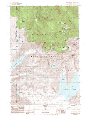
Spirit Lake West Topo Map Washington
To zoom in, hover over the map of Spirit Lake West
USGS Topo Quad 46122c2 - 1:24,000 scale
| Topo Map Name: | Spirit Lake West |
| USGS Topo Quad ID: | 46122c2 |
| Print Size: | ca. 21 1/4" wide x 27" high |
| Southeast Coordinates: | 46.25° N latitude / 122.125° W longitude |
| Map Center Coordinates: | 46.3125° N latitude / 122.1875° W longitude |
| U.S. State: | WA |
| Filename: | o46122c2.jpg |
| Download Map JPG Image: | Spirit Lake West topo map 1:24,000 scale |
| Map Type: | Topographic |
| Topo Series: | 7.5´ |
| Map Scale: | 1:24,000 |
| Source of Map Images: | United States Geological Survey (USGS) |
| Alternate Map Versions: |
Spirit Lake SW WA 1975, updated 1980 Download PDF Buy paper map Spirit Lake West WA 1984, updated 1984 Download PDF Buy paper map Spirit Lake West WA 1984, updated 1984 Download PDF Buy paper map Spirit Lake West WA 1998, updated 2003 Download PDF Buy paper map Spirit Lake West WA 2011 Download PDF Buy paper map Spirit Lake West WA 2013 Download PDF Buy paper map |
| FStopo: | US Forest Service topo Spirit Lake West is available: Download FStopo PDF Download FStopo TIF |
1:24,000 Topo Quads surrounding Spirit Lake West
> Back to 46122a1 at 1:100,000 scale
> Back to 46122a1 at 1:250,000 scale
> Back to U.S. Topo Maps home
Spirit Lake West topo map: Gazetteer
Spirit Lake West: Areas
Langes Crest elevation 1077m 3533′The Spillover elevation 1273m 4176′
Spirit Lake West: Bays
Bear Cove elevation 1050m 3444′Duck Bay elevation 1050m 3444′
Spirit Lake West: Dams
Coes Dam elevation 1050m 3444′Spirit Lake West: Flats
Elk Prairie elevation 1278m 4192′Spirit Lake West: Lakes
Coldwater Lake elevation 761m 2496′Deer Lake elevation 1177m 3861′
Elk Lake elevation 1211m 3973′
Forest Lake elevation 1190m 3904′
Hanaford Lake elevation 1239m 4064′
Heart Lake elevation 1411m 4629′
Holmstedt Lake elevation 1545m 5068′
Island Lake elevation 1470m 4822′
Lonesome Lake elevation 1188m 3897′
Lower Venus Lake elevation 1412m 4632′
O Conner Lake elevation 1005m 3297′
O'Conner Lake elevation 1470m 4822′
Saint Helens Lake elevation 1394m 4573′
Shovel Lake elevation 1422m 4665′
Snow Lake elevation 1445m 4740′
Spirit Lake elevation 1050m 3444′
Tradedollar Lake elevation 1092m 3582′
Venus Lake elevation 1495m 4904′
Spirit Lake West: Mines
Black Prince Mine elevation 801m 2627′Lang Mine elevation 1181m 3874′
Minnie Lee Mine elevation 764m 2506′
Spirit Lake West: Populated Places
Harmony Falls Landing elevation 1050m 3444′Spirit Lake West: Post Offices
Spirit Lake Post Office (historical) elevation 1086m 3562′Spirit Lake West: Ridges
Harrys Ridge elevation 1309m 4294′Johnston Ridge elevation 1314m 4311′
Windy Ridge elevation 1230m 4035′
Spirit Lake West: Streams
Bear Creek elevation 1050m 3444′Coldwater Creek elevation 761m 2496′
Glacier Creek elevation 968m 3175′
Studebaker Creek elevation 870m 2854′
Spirit Lake West: Summits
Black Mountain elevation 1581m 5187′Coldwater Peak elevation 1701m 5580′
Minnie Peak elevation 1678m 5505′
Mount Margaret elevation 1761m 5777′
Mount Venus elevation 1727m 5666′
Mount Whittier elevation 1772m 5813′
The Dome elevation 1703m 5587′
Spirit Lake West: Trails
Coldwater Trail elevation 1224m 4015′Spirit Lake West digital topo map on disk
Buy this Spirit Lake West topo map showing relief, roads, GPS coordinates and other geographical features, as a high-resolution digital map file on DVD:


