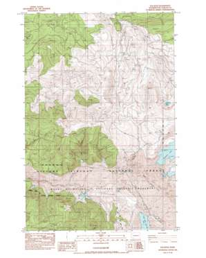
Elk Rock Topo Map Washington
To zoom in, hover over the map of Elk Rock
USGS Topo Quad 46122c3 - 1:24,000 scale
| Topo Map Name: | Elk Rock |
| USGS Topo Quad ID: | 46122c3 |
| Print Size: | ca. 21 1/4" wide x 27" high |
| Southeast Coordinates: | 46.25° N latitude / 122.25° W longitude |
| Map Center Coordinates: | 46.3125° N latitude / 122.3125° W longitude |
| U.S. State: | WA |
| Filename: | o46122c3.jpg |
| Download Map JPG Image: | Elk Rock topo map 1:24,000 scale |
| Map Type: | Topographic |
| Topo Series: | 7.5´ |
| Map Scale: | 1:24,000 |
| Source of Map Images: | United States Geological Survey (USGS) |
| Alternate Map Versions: |
Elk Rock SE WA 1975, updated 1980 Download PDF Buy paper map Elk Rock WA 1983, updated 1984 Download PDF Buy paper map Elk Rock WA 1998, updated 2003 Download PDF Buy paper map Elk Rock WA 2011 Download PDF Buy paper map Elk Rock WA 2013 Download PDF Buy paper map |
| FStopo: | US Forest Service topo Elk Rock is available: Download FStopo PDF Download FStopo TIF |
1:24,000 Topo Quads surrounding Elk Rock
> Back to 46122a1 at 1:100,000 scale
> Back to 46122a1 at 1:250,000 scale
> Back to U.S. Topo Maps home
Elk Rock topo map: Gazetteer
Elk Rock: Lakes
Castle Lake elevation 787m 2582′Fawn Lake elevation 1134m 3720′
Elk Rock: Streams
Castle Creek elevation 632m 2073′Elk Creek elevation 589m 1932′
Jackson Creek elevation 515m 1689′
Maratta Creek elevation 635m 2083′
South Coldwater Creek elevation 776m 2545′
South Fork Castle Creek elevation 769m 2522′
Elk Rock: Summits
Elk Rock elevation 1329m 4360′Spud Mountain elevation 1365m 4478′
Elk Rock: Trails
Fawn Lake Trail elevation 1285m 4215′Elk Rock digital topo map on disk
Buy this Elk Rock topo map showing relief, roads, GPS coordinates and other geographical features, as a high-resolution digital map file on DVD:


