Silver Lake Topo Map Washington
To zoom in, hover over the map of Silver Lake
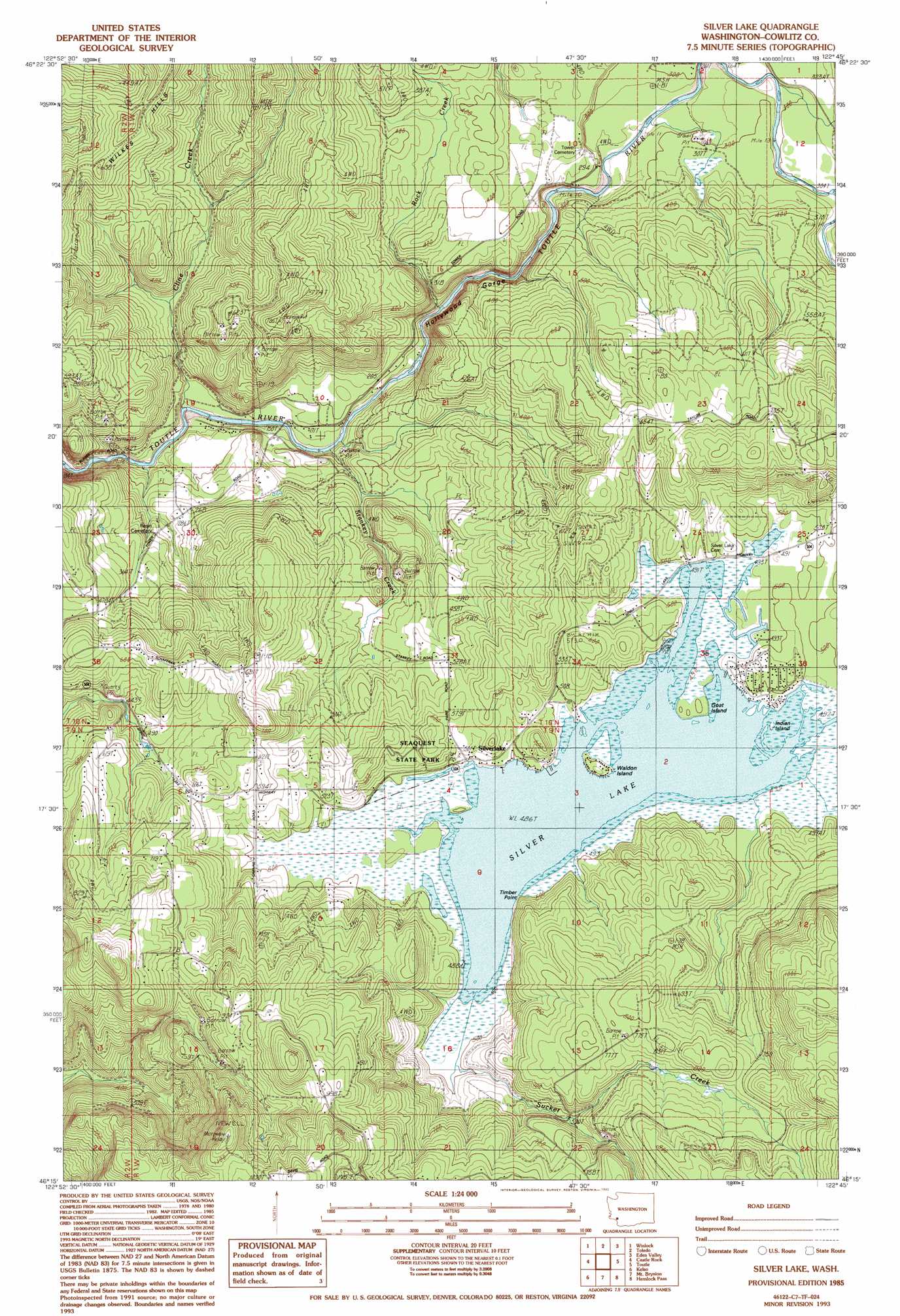
USGS Topo Quad 46122c7 - 1:24,000 scale
| Topo Map Name: | Silver Lake |
| USGS Topo Quad ID: | 46122c7 |
| Print Size: | ca. 21 1/4" wide x 27" high |
| Southeast Coordinates: | 46.25° N latitude / 122.75° W longitude |
| Map Center Coordinates: | 46.3125° N latitude / 122.8125° W longitude |
| U.S. State: | WA |
| Filename: | o46122c7.jpg |
| Download Map JPG Image: | Silver Lake topo map 1:24,000 scale |
| Map Type: | Topographic |
| Topo Series: | 7.5´ |
| Map Scale: | 1:24,000 |
| Source of Map Images: | United States Geological Survey (USGS) |
| Alternate Map Versions: |
Silver Lake WA 1985, updated 1985 Download PDF Buy paper map Silver Lake WA 1985, updated 1993 Download PDF Buy paper map Silver Lake WA 2011 Download PDF Buy paper map Silver Lake WA 2013 Download PDF Buy paper map |
1:24,000 Topo Quads surrounding Silver Lake
Curtis |
Napavine |
Jackson Prairie |
Onalaska |
Mayfield Lake |
Wildwood |
Winlock |
Toledo |
Eden Valley |
Hatchet Mountain |
Abernathy Mountain |
Castle Rock |
Silver Lake |
Toutle |
Toutle Mountain |
Coal Creek |
Kelso |
Mount Brynion |
Hemlock Pass |
Wolf Point |
Delena |
Rainier |
Kalama |
Woolford Creek |
Georges Peak |
> Back to 46122a1 at 1:100,000 scale
> Back to 46122a1 at 1:250,000 scale
> Back to U.S. Topo Maps home
Silver Lake topo map: Gazetteer
Silver Lake: Capes
Timber Point elevation 150m 492′Silver Lake: Islands
Goat Island elevation 152m 498′Indian Island elevation 149m 488′
Pete Moore Island elevation 152m 498′
Waldon Island elevation 152m 498′
Silver Lake: Lakes
Silver Lake elevation 149m 488′Silver Lake: Parks
Seaquest State Park elevation 183m 600′Silver Lake: Populated Places
Silver Lake elevation 158m 518′Silver Lake: Streams
Cline Creek elevation 39m 127′Rock Creek elevation 62m 203′
Stankey Creek elevation 40m 131′
Sucker Creek elevation 152m 498′
Silver Lake: Valleys
Hollywood Gorge elevation 52m 170′Silver Lake digital topo map on disk
Buy this Silver Lake topo map showing relief, roads, GPS coordinates and other geographical features, as a high-resolution digital map file on DVD: