Cowlitz Falls Topo Map Washington
To zoom in, hover over the map of Cowlitz Falls
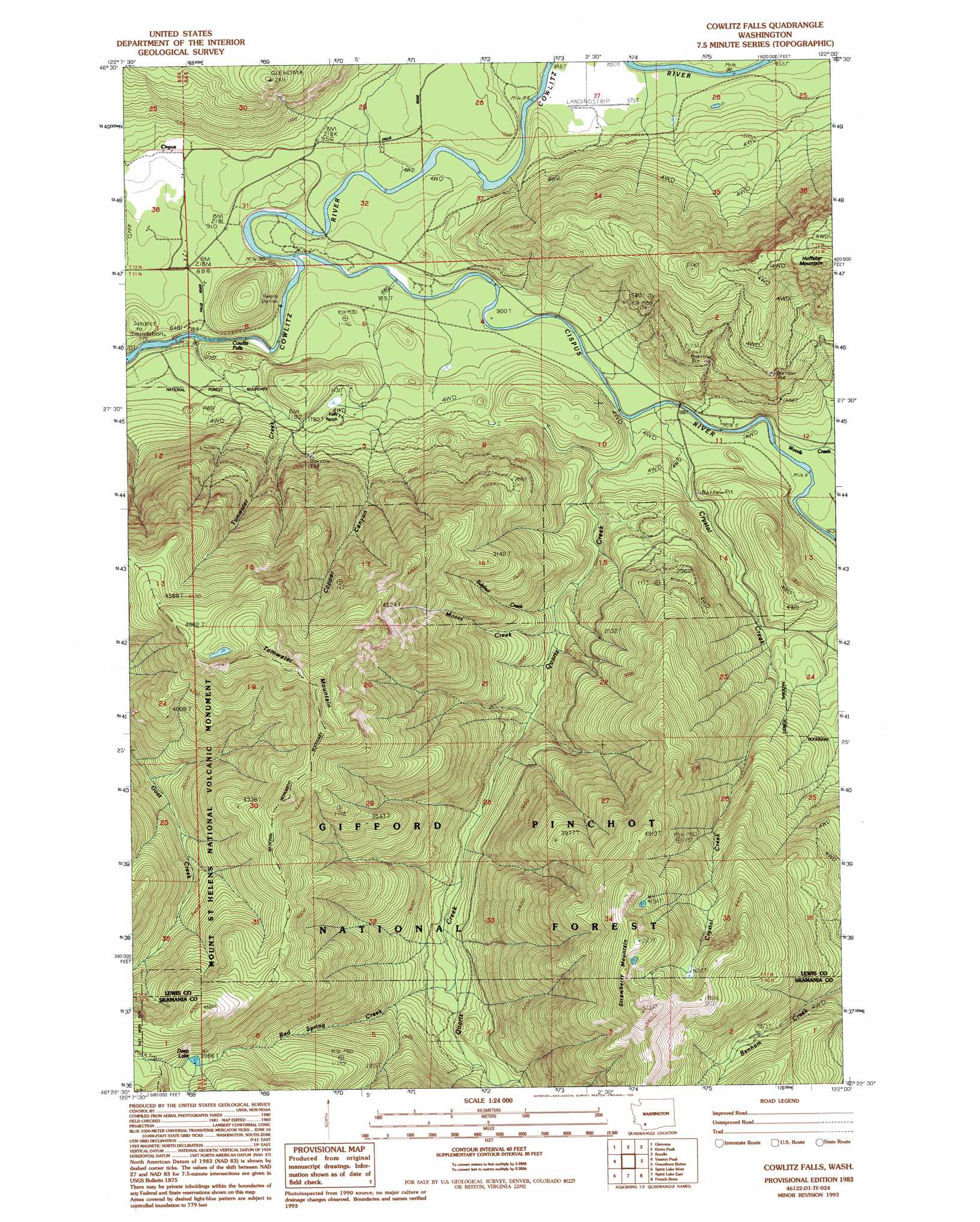
USGS Topo Quad 46122d1 - 1:24,000 scale
| Topo Map Name: | Cowlitz Falls |
| USGS Topo Quad ID: | 46122d1 |
| Print Size: | ca. 21 1/4" wide x 27" high |
| Southeast Coordinates: | 46.375° N latitude / 122° W longitude |
| Map Center Coordinates: | 46.4375° N latitude / 122.0625° W longitude |
| U.S. State: | WA |
| Filename: | o46122d1.jpg |
| Download Map JPG Image: | Cowlitz Falls topo map 1:24,000 scale |
| Map Type: | Topographic |
| Topo Series: | 7.5´ |
| Map Scale: | 1:24,000 |
| Source of Map Images: | United States Geological Survey (USGS) |
| Alternate Map Versions: |
Cowlitz Falls WA 1983, updated 1984 Download PDF Buy paper map Cowlitz Falls WA 1983, updated 1994 Download PDF Buy paper map Cowlitz Falls WA 1994, updated 1996 Download PDF Buy paper map Cowlitz Falls WA 2011 Download PDF Buy paper map Cowlitz Falls WA 2014 Download PDF Buy paper map |
| FStopo: | US Forest Service topo Cowlitz Falls is available: Download FStopo PDF Download FStopo TIF |
1:24,000 Topo Quads surrounding Cowlitz Falls
The Rockies |
Mineral |
Anderson Lake |
Sawtooth Ridge |
Wahpenayo Peak |
Morton |
Glenoma |
Kiona Peak |
Randle |
Purcell Mountain |
Winters Mountain |
Vanson Peak |
Cowlitz Falls |
Greenhorn Buttes |
Tower Rock |
Elk Rock |
Spirit Lake West |
Spirit Lake East |
French Butte |
Mccoy Peak |
Goat Mountain |
Mount Sainte Helens |
Smith Creek Butte |
Spencer Butte |
Quartz Creek Butte |
> Back to 46122a1 at 1:100,000 scale
> Back to 46122a1 at 1:250,000 scale
> Back to U.S. Topo Maps home
Cowlitz Falls topo map: Gazetteer
Cowlitz Falls: Falls
Cowlitz Falls elevation 265m 869′Cowlitz Falls: Lakes
Deep Lake elevation 1214m 3982′Cowlitz Falls: Populated Places
Cispus elevation 335m 1099′Cowlitz Falls: Reservoirs
Lake Scanewa elevation 241m 790′Cowlitz Falls: Streams
Cispus River elevation 254m 833′Copper Canyon Creek elevation 262m 859′
Crystal Creek elevation 299m 980′
Moses Creek elevation 470m 1541′
Quartz Creek elevation 299m 980′
Red Spring Creek elevation 606m 1988′
Sulphur Creek elevation 443m 1453′
Tumwater Creek elevation 239m 784′
Woods Creek elevation 314m 1030′
Cowlitz Falls: Summits
Strawberry Mountain elevation 1737m 5698′Tumwater Mountain elevation 1597m 5239′
Cowlitz Falls: Valleys
Copper Canyon elevation 320m 1049′Cowlitz Falls digital topo map on disk
Buy this Cowlitz Falls topo map showing relief, roads, GPS coordinates and other geographical features, as a high-resolution digital map file on DVD: