Coyote Mountain Topo Map Washington
To zoom in, hover over the map of Coyote Mountain
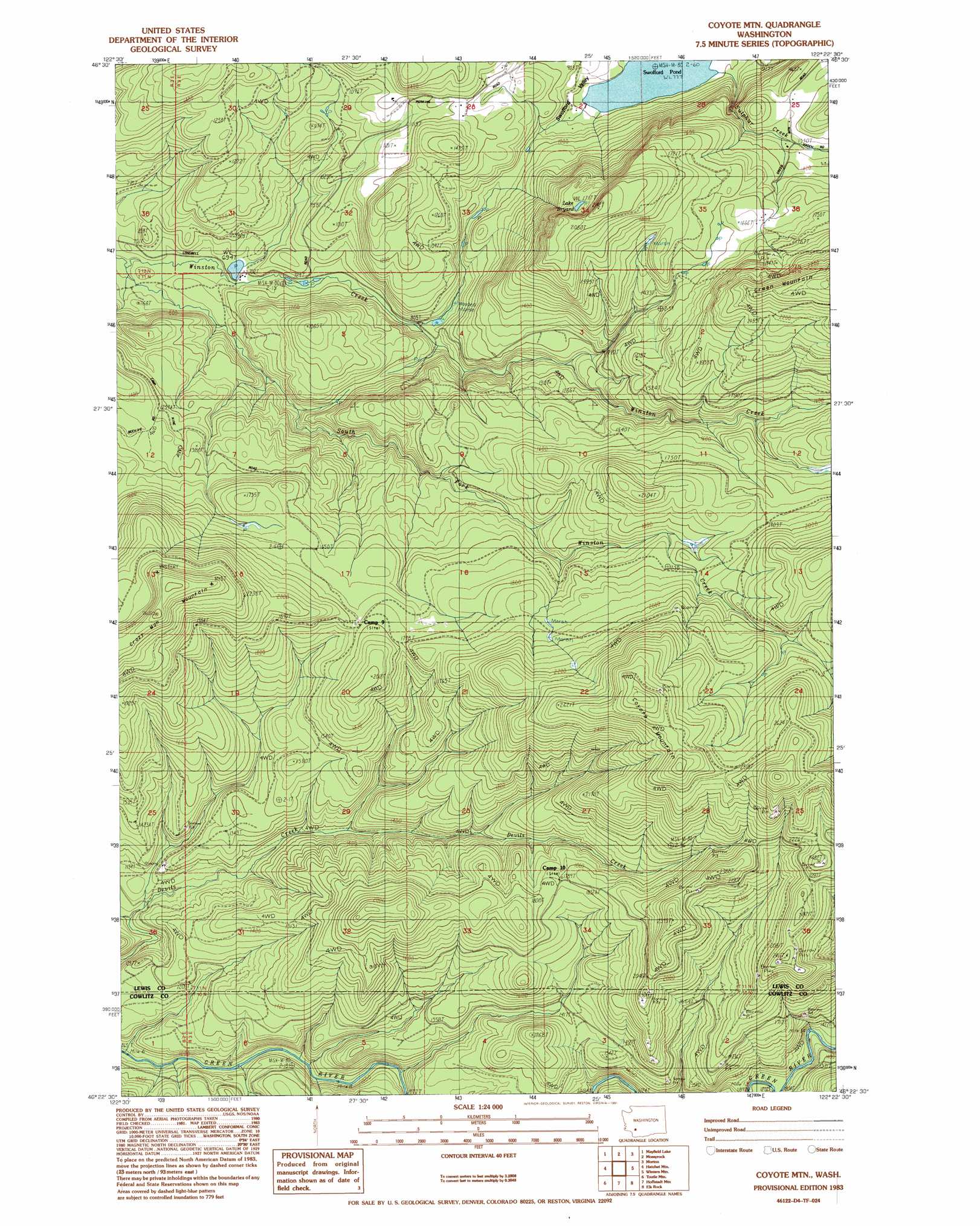
USGS Topo Quad 46122d4 - 1:24,000 scale
| Topo Map Name: | Coyote Mountain |
| USGS Topo Quad ID: | 46122d4 |
| Print Size: | ca. 21 1/4" wide x 27" high |
| Southeast Coordinates: | 46.375° N latitude / 122.375° W longitude |
| Map Center Coordinates: | 46.4375° N latitude / 122.4375° W longitude |
| U.S. State: | WA |
| Filename: | o46122d4.jpg |
| Download Map JPG Image: | Coyote Mountain topo map 1:24,000 scale |
| Map Type: | Topographic |
| Topo Series: | 7.5´ |
| Map Scale: | 1:24,000 |
| Source of Map Images: | United States Geological Survey (USGS) |
| Alternate Map Versions: |
Coyote Mtn WA 1983, updated 1983 Download PDF Buy paper map Coyote Mtn WA 1983, updated 1991 Download PDF Buy paper map Coyote Mountain WA 2011 Download PDF Buy paper map Coyote Mountain WA 2013 Download PDF Buy paper map |
| FStopo: | US Forest Service topo Coyote Mountain is available: Download FStopo PDF Download FStopo TIF |
1:24,000 Topo Quads surrounding Coyote Mountain
Onalaska Nw |
Bernier Creek |
Newaukum Lake |
The Rockies |
Mineral |
Onalaska |
Mayfield Lake |
Mossyrock |
Morton |
Glenoma |
Eden Valley |
Hatchet Mountain |
Coyote Mountain |
Winters Mountain |
Vanson Peak |
Toutle |
Toutle Mountain |
Huffstadt Mountain |
Elk Rock |
Spirit Lake West |
Hemlock Pass |
Wolf Point |
Elk Mountain |
Goat Mountain |
Mount Sainte Helens |
> Back to 46122a1 at 1:100,000 scale
> Back to 46122a1 at 1:250,000 scale
> Back to U.S. Topo Maps home
Coyote Mountain topo map: Gazetteer
Coyote Mountain: Dams
Long-Bell Mill Pond Dam elevation 211m 692′Coyote Mountain: Lakes
Lake Bryant elevation 523m 1715′Coyote Mountain: Reservoirs
Long-Bell Mill Pond elevation 211m 692′Swofford Pond elevation 238m 780′
Coyote Mountain: Streams
South Fork Winston Creek elevation 194m 636′Thurston Creek elevation 452m 1482′
Coyote Mountain: Summits
Coyote Mountain elevation 885m 2903′Crazy Man Mountain elevation 796m 2611′
Coyote Mountain digital topo map on disk
Buy this Coyote Mountain topo map showing relief, roads, GPS coordinates and other geographical features, as a high-resolution digital map file on DVD: