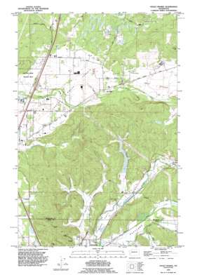
Violet Prairie Topo Map Washington
To zoom in, hover over the map of Violet Prairie
USGS Topo Quad 46122g8 - 1:24,000 scale
| Topo Map Name: | Violet Prairie |
| USGS Topo Quad ID: | 46122g8 |
| Print Size: | ca. 21 1/4" wide x 27" high |
| Southeast Coordinates: | 46.75° N latitude / 122.875° W longitude |
| Map Center Coordinates: | 46.8125° N latitude / 122.9375° W longitude |
| U.S. State: | WA |
| Filename: | o46122g8.jpg |
| Download Map JPG Image: | Violet Prairie topo map 1:24,000 scale |
| Map Type: | Topographic |
| Topo Series: | 7.5´ |
| Map Scale: | 1:24,000 |
| Source of Map Images: | United States Geological Survey (USGS) |
| Alternate Map Versions: |
Tenino SW WA 1959, updated 1966 Download PDF Buy paper map Tenino SW WA 1959, updated 1976 Download PDF Buy paper map Violet Prairie WA 1990, updated 1995 Download PDF Buy paper map Violet Prairie WA 2011 Download PDF Buy paper map Violet Prairie WA 2013 Download PDF Buy paper map |
1:24,000 Topo Quads surrounding Violet Prairie
> Back to 46122e1 at 1:100,000 scale
> Back to 46122a1 at 1:250,000 scale
> Back to U.S. Topo Maps home
Violet Prairie topo map: Gazetteer
Violet Prairie: Airports
Sorrell Airport elevation 78m 255′Wissler's Airport elevation 76m 249′
Violet Prairie: Dams
Dunlap Pond Dam elevation 68m 223′Kyte Dam elevation 73m 239′
Monte Vista Poultry Detention Pond Dam elevation 74m 242′
Violet Prairie: Flats
Grand Mound Prairie elevation 61m 200′Rock Prairie elevation 84m 275′
Violet Prairie elevation 80m 262′
Violet Prairie: Mines
Majestic Mine elevation 80m 262′Monarch Mine elevation 125m 410′
Stoker Mine elevation 93m 305′
Violet Prairie: Populated Places
Sunnydale elevation 70m 229′Violet Prairie: Reservoirs
Dunlap Pond elevation 68m 223′Monte Vista Poultry Detention Pond elevation 74m 242′
Violet Prairie: Streams
Cupacoffee Creek elevation 63m 206′North Hanaford Creek elevation 59m 193′
South Hanaford Creek elevation 59m 193′
Violet Prairie: Summits
Davis Hill elevation 159m 521′Lemon Hill elevation 206m 675′
Violet Prairie: Valleys
Hanaford Valley elevation 62m 203′Zenkner Valley elevation 65m 213′
Violet Prairie digital topo map on disk
Buy this Violet Prairie topo map showing relief, roads, GPS coordinates and other geographical features, as a high-resolution digital map file on DVD:


