Nicolai Mountain Topo Map Oregon
To zoom in, hover over the map of Nicolai Mountain
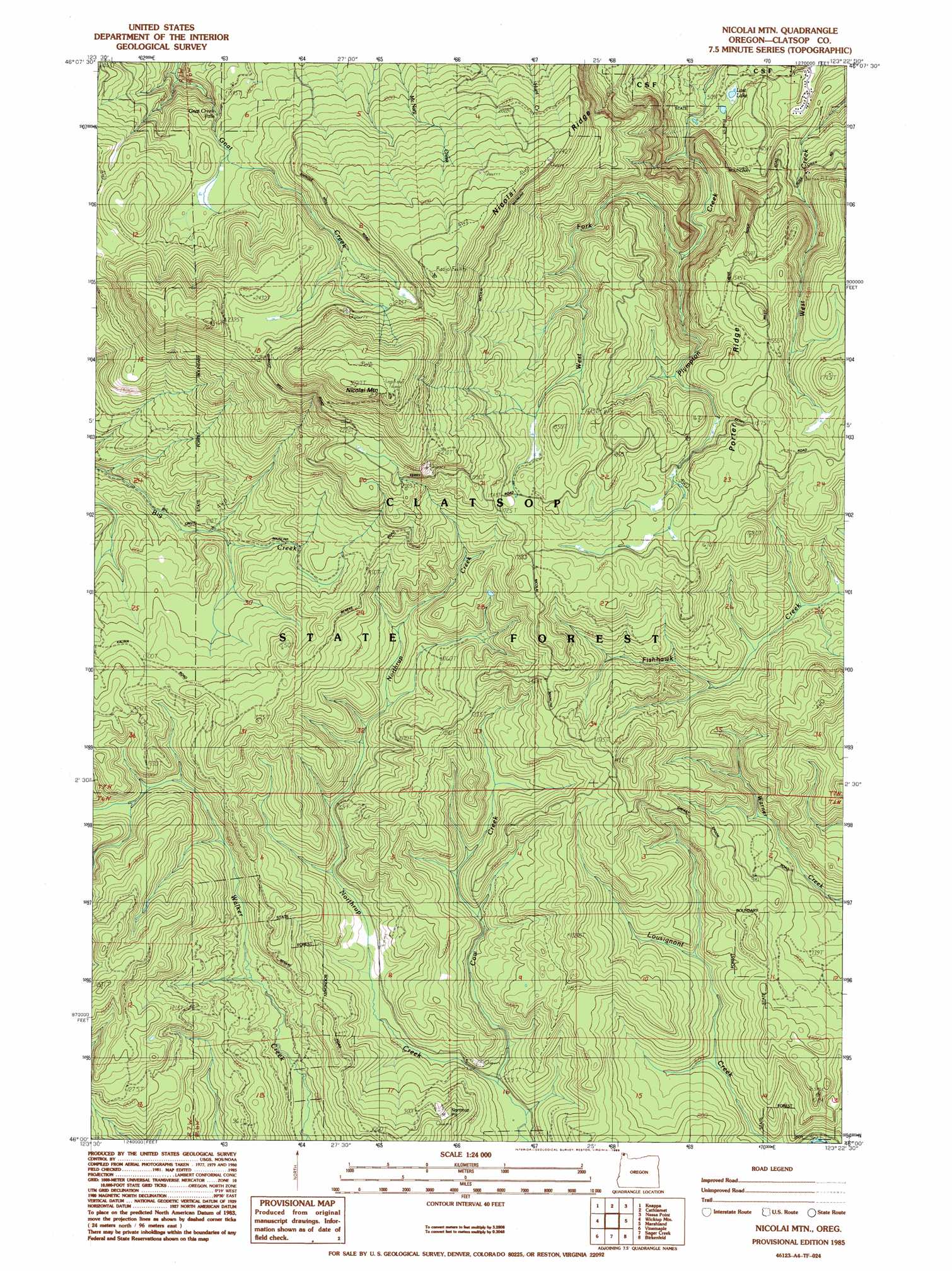
USGS Topo Quad 46123a4 - 1:24,000 scale
| Topo Map Name: | Nicolai Mountain |
| USGS Topo Quad ID: | 46123a4 |
| Print Size: | ca. 21 1/4" wide x 27" high |
| Southeast Coordinates: | 46° N latitude / 123.375° W longitude |
| Map Center Coordinates: | 46.0625° N latitude / 123.4375° W longitude |
| U.S. State: | OR |
| Filename: | o46123a4.jpg |
| Download Map JPG Image: | Nicolai Mountain topo map 1:24,000 scale |
| Map Type: | Topographic |
| Topo Series: | 7.5´ |
| Map Scale: | 1:24,000 |
| Source of Map Images: | United States Geological Survey (USGS) |
| Alternate Map Versions: |
Nicolai Mtn OR 1985, updated 1985 Download PDF Buy paper map Nicolai Mountain OR 2011 Download PDF Buy paper map Nicolai Mountain OR 2014 Download PDF Buy paper map |
1:24,000 Topo Quads surrounding Nicolai Mountain
Rosburg |
Grays River |
Skamokawa |
Skamokawa Pass |
Elochoman Lake |
Cathlamet Bay |
Knappa |
Cathlamet |
Nassa Point |
Oak Point |
Green Mountain |
Wickiup Mountain |
Nicolai Mountain |
Marshland |
Clatskanie |
Saddle Mountain |
Vinemaple |
Sager Creek |
Birkenfeld |
Pittsburg |
Hamlet |
Elsie |
Sunset Spring |
Clear Creek |
Vernonia |
> Back to 46123a1 at 1:100,000 scale
> Back to 46122a1 at 1:250,000 scale
> Back to U.S. Topo Maps home
Nicolai Mountain topo map: Gazetteer
Nicolai Mountain: Falls
Gnat Creek Falls elevation 459m 1505′Nicolai Mountain: Lakes
Lost Lake elevation 156m 511′Nicolai Mountain: Ridges
Nicolai Ridge elevation 690m 2263′Porter Ridge elevation 504m 1653′
Nicolai Mountain: Streams
Cow Creek elevation 169m 554′West Fork Plympton Creek elevation 242m 793′
Nicolai Mountain: Summits
Nicolai Mountain elevation 901m 2956′Nicolai Mountain digital topo map on disk
Buy this Nicolai Mountain topo map showing relief, roads, GPS coordinates and other geographical features, as a high-resolution digital map file on DVD: