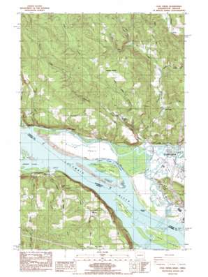
Coal Creek Topo Map Washington
To zoom in, hover over the map of Coal Creek
USGS Topo Quad 46123b1 - 1:24,000 scale
| Topo Map Name: | Coal Creek |
| USGS Topo Quad ID: | 46123b1 |
| Print Size: | ca. 21 1/4" wide x 27" high |
| Southeast Coordinates: | 46.125° N latitude / 123° W longitude |
| Map Center Coordinates: | 46.1875° N latitude / 123.0625° W longitude |
| U.S. States: | WA, OR |
| Filename: | o46123b1.jpg |
| Download Map JPG Image: | Coal Creek topo map 1:24,000 scale |
| Map Type: | Topographic |
| Topo Series: | 7.5´ |
| Map Scale: | 1:24,000 |
| Source of Map Images: | United States Geological Survey (USGS) |
| Alternate Map Versions: |
Coal Creek WA 1985, updated 1986 Download PDF Buy paper map Coal Creek WA 2011 Download PDF Buy paper map Coal Creek WA 2014 Download PDF Buy paper map |
1:24,000 Topo Quads surrounding Coal Creek
> Back to 46123a1 at 1:100,000 scale
> Back to 46122a1 at 1:250,000 scale
> Back to U.S. Topo Maps home
Coal Creek topo map: Gazetteer
Coal Creek: Bars
Hump Island elevation 3m 9′Coal Creek: Canals
Ditch Number Eight elevation 4m 13′Ditch Number Six elevation 7m 22′
Ditch Number Ten elevation 4m 13′
Coal Creek: Capes
Barlow Point elevation 4m 13′Green Point elevation 2m 6′
Coal Creek: Channels
Barlow Channel elevation 2m 6′Barlow Point Channel elevation 2m 6′
Barlow Point Channel elevation 2m 6′
Barlow Point Channel elevation 2m 6′
Barlow Point Channel elevation 2m 6′
Fisher Channel elevation 2m 6′
Fisher Island Channel elevation 2m 6′
Stella Range elevation 2m 6′
Stella Range elevation 2m 6′
Stella Range elevation 2m 6′
Stella Range elevation 2m 6′
Walker Island Channel elevation 2m 6′
Walker Island Channel elevation 2m 6′
Walker Island Channel elevation 2m 6′
Walker Island Channel elevation 2m 6′
Coal Creek: Cliffs
Alder Bluff elevation 86m 282′Coal Creek: Guts
Cut-Off Slough elevation 6m 19′Solo Slough elevation 2m 6′
Coal Creek: Islands
Fisher Island elevation 5m 16′Hump Island elevation 2m 6′
Lord Island elevation 4m 13′
Walker Island elevation 3m 9′
Coal Creek: Parks
Roy Morse Park elevation 5m 16′Coal Creek: Populated Places
Coal Creek elevation 68m 223′Eufaula elevation 122m 400′
Eufaula Heights elevation 249m 816′
Mayger elevation 43m 141′
Stella elevation 48m 157′
Coal Creek: Post Offices
Beaver Landing Post Office (historical) elevation 3m 9′Mayger Post Office (historical) elevation 43m 141′
Tryon Post Office (historical) elevation 92m 301′
Coal Creek: Streams
Brock Creek elevation 91m 298′Coal Creek elevation 5m 16′
Coal Creek Slough elevation 2m 6′
East Fork Coal Creek elevation 119m 390′
Fall Creek elevation 46m 150′
Fisher Island Slough elevation 2m 6′
Flume Creek elevation 4m 13′
Germany Creek elevation 7m 22′
Green Creek elevation 4m 13′
Harmony Creek elevation 12m 39′
Rinearson Slough elevation 7m 22′
Coal Creek: Valleys
Goose Hollow elevation 97m 318′Coal Creek: Woods
Willow Grove elevation 3m 9′Coal Creek digital topo map on disk
Buy this Coal Creek topo map showing relief, roads, GPS coordinates and other geographical features, as a high-resolution digital map file on DVD:


