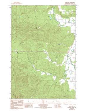
Boistfort Topo Map Washington
To zoom in, hover over the map of Boistfort
USGS Topo Quad 46123e2 - 1:24,000 scale
| Topo Map Name: | Boistfort |
| USGS Topo Quad ID: | 46123e2 |
| Print Size: | ca. 21 1/4" wide x 27" high |
| Southeast Coordinates: | 46.5° N latitude / 123.125° W longitude |
| Map Center Coordinates: | 46.5625° N latitude / 123.1875° W longitude |
| U.S. State: | WA |
| Filename: | o46123e2.jpg |
| Download Map JPG Image: | Boistfort topo map 1:24,000 scale |
| Map Type: | Topographic |
| Topo Series: | 7.5´ |
| Map Scale: | 1:24,000 |
| Source of Map Images: | United States Geological Survey (USGS) |
| Alternate Map Versions: |
Boistfort WA 1986, updated 1986 Download PDF Buy paper map Boistfort WA 1986, updated 1994 Download PDF Buy paper map Boistfort WA 2011 Download PDF Buy paper map Boistfort WA 2013 Download PDF Buy paper map |
1:24,000 Topo Quads surrounding Boistfort
> Back to 46123e1 at 1:100,000 scale
> Back to 46122a1 at 1:250,000 scale
> Back to U.S. Topo Maps home
Boistfort topo map: Gazetteer
Boistfort: Flats
Boistfort Prairie elevation 93m 305′Boistfort: Populated Places
Boistfort elevation 87m 285′Ceres elevation 73m 239′
Klaber elevation 74m 242′
Boistfort: Streams
Beaver Creek elevation 71m 232′Halfway Creek elevation 92m 301′
Halsea Creek elevation 146m 479′
Keller Creek elevation 125m 410′
Little Mill Creek elevation 120m 393′
Lost Creek elevation 79m 259′
Slide Creek elevation 113m 370′
Stillman Creek elevation 74m 242′
Boistfort: Summits
Ceres Hill elevation 239m 784′Boistfort: Swamps
Miller Swamp elevation 75m 246′Boistfort: Valleys
Lost Valley elevation 86m 282′Boistfort digital topo map on disk
Buy this Boistfort topo map showing relief, roads, GPS coordinates and other geographical features, as a high-resolution digital map file on DVD:


