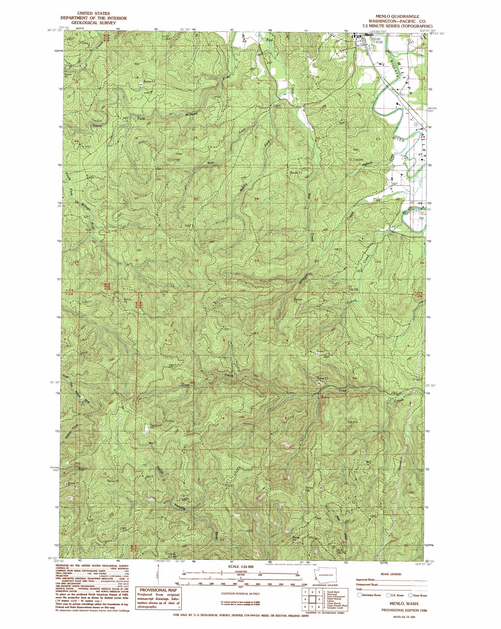
Menlo Topo Map Washington
To zoom in, hover over the map of Menlo
USGS Topo Quad 46123e6 - 1:24,000 scale
| Topo Map Name: | Menlo |
| USGS Topo Quad ID: | 46123e6 |
| Print Size: | ca. 21 1/4" wide x 27" high |
| Southeast Coordinates: | 46.5° N latitude / 123.625° W longitude |
| Map Center Coordinates: | 46.5625° N latitude / 123.6875° W longitude |
| U.S. State: | WA |
| Filename: | o46123e6.jpg |
| Download Map JPG Image: | Menlo topo map 1:24,000 scale |
| Map Type: | Topographic |
| Topo Series: | 7.5´ |
| Map Scale: | 1:24,000 |
| Source of Map Images: | United States Geological Survey (USGS) |
| Alternate Map Versions: |
Menlo WA 1986, updated 1986 Download PDF Buy paper map Menlo WA 2011 Download PDF Buy paper map Menlo WA 2013 Download PDF Buy paper map |
1:24,000 Topo Quads surrounding Menlo
Western |
Aberdeen Se |
Elkhorn Creek |
Brooklyn |
Blue Mountain |
Bay Center |
South Bend |
Raymond |
East Of Raymond |
Dean Creek |
Nemah |
North Nemah |
Menlo |
Lebam |
Pluvius |
Long Island |
Oman Ranch |
Upper Naselle River |
Sweigiler Creek |
Blaney Creek |
Chinook |
Knappton |
Rosburg |
Grays River |
Skamokawa |
> Back to 46123e1 at 1:100,000 scale
> Back to 46122a1 at 1:250,000 scale
> Back to U.S. Topo Maps home
Menlo topo map: Gazetteer
Menlo: Populated Places
Menlo elevation 21m 68′Menlo: Streams
Highland Creek elevation 27m 88′Middle Fork Rue Creek elevation 97m 318′
Oxbow Creek elevation 25m 82′
Stringer Creek elevation 28m 91′
West Fork Rue Creek elevation 70m 229′
Menlo digital topo map on disk
Buy this Menlo topo map showing relief, roads, GPS coordinates and other geographical features, as a high-resolution digital map file on DVD: