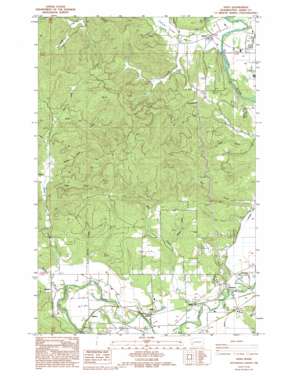
Adna Topo Map Washington
To zoom in, hover over the map of Adna
USGS Topo Quad 46123f1 - 1:24,000 scale
| Topo Map Name: | Adna |
| USGS Topo Quad ID: | 46123f1 |
| Print Size: | ca. 21 1/4" wide x 27" high |
| Southeast Coordinates: | 46.625° N latitude / 123° W longitude |
| Map Center Coordinates: | 46.6875° N latitude / 123.0625° W longitude |
| U.S. State: | WA |
| Filename: | o46123f1.jpg |
| Download Map JPG Image: | Adna topo map 1:24,000 scale |
| Map Type: | Topographic |
| Topo Series: | 7.5´ |
| Map Scale: | 1:24,000 |
| Source of Map Images: | United States Geological Survey (USGS) |
| Alternate Map Versions: |
Adna WA 1986, updated 1986 Download PDF Buy paper map Adna WA 1986, updated 1994 Download PDF Buy paper map Adna WA 2011 Download PDF Buy paper map Adna WA 2014 Download PDF Buy paper map |
1:24,000 Topo Quads surrounding Adna
> Back to 46123e1 at 1:100,000 scale
> Back to 46122a1 at 1:250,000 scale
> Back to U.S. Topo Maps home
Adna topo map: Gazetteer
Adna: Dams
Eagle Creek Dam elevation 79m 259′Adna: Populated Places
Adna elevation 56m 183′Bunker elevation 63m 206′
Claquato elevation 61m 200′
Fayette elevation 65m 213′
Galvin elevation 50m 164′
Littell elevation 61m 200′
Millburn elevation 69m 226′
Adna: Streams
Bunker Creek elevation 58m 190′Byron Creek elevation 98m 321′
Carson Creek elevation 87m 285′
Deep Creek elevation 65m 213′
Eagle Creek elevation 44m 144′
Gabel Creek elevation 80m 262′
Lincoln Creek elevation 47m 154′
Mill Creek elevation 52m 170′
Rudolph Creek elevation 107m 351′
Scammon Creek elevation 46m 150′
South Branch Scammon Creek elevation 56m 183′
Stearns Creek elevation 51m 167′
Tapp Creek elevation 111m 364′
Van Ornum Creek elevation 61m 200′
Wisner Creek elevation 81m 265′
Adna: Summits
Cook Hill elevation 177m 580′Adna: Valleys
Lincoln Creek Valley elevation 50m 164′Adna digital topo map on disk
Buy this Adna topo map showing relief, roads, GPS coordinates and other geographical features, as a high-resolution digital map file on DVD:


