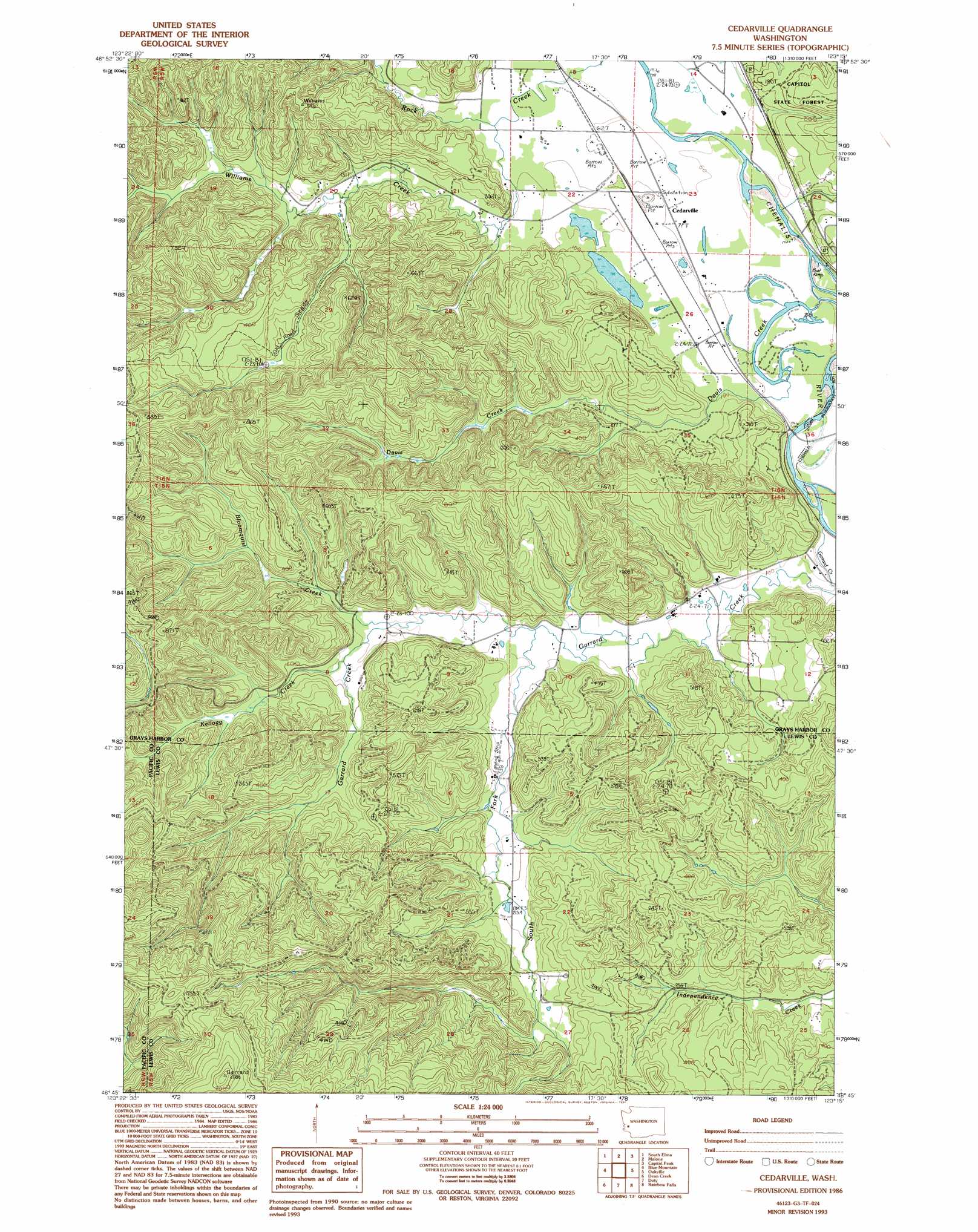
Cedarville Topo Map Washington
To zoom in, hover over the map of Cedarville
USGS Topo Quad 46123g3 - 1:24,000 scale
| Topo Map Name: | Cedarville |
| USGS Topo Quad ID: | 46123g3 |
| Print Size: | ca. 21 1/4" wide x 27" high |
| Southeast Coordinates: | 46.75° N latitude / 123.25° W longitude |
| Map Center Coordinates: | 46.8125° N latitude / 123.3125° W longitude |
| U.S. State: | WA |
| Filename: | o46123g3.jpg |
| Download Map JPG Image: | Cedarville topo map 1:24,000 scale |
| Map Type: | Topographic |
| Topo Series: | 7.5´ |
| Map Scale: | 1:24,000 |
| Source of Map Images: | United States Geological Survey (USGS) |
| Alternate Map Versions: |
Cedarville WA 1986, updated 1986 Download PDF Buy paper map Cedarville WA 1986, updated 1994 Download PDF Buy paper map Cedarville WA 2011 Download PDF Buy paper map Cedarville WA 2014 Download PDF Buy paper map |
1:24,000 Topo Quads surrounding Cedarville
Prices Peak |
Elma |
Mccleary |
Kamilche Valley |
Summit Lake |
Montesano |
South Elma |
Malone |
Capitol Peak |
Little Rock |
Brooklyn |
Blue Mountain |
Cedarville |
Oakville |
Rochester |
East Of Raymond |
Dean Creek |
Doty |
Rainbow Falls |
Adna |
Lebam |
Pluvius |
Pe Ell |
Boistfort |
Curtis |
> Back to 46123e1 at 1:100,000 scale
> Back to 46122a1 at 1:250,000 scale
> Back to U.S. Topo Maps home
Cedarville topo map: Gazetteer
Cedarville: Airports
Kimbrel Farm Airport elevation 38m 124′Cedarville: Dams
Reilly Dam elevation 68m 223′Cedarville: Populated Places
Cedarville elevation 25m 82′Cedarville: Streams
Bloomquist Creek elevation 39m 127′Davis Creek elevation 19m 62′
Garrard Creek elevation 19m 62′
Kellogg Creek elevation 53m 173′
South Fork Garrard Creek elevation 34m 111′
Williams Creek elevation 24m 78′
Cedarville digital topo map on disk
Buy this Cedarville topo map showing relief, roads, GPS coordinates and other geographical features, as a high-resolution digital map file on DVD: