Blue Mountain Topo Map Washington
To zoom in, hover over the map of Blue Mountain
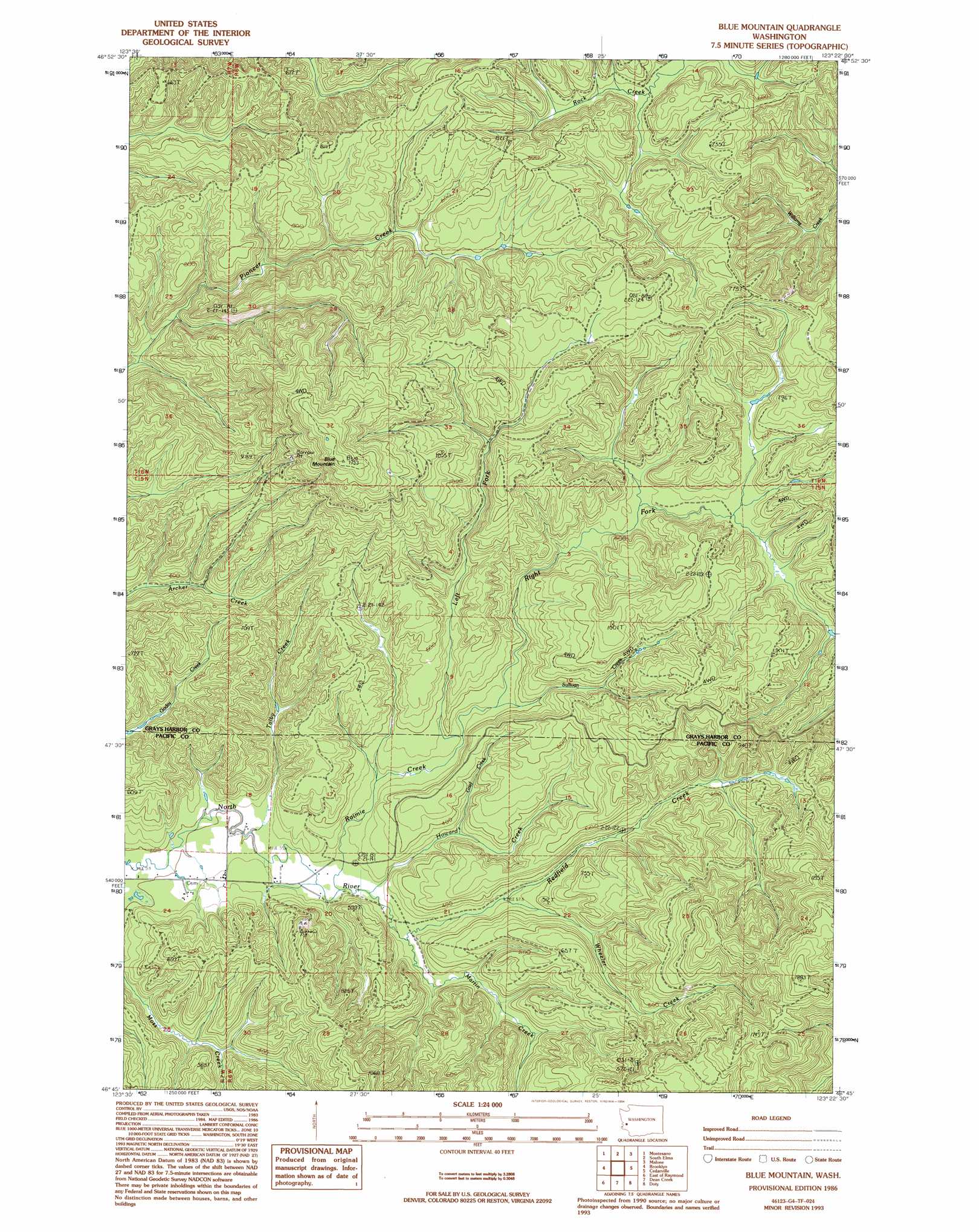
USGS Topo Quad 46123g4 - 1:24,000 scale
| Topo Map Name: | Blue Mountain |
| USGS Topo Quad ID: | 46123g4 |
| Print Size: | ca. 21 1/4" wide x 27" high |
| Southeast Coordinates: | 46.75° N latitude / 123.375° W longitude |
| Map Center Coordinates: | 46.8125° N latitude / 123.4375° W longitude |
| U.S. State: | WA |
| Filename: | o46123g4.jpg |
| Download Map JPG Image: | Blue Mountain topo map 1:24,000 scale |
| Map Type: | Topographic |
| Topo Series: | 7.5´ |
| Map Scale: | 1:24,000 |
| Source of Map Images: | United States Geological Survey (USGS) |
| Alternate Map Versions: |
Blue Mountain WA 1986, updated 1986 Download PDF Buy paper map Blue Mountain WA 1986, updated 1994 Download PDF Buy paper map Blue Mountain WA 2011 Download PDF Buy paper map Blue Mountain WA 2014 Download PDF Buy paper map |
1:24,000 Topo Quads surrounding Blue Mountain
Wynoochee Valley Sw |
Prices Peak |
Elma |
Mccleary |
Kamilche Valley |
Central Park |
Montesano |
South Elma |
Malone |
Capitol Peak |
Elkhorn Creek |
Brooklyn |
Blue Mountain |
Cedarville |
Oakville |
Raymond |
East Of Raymond |
Dean Creek |
Doty |
Rainbow Falls |
Menlo |
Lebam |
Pluvius |
Pe Ell |
Boistfort |
> Back to 46123e1 at 1:100,000 scale
> Back to 46122a1 at 1:250,000 scale
> Back to U.S. Topo Maps home
Blue Mountain topo map: Gazetteer
Blue Mountain: Streams
Grief Creek elevation 84m 275′Howard Creek elevation 68m 223′
Left Fork Raimie Creek elevation 99m 324′
Martin Creek elevation 78m 255′
Raimie Creek elevation 72m 236′
Redfield Creek elevation 70m 229′
Right Fork Raimie Creek elevation 108m 354′
Sullivan Creek elevation 103m 337′
Talby Creek elevation 63m 206′
Wheeler Creek elevation 104m 341′
Blue Mountain: Summits
Blue Mountain elevation 533m 1748′Blue Mountain: Trails
Vesta Truck Trail elevation 212m 695′Blue Mountain digital topo map on disk
Buy this Blue Mountain topo map showing relief, roads, GPS coordinates and other geographical features, as a high-resolution digital map file on DVD: