Montesano Topo Map Washington
To zoom in, hover over the map of Montesano
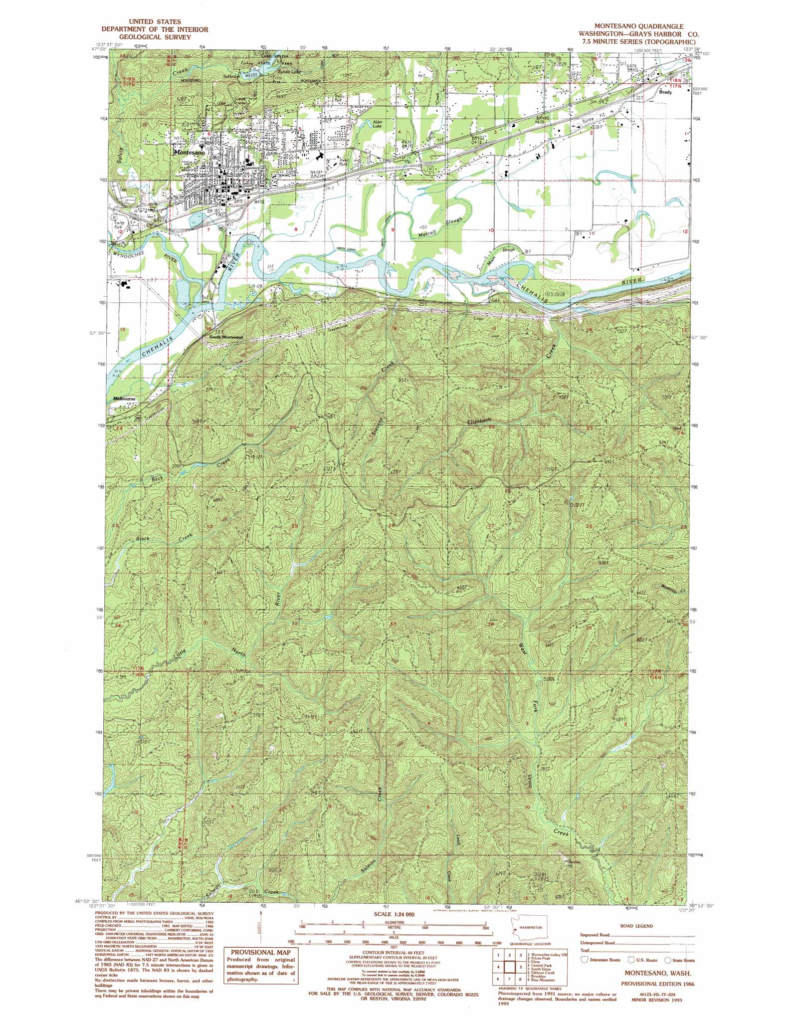
USGS Topo Quad 46123h5 - 1:24,000 scale
| Topo Map Name: | Montesano |
| USGS Topo Quad ID: | 46123h5 |
| Print Size: | ca. 21 1/4" wide x 27" high |
| Southeast Coordinates: | 46.875° N latitude / 123.5° W longitude |
| Map Center Coordinates: | 46.9375° N latitude / 123.5625° W longitude |
| U.S. State: | WA |
| Filename: | o46123h5.jpg |
| Download Map JPG Image: | Montesano topo map 1:24,000 scale |
| Map Type: | Topographic |
| Topo Series: | 7.5´ |
| Map Scale: | 1:24,000 |
| Source of Map Images: | United States Geological Survey (USGS) |
| Alternate Map Versions: |
Montesano WA 1965, updated 1988 Download PDF Buy paper map Montesano WA 1986, updated 1993 Download PDF Buy paper map Montesano WA 2011 Download PDF Buy paper map Montesano WA 2014 Download PDF Buy paper map |
1:24,000 Topo Quads surrounding Montesano
Railroad Camp |
Wynoochee Valley Nw |
Wynoochee Valley Ne |
Matlock |
Nahwatzel Lake |
Aberdeen Gardens |
Wynoochee Valley Sw |
Prices Peak |
Elma |
Mccleary |
Aberdeen |
Central Park |
Montesano |
South Elma |
Malone |
Aberdeen Se |
Elkhorn Creek |
Brooklyn |
Blue Mountain |
Cedarville |
South Bend |
Raymond |
East Of Raymond |
Dean Creek |
Doty |
> Back to 46123e1 at 1:100,000 scale
> Back to 46122a1 at 1:250,000 scale
> Back to U.S. Topo Maps home
Montesano topo map: Gazetteer
Montesano: Canals
Smith Canal elevation 3m 9′Montesano: Dams
Sylvia Lake Dam elevation 38m 124′Montesano: Populated Places
Brady elevation 14m 45′Montesano elevation 19m 62′
South Montesano elevation 15m 49′
Montesano: Reservoirs
Sylvia Lake elevation 38m 124′Montesano: Streams
Camp Creek elevation 5m 16′Cutoff Slough elevation 3m 9′
Elizabeth Creek elevation 8m 26′
Metcalf Slough elevation 3m 9′
Moon Slough elevation 7m 22′
Stevens Creek elevation 7m 22′
Sylvia Creek elevation 7m 22′
Wynoochee River elevation 7m 22′
Montesano digital topo map on disk
Buy this Montesano topo map showing relief, roads, GPS coordinates and other geographical features, as a high-resolution digital map file on DVD: