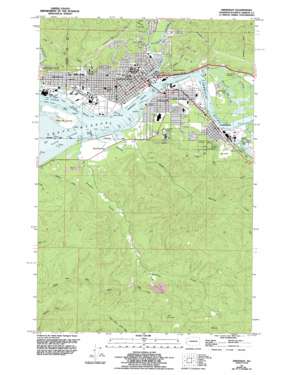
Aberdeen Topo Map Washington
To zoom in, hover over the map of Aberdeen
USGS Topo Quad 46123h7 - 1:24,000 scale
| Topo Map Name: | Aberdeen |
| USGS Topo Quad ID: | 46123h7 |
| Print Size: | ca. 21 1/4" wide x 27" high |
| Southeast Coordinates: | 46.875° N latitude / 123.75° W longitude |
| Map Center Coordinates: | 46.9375° N latitude / 123.8125° W longitude |
| U.S. State: | WA |
| Filename: | o46123h7.jpg |
| Download Map JPG Image: | Aberdeen topo map 1:24,000 scale |
| Map Type: | Topographic |
| Topo Series: | 7.5´ |
| Map Scale: | 1:24,000 |
| Source of Map Images: | United States Geological Survey (USGS) |
| Alternate Map Versions: |
Aberdeen WA 1957, updated 1995 Download PDF Buy paper map Aberdeen WA 2011 Download PDF Buy paper map Aberdeen WA 2014 Download PDF Buy paper map |
1:24,000 Topo Quads surrounding Aberdeen
> Back to 46123e1 at 1:100,000 scale
> Back to 46122a1 at 1:250,000 scale
> Back to U.S. Topo Maps home
Aberdeen topo map: Gazetteer
Aberdeen: Bridges
North Aberdeen Bridge elevation -3m -10′Aberdeen: Capes
Cow Point elevation 6m 19′Aberdeen: Channels
Aberdeen Reach elevation 0m 0′Aberdeen: Guts
Cosmopolis Waterway elevation 2m 6′Aberdeen: Islands
Rennie Island elevation 4m 13′Aberdeen: Parks
Benn Memorial Park elevation 31m 101′Finch Playfield elevation 6m 19′
Franklin Field elevation 6m 19′
L Street Park elevation 28m 91′
Mill Creek Park elevation 36m 118′
Miller Natatorium and Gym/Stewart Field Complex elevation 13m 42′
North Aberdeen Playfield elevation 9m 29′
Olympic Stadium elevation 7m 22′
Pioneer Park elevation 9m 29′
Stewart Memorial Park elevation 19m 62′
West End Playfield elevation 4m 13′
Zelasko Park elevation 5m 16′
Aberdeen: Populated Places
Aberdeen elevation 7m 22′Aberdeen Junction elevation 13m 42′
Bel-Aire elevation 100m 328′
Broadway Heights elevation 85m 278′
Cosmopolis elevation 8m 26′
East Aberdeen elevation 9m 29′
East Hoquiam elevation 4m 13′
Herbig Heights elevation 98m 321′
Junction City elevation 9m 29′
North Aberdeen elevation 9m 29′
Pilgrim Heights elevation 25m 82′
South Aberdeen elevation 10m 32′
Aberdeen: Streams
Bear Creek elevation 9m 29′Charley Creek elevation 0m 0′
Chehalis River elevation 0m 0′
Elliott Slough elevation 0m 0′
Falls Creek elevation 14m 45′
Fry Creek elevation 4m 13′
Mill Creek elevation 1m 3′
Newskah Creek elevation 1m 3′
Stewart Creek elevation 6m 19′
Van Winkle Creek elevation 3m 9′
Wilson Creek elevation 13m 42′
Wishkah River elevation 4m 13′
Aberdeen digital topo map on disk
Buy this Aberdeen topo map showing relief, roads, GPS coordinates and other geographical features, as a high-resolution digital map file on DVD:


