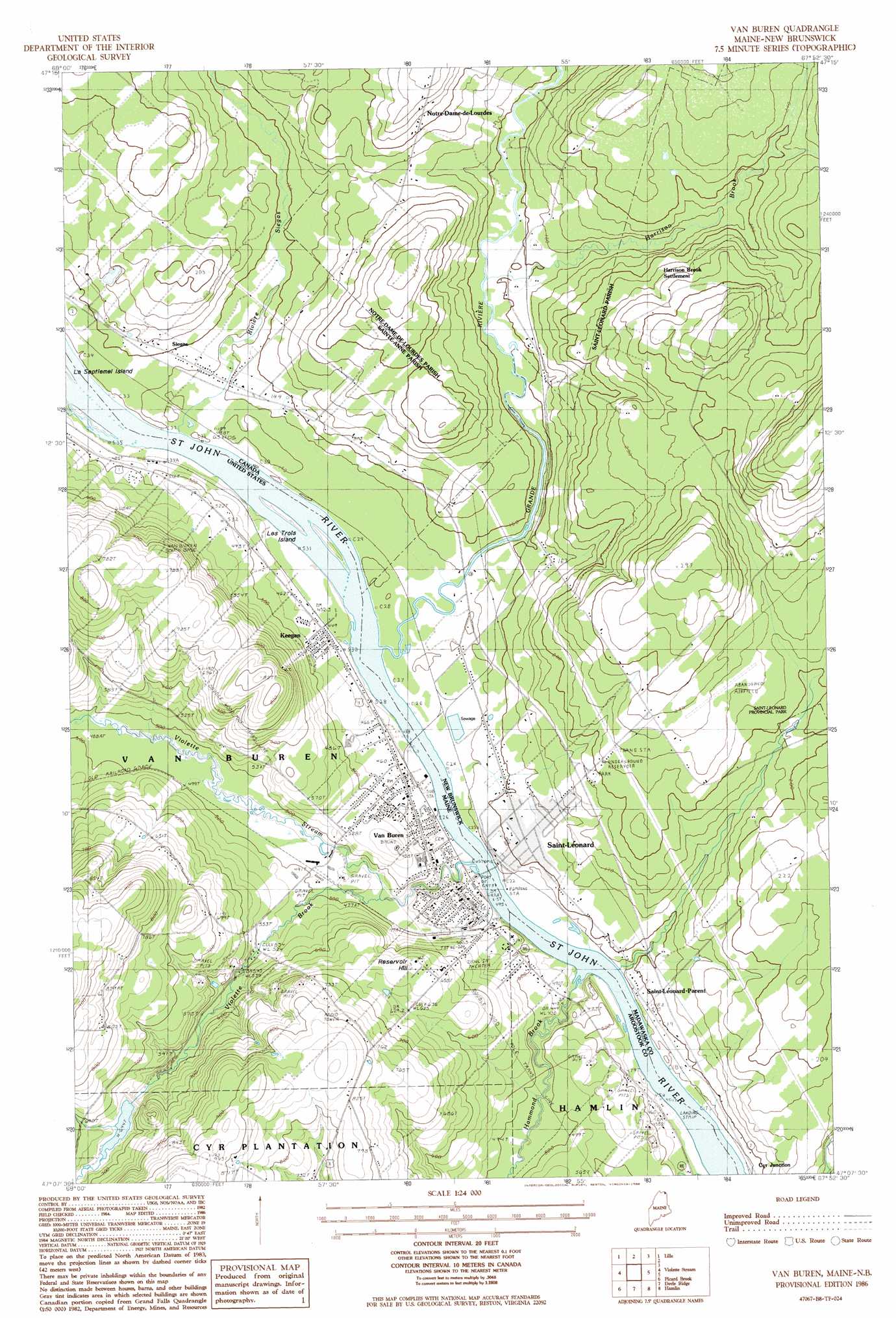
Van Buren Topo Map Maine
To zoom in, hover over the map of Van Buren
USGS Topo Quad 47067b8 - 1:24,000 scale
| Topo Map Name: | Van Buren |
| USGS Topo Quad ID: | 47067b8 |
| Print Size: | ca. 21 1/4" wide x 27" high |
| Southeast Coordinates: | 47.125° N latitude / 67.875° W longitude |
| Map Center Coordinates: | 47.1875° N latitude / 67.9375° W longitude |
| U.S. State: | ME |
| Filename: | o47067b8.jpg |
| Download Map JPG Image: | Van Buren topo map 1:24,000 scale |
| Map Type: | Topographic |
| Topo Series: | 7.5´ |
| Map Scale: | 1:24,000 |
| Source of Map Images: | United States Geological Survey (USGS) |
| Alternate Map Versions: |
Van Buren NW ME 1975, updated 1981 Download PDF Buy paper map Van Buren ME 1986, updated 1986 Download PDF Buy paper map Van Buren ME 2011 Download PDF Buy paper map Van Buren ME 2014 Download PDF Buy paper map |
1:24,000 Topo Quads surrounding Van Buren
Grand Isle |
Lille |
|||
Paulette Brook |
Violette Stream |
Van Buren |
||
Stockholm |
Picard Brook |
Doyle Ridge |
Hamlin |
|
Mud Lake |
New Sweden |
Fort Fairfield Nw |
Limestone |
> Back to 47067a1 at 1:100,000 scale
> Back to 47066a1 at 1:250,000 scale
> Back to U.S. Topo Maps home
Van Buren topo map: Gazetteer
Van Buren: Airports
Morrill Airpark elevation 245m 803′Van Buren Seaplane Base elevation 128m 419′
Van Buren: Dams
Old Water Reservoir Dam elevation 167m 547′Violette Lake Dam elevation 199m 652′
Van Buren: Islands
King Island elevation 128m 419′Les Trois Island elevation 131m 429′
Septiemel Island elevation 132m 433′
Van Buren: Populated Places
Keegan elevation 139m 456′Kennedy Terrace elevation 143m 469′
Van Buren elevation 147m 482′
Van Buren: Post Offices
Van Buren Post Office elevation 151m 495′Van Buren: Reservoirs
Violette Brook Reservoir elevation 167m 547′Violette Lake elevation 199m 652′
Van Buren: Streams
Hammond Brook elevation 128m 419′Violette Brook elevation 142m 465′
Violette Stream elevation 129m 423′
Van Buren: Summits
Reservoir Hill elevation 205m 672′Van Buren digital topo map on disk
Buy this Van Buren topo map showing relief, roads, GPS coordinates and other geographical features, as a high-resolution digital map file on DVD:
Maine, New Hampshire, Rhode Island & Eastern Massachusetts
Buy digital topo maps: Maine, New Hampshire, Rhode Island & Eastern Massachusetts