Point Isabelle Topo Map Michigan
To zoom in, hover over the map of Point Isabelle
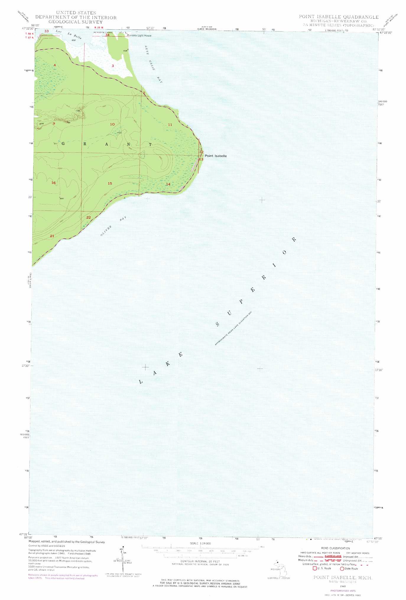
USGS Topo Quad 47087c8 - 1:24,000 scale
| Topo Map Name: | Point Isabelle |
| USGS Topo Quad ID: | 47087c8 |
| Print Size: | ca. 21 1/4" wide x 27" high |
| Southeast Coordinates: | 47.25° N latitude / 87.875° W longitude |
| Map Center Coordinates: | 47.3125° N latitude / 87.9375° W longitude |
| U.S. State: | MI |
| Filename: | o47087c8.jpg |
| Download Map JPG Image: | Point Isabelle topo map 1:24,000 scale |
| Map Type: | Topographic |
| Topo Series: | 7.5´ |
| Map Scale: | 1:24,000 |
| Source of Map Images: | United States Geological Survey (USGS) |
| Alternate Map Versions: |
Point Isabelle MI 1948, updated 1968 Download PDF Buy paper map Point Isabelle MI 1948, updated 1976 Download PDF Buy paper map Point Isabelle MI 1949, updated 1949 Download PDF Buy paper map Point Isabelle MI 2011 Download PDF Buy paper map Point Isabelle MI 2014 Download PDF Buy paper map Point Isabelle MI 2017 Download PDF Buy paper map |
1:24,000 Topo Quads surrounding Point Isabelle
Eagle Harbor |
Delaware |
Lake Medora |
Fort Wilkins |
Manitou Island |
Bruneau Creek |
Deer Lake |
Point Isabelle |
||
Gay |
||||
> Back to 47087a1 at 1:100,000 scale
> Back to 47086a1 at 1:250,000 scale
> Back to U.S. Topo Maps home
Point Isabelle topo map: Gazetteer
Point Isabelle: Bays
Bete Grise Bay elevation 183m 600′Oliver Bay elevation 183m 600′
Point Isabelle: Canals
Mendota Canal elevation 184m 603′Point Isabelle: Capes
Point Isabelle elevation 188m 616′Point Isabelle: Lakes
Lac La Belle elevation 183m 600′Point Isabelle digital topo map on disk
Buy this Point Isabelle topo map showing relief, roads, GPS coordinates and other geographical features, as a high-resolution digital map file on DVD: