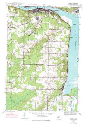
Chassell Topo Map Michigan
To zoom in, hover over the map of Chassell
USGS Topo Quad 47088a5 - 1:24,000 scale
| Topo Map Name: | Chassell |
| USGS Topo Quad ID: | 47088a5 |
| Print Size: | ca. 21 1/4" wide x 27" high |
| Southeast Coordinates: | 47° N latitude / 88.5° W longitude |
| Map Center Coordinates: | 47.0625° N latitude / 88.5625° W longitude |
| U.S. State: | MI |
| Filename: | o47088a5.jpg |
| Download Map JPG Image: | Chassell topo map 1:24,000 scale |
| Map Type: | Topographic |
| Topo Series: | 7.5´ |
| Map Scale: | 1:24,000 |
| Source of Map Images: | United States Geological Survey (USGS) |
| Alternate Map Versions: |
Chassell MI 1946, updated 1966 Download PDF Buy paper map Chassell MI 1946, updated 1976 Download PDF Buy paper map Chassell MI 1948 Download PDF Buy paper map Chassell MI 1978, updated 1980 Download PDF Buy paper map Chassell MI 2011 Download PDF Buy paper map Chassell MI 2014 Download PDF Buy paper map Chassell MI 2017 Download PDF Buy paper map |
1:24,000 Topo Quads surrounding Chassell
> Back to 47088a1 at 1:100,000 scale
> Back to 47088a1 at 1:250,000 scale
> Back to U.S. Topo Maps home
Chassell topo map: Gazetteer
Chassell: Airports
Grognet Flying Service Seaplane Base elevation 184m 603′Chassell: Bays
Pike Bay elevation 184m 603′Chassell: Capes
Atlantic Point elevation 183m 600′Pilgrim Point elevation 189m 620′
Chassell: Lakes
Huron Lake elevation 272m 892′Chassell: Mines
Isle Royale Mine elevation 293m 961′Old Superior Mine elevation 289m 948′
Chassell: Parks
Chassell Centennial Park elevation 185m 606′Chassell Township Park elevation 194m 636′
Grace Methodist Church Historical Marker elevation 198m 649′
Hoar Family Mausoleum Historical Marker elevation 245m 803′
Houghton City Park elevation 188m 616′
Houghton County Courthouse Historical Marker elevation 220m 721′
Houghton County Historical Marker elevation 220m 721′
Michigan Tech Historical Marker elevation 210m 688′
Saint Ignatius Loyola Church Historical Marker elevation 226m 741′
Sherman Field elevation 253m 830′
Trinity Episcopal Church Historical Marker elevation 212m 695′
Chassell: Populated Places
Chassell elevation 189m 620′Chassell Bay Cabins Mobile Home Park elevation 186m 610′
Dodgeville elevation 300m 984′
Dollar Bay elevation 191m 626′
Houghton elevation 196m 643′
Hurontown elevation 282m 925′
Pilgrim elevation 194m 636′
Sunshine Beach elevation 186m 610′
Superior elevation 278m 912′
Chassell: Post Offices
Chassell Post Office elevation 187m 613′Dodgeville Post Office (historical) elevation 299m 980′
Dollar Bay Post Office elevation 191m 626′
Houghton Post Office elevation 187m 613′
Chassell: Streams
Denton Creek elevation 194m 636′Eaton Creek elevation 194m 636′
Little Otter River elevation 261m 856′
Pike River elevation 184m 603′
Pilgrim River elevation 186m 610′
Slates Creek elevation 252m 826′
Chassell digital topo map on disk
Buy this Chassell topo map showing relief, roads, GPS coordinates and other geographical features, as a high-resolution digital map file on DVD:


