Graveraet River Topo Map Michigan
To zoom in, hover over the map of Graveraet River
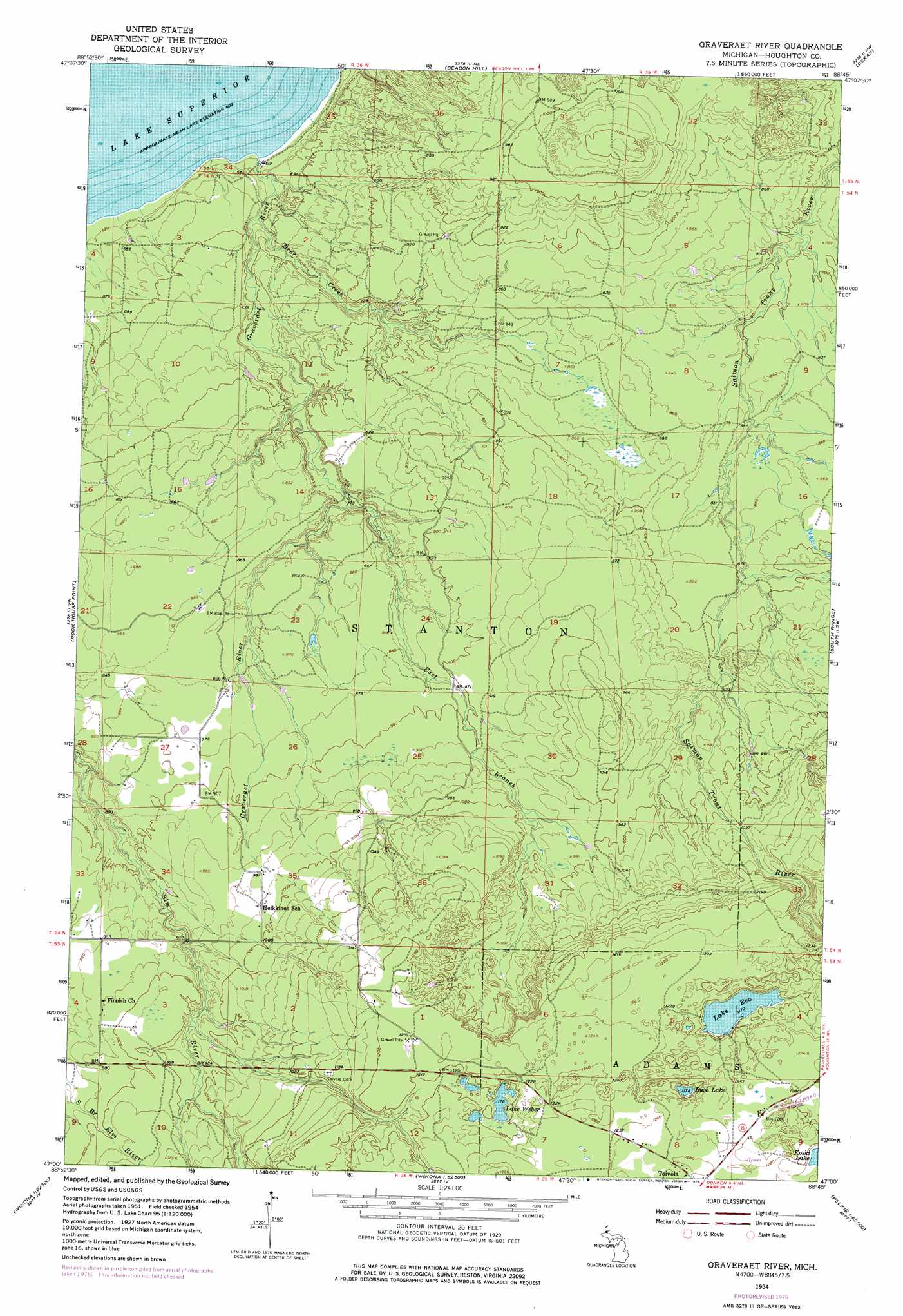
USGS Topo Quad 47088a7 - 1:24,000 scale
| Topo Map Name: | Graveraet River |
| USGS Topo Quad ID: | 47088a7 |
| Print Size: | ca. 21 1/4" wide x 27" high |
| Southeast Coordinates: | 47° N latitude / 88.75° W longitude |
| Map Center Coordinates: | 47.0625° N latitude / 88.8125° W longitude |
| U.S. State: | MI |
| Filename: | o47088a7.jpg |
| Download Map JPG Image: | Graveraet River topo map 1:24,000 scale |
| Map Type: | Topographic |
| Topo Series: | 7.5´ |
| Map Scale: | 1:24,000 |
| Source of Map Images: | United States Geological Survey (USGS) |
| Alternate Map Versions: |
Graveraet River MI 1954, updated 1955 Download PDF Buy paper map Graveraet River MI 1954, updated 1967 Download PDF Buy paper map Graveraet River MI 1954, updated 1976 Download PDF Buy paper map Graveraet River MI 2011 Download PDF Buy paper map Graveraet River MI 2014 Download PDF Buy paper map Graveraet River MI 2017 Download PDF Buy paper map |
1:24,000 Topo Quads surrounding Graveraet River
Muggun Creek |
||||
Beacon Hill |
Oskar |
Hancock |
||
Rockhouse Point |
Graveraet River |
South Range |
Chassell |
|
Four Corners |
Winona North |
Donken |
Pine Lake |
Otter Lake |
Greenland |
Winona South |
Nisula |
Pelkie |
Bear Town |
> Back to 47088a1 at 1:100,000 scale
> Back to 47088a1 at 1:250,000 scale
> Back to U.S. Topo Maps home
Graveraet River topo map: Gazetteer
Graveraet River: Lakes
Bush Lake elevation 356m 1167′Lake Eva elevation 357m 1171′
Lake Weber elevation 359m 1177′
Graveraet River: Streams
Deer Creek elevation 198m 649′East Branch Graveraet River elevation 237m 777′
Graveraet River elevation 183m 600′
Graveraet River digital topo map on disk
Buy this Graveraet River topo map showing relief, roads, GPS coordinates and other geographical features, as a high-resolution digital map file on DVD: