Good Harbor Bay Topo Map Minnesota
To zoom in, hover over the map of Good Harbor Bay
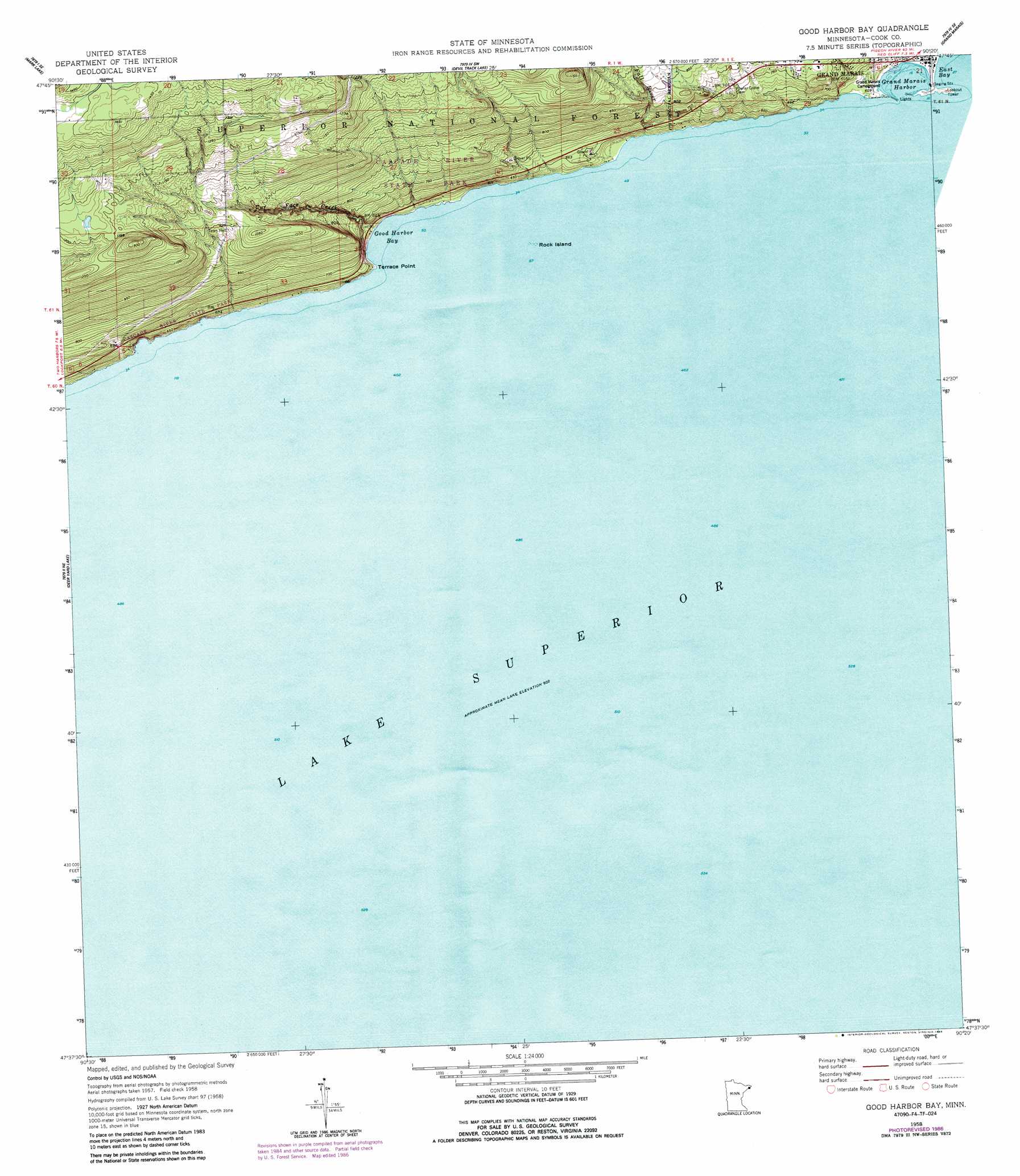
USGS Topo Quad 47090f3 - 1:24,000 scale
| Topo Map Name: | Good Harbor Bay |
| USGS Topo Quad ID: | 47090f3 |
| Print Size: | ca. 21 1/4" wide x 27" high |
| Southeast Coordinates: | 47.625° N latitude / 90.25° W longitude |
| Map Center Coordinates: | 47.6875° N latitude / 90.3125° W longitude |
| U.S. State: | MN |
| Filename: | o47090f3.jpg |
| Download Map JPG Image: | Good Harbor Bay topo map 1:24,000 scale |
| Map Type: | Topographic |
| Topo Series: | 7.5´ |
| Map Scale: | 1:24,000 |
| Source of Map Images: | United States Geological Survey (USGS) |
| Alternate Map Versions: |
Good Harbor Bay OE E MN 2011 Download PDF Buy paper map Good Harbor Bay OE E MN 2013 Download PDF Buy paper map Good Harbor Bay OE E MN 2016 Download PDF Buy paper map |
| FStopo: | US Forest Service topo Good Harbor Bay OE E is available: Download FStopo PDF Download FStopo TIF |
1:24,000 Topo Quads surrounding Good Harbor Bay
Eagle Mountain |
Lima Mountain |
Pine Mountain |
Northern Light Lake |
Tom Lake |
Mark Lake |
Devil Track Lake |
Grand Marais |
Kadunce River |
Marr Island |
Deer Yard Lake |
Good Harbor Bay |
|||
> Back to 47090e1 at 1:100,000 scale
> Back to 47090a1 at 1:250,000 scale
> Back to U.S. Topo Maps home
Good Harbor Bay topo map: Gazetteer
Good Harbor Bay: Bays
East Bay elevation 183m 600′Grand Marais Harbor elevation 183m 600′
Good Harbor Bay: Parks
Grand Marais Geological Marker elevation 191m 626′Grand Marais Wayside Park elevation 191m 626′
Good Harbor Bay digital topo map on disk
Buy this Good Harbor Bay topo map showing relief, roads, GPS coordinates and other geographical features, as a high-resolution digital map file on DVD: