Marr Island Topo Map Minnesota
To zoom in, hover over the map of Marr Island
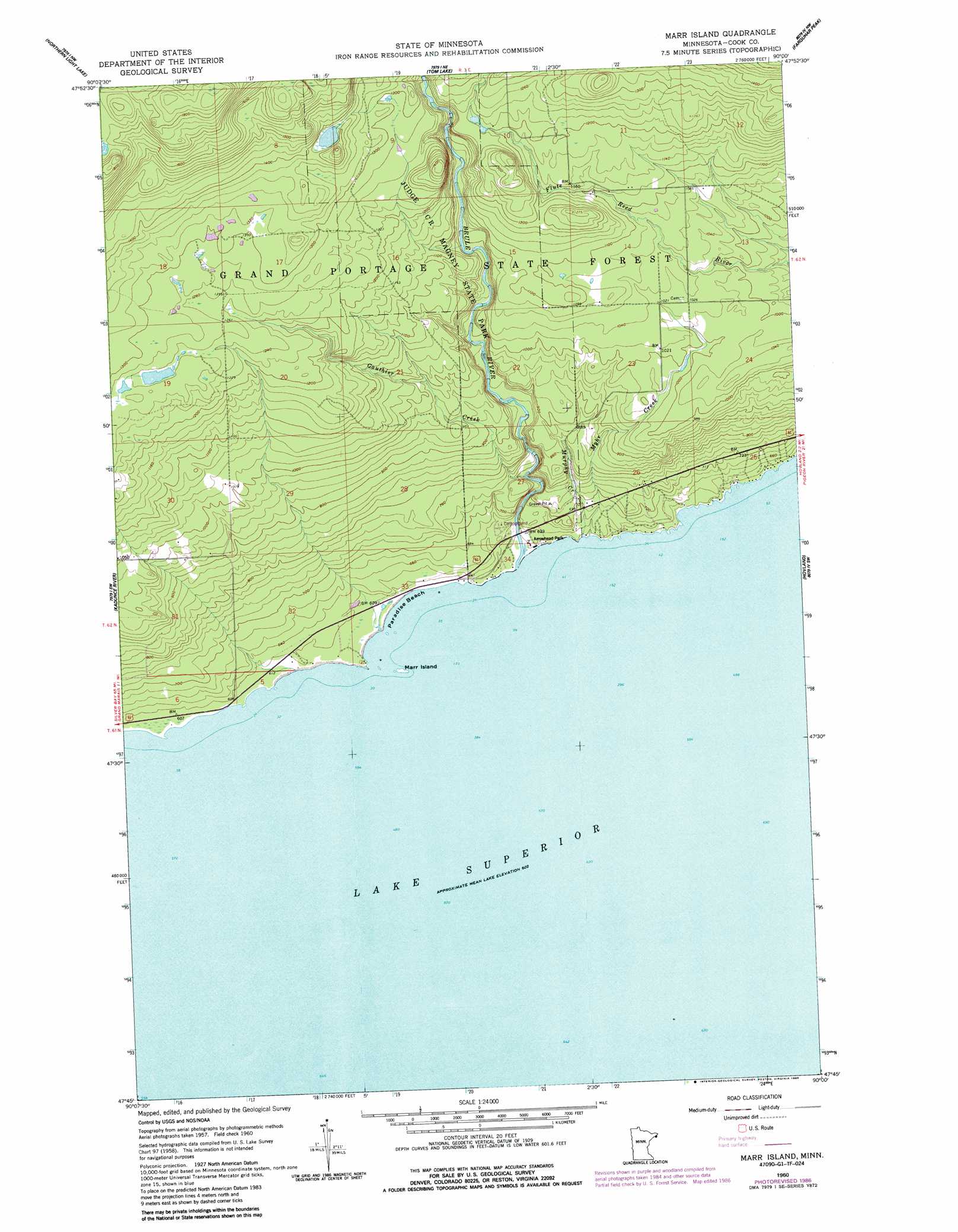
USGS Topo Quad 47090g1 - 1:24,000 scale
| Topo Map Name: | Marr Island |
| USGS Topo Quad ID: | 47090g1 |
| Print Size: | ca. 21 1/4" wide x 27" high |
| Southeast Coordinates: | 47.75° N latitude / 90° W longitude |
| Map Center Coordinates: | 47.8125° N latitude / 90.0625° W longitude |
| U.S. State: | MN |
| Filename: | o47090g1.jpg |
| Download Map JPG Image: | Marr Island topo map 1:24,000 scale |
| Map Type: | Topographic |
| Topo Series: | 7.5´ |
| Map Scale: | 1:24,000 |
| Source of Map Images: | United States Geological Survey (USGS) |
| Alternate Map Versions: |
Marr Island MN 1960, updated 1963 Download PDF Buy paper map Marr Island MN 1960, updated 1982 Download PDF Buy paper map Marr Island MN 1960, updated 1986 Download PDF Buy paper map Marr Island MN 2011 Download PDF Buy paper map Marr Island MN 2013 Download PDF Buy paper map Marr Island MN 2016 Download PDF Buy paper map |
| FStopo: | US Forest Service topo Marr Island is available: Download FStopo PDF Download FStopo TIF |
1:24,000 Topo Quads surrounding Marr Island
Crocodile Lake |
Pine Lake West |
Pine Lake East |
South Fowl Lake |
The Cascades |
Pine Mountain |
Northern Light Lake |
Tom Lake |
Farquhar Peak |
Mineral Center |
Grand Marais |
Kadunce River |
Marr Island |
Hovland |
|
Good Harbor Bay |
||||
> Back to 47090e1 at 1:100,000 scale
> Back to 47090a1 at 1:250,000 scale
> Back to U.S. Topo Maps home
Marr Island topo map: Gazetteer
Marr Island: Beaches
Paradise Beach elevation 184m 603′Marr Island: Islands
Marr Island elevation 185m 606′Marr Island: Parks
Arrowhead Park elevation 189m 620′Judge C R Magney State Park elevation 327m 1072′
Judge C R Magney State Park Historical Marker elevation 198m 649′
Marr Island: Streams
Brule River elevation 188m 616′Gauthier Creek elevation 207m 679′
Murphy Creek elevation 184m 603′
Myhr Creek elevation 184m 603′
Marr Island digital topo map on disk
Buy this Marr Island topo map showing relief, roads, GPS coordinates and other geographical features, as a high-resolution digital map file on DVD: