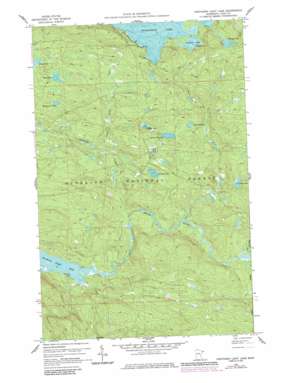
Northern Light Lake Topo Map Minnesota
To zoom in, hover over the map of Northern Light Lake
USGS Topo Quad 47090h2 - 1:24,000 scale
| Topo Map Name: | Northern Light Lake |
| USGS Topo Quad ID: | 47090h2 |
| Print Size: | ca. 21 1/4" wide x 27" high |
| Southeast Coordinates: | 47.875° N latitude / 90.125° W longitude |
| Map Center Coordinates: | 47.9375° N latitude / 90.1875° W longitude |
| U.S. State: | MN |
| Filename: | o47090h2.jpg |
| Download Map JPG Image: | Northern Light Lake topo map 1:24,000 scale |
| Map Type: | Topographic |
| Topo Series: | 7.5´ |
| Map Scale: | 1:24,000 |
| Source of Map Images: | United States Geological Survey (USGS) |
| Alternate Map Versions: |
Northern Light Lake MN 1959, updated 1965 Download PDF Buy paper map Northern Light Lake MN 1959, updated 1978 Download PDF Buy paper map Northern Light Lake MN 1959, updated 1986 Download PDF Buy paper map Northern Light Lake MN 2011 Download PDF Buy paper map Northern Light Lake MN 2013 Download PDF Buy paper map Northern Light Lake MN 2016 Download PDF Buy paper map |
| FStopo: | US Forest Service topo Northern Light Lake is available: Download FStopo PDF Download FStopo TIF |
1:24,000 Topo Quads surrounding Northern Light Lake
> Back to 47090e1 at 1:100,000 scale
> Back to 47090a1 at 1:250,000 scale
> Back to U.S. Topo Maps home
Northern Light Lake topo map: Gazetteer
Northern Light Lake: Lakes
Cyprinid Lake elevation 530m 1738′Northern Light Lake elevation 468m 1535′
Paine Lake elevation 502m 1646′
Puddle Lake elevation 545m 1788′
Redcoat Lake elevation 503m 1650′
Section Ten Lake elevation 534m 1751′
Spark Lake elevation 570m 1870′
Sunfish Lake elevation 570m 1870′
Triangle Lake elevation 595m 1952′
Woodpecker Lake elevation 564m 1850′
Northern Light Lake: Streams
Assinika Creek elevation 457m 1499′Greenwood River elevation 451m 1479′
Little Stony Creek elevation 494m 1620′
Northern Light Lake digital topo map on disk
Buy this Northern Light Lake topo map showing relief, roads, GPS coordinates and other geographical features, as a high-resolution digital map file on DVD:


