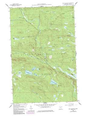
Pine Mountain Topo Map Minnesota
To zoom in, hover over the map of Pine Mountain
USGS Topo Quad 47090h3 - 1:24,000 scale
| Topo Map Name: | Pine Mountain |
| USGS Topo Quad ID: | 47090h3 |
| Print Size: | ca. 21 1/4" wide x 27" high |
| Southeast Coordinates: | 47.875° N latitude / 90.25° W longitude |
| Map Center Coordinates: | 47.9375° N latitude / 90.3125° W longitude |
| U.S. State: | MN |
| Filename: | o47090h3.jpg |
| Download Map JPG Image: | Pine Mountain topo map 1:24,000 scale |
| Map Type: | Topographic |
| Topo Series: | 7.5´ |
| Map Scale: | 1:24,000 |
| Source of Map Images: | United States Geological Survey (USGS) |
| Alternate Map Versions: |
Pine Mountain MN 1959, updated 1964 Download PDF Buy paper map Pine Mountain MN 1959, updated 1986 Download PDF Buy paper map Pine Mountain MN 2011 Download PDF Buy paper map Pine Mountain MN 2013 Download PDF Buy paper map Pine Mountain MN 2016 Download PDF Buy paper map |
| FStopo: | US Forest Service topo Pine Mountain is available: Download FStopo PDF Download FStopo TIF |
1:24,000 Topo Quads surrounding Pine Mountain
> Back to 47090e1 at 1:100,000 scale
> Back to 47090a1 at 1:250,000 scale
> Back to U.S. Topo Maps home
Pine Mountain topo map: Gazetteer
Pine Mountain: Lakes
Assinika Lake elevation 540m 1771′Chase Lake elevation 506m 1660′
Circle Lake elevation 573m 1879′
Duke Lake elevation 564m 1850′
Kindle Lake elevation 570m 1870′
Lake Twelve elevation 534m 1751′
Logger Lake elevation 521m 1709′
Lullaby Lake elevation 552m 1811′
Makada Lake elevation 541m 1774′
Merganser Lake elevation 472m 1548′
Muckwa Lake elevation 576m 1889′
Muma Lake elevation 582m 1909′
Mush Lake elevation 576m 1889′
Musquash Lake elevation 576m 1889′
Pine Mountain Lake elevation 540m 1771′
Pistol Lake elevation 503m 1650′
Stony Lake elevation 552m 1811′
Pine Mountain: Streams
Falls Creek elevation 471m 1545′Lullaby Creek elevation 500m 1640′
Pine Mountain Creek elevation 531m 1742′
South Brule River elevation 477m 1564′
Swamper Creek elevation 524m 1719′
Timber Creek elevation 469m 1538′
Woodpile Creek elevation 523m 1715′
Pine Mountain: Summits
Pine Mountain elevation 667m 2188′Pine Mountain digital topo map on disk
Buy this Pine Mountain topo map showing relief, roads, GPS coordinates and other geographical features, as a high-resolution digital map file on DVD:


