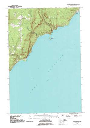
Castle Danger Topo Map Minnesota
To zoom in, hover over the map of Castle Danger
USGS Topo Quad 47091a5 - 1:24,000 scale
| Topo Map Name: | Castle Danger |
| USGS Topo Quad ID: | 47091a5 |
| Print Size: | ca. 21 1/4" wide x 27" high |
| Southeast Coordinates: | 47° N latitude / 91.5° W longitude |
| Map Center Coordinates: | 47.0625° N latitude / 91.5625° W longitude |
| U.S. State: | MN |
| Filename: | o47091a5.jpg |
| Download Map JPG Image: | Castle Danger topo map 1:24,000 scale |
| Map Type: | Topographic |
| Topo Series: | 7.5´ |
| Map Scale: | 1:24,000 |
| Source of Map Images: | United States Geological Survey (USGS) |
| Alternate Map Versions: |
Castle Danger MN 1957, updated 1958 Download PDF Buy paper map Castle Danger MN 1957, updated 1974 Download PDF Buy paper map Castle Danger MN 1992, updated 1995 Download PDF Buy paper map Castle Danger MN 2010 Download PDF Buy paper map Castle Danger MN 2013 Download PDF Buy paper map Castle Danger MN 2016 Download PDF Buy paper map |
1:24,000 Topo Quads surrounding Castle Danger
Brimson |
Kane Lake |
Legler Lake |
Silver Bay Sw |
Silver Bay |
King Lake |
Highland |
Two Harbors Ne |
Split Rock Point |
Split Rock Point Ne |
Mccarthy Creek |
Two Harbors |
Castle Danger |
||
Knife River |
||||
Port Wing |
Herbster |
> Back to 47091a1 at 1:100,000 scale
> Back to 47090a1 at 1:250,000 scale
> Back to U.S. Topo Maps home
Castle Danger topo map: Gazetteer
Castle Danger: Airports
Weideman International Airport elevation 281m 921′Castle Danger: Cliffs
Lafayette Bluff elevation 246m 807′Silver Cliff elevation 230m 754′
Castle Danger: Islands
Encampment Island elevation 188m 616′Castle Danger: Parks
Silver Creek Cliff Wayside Park elevation 210m 688′Castle Danger: Populated Places
Castle Danger elevation 191m 626′Silver Creek elevation 299m 980′
Castle Danger: Streams
Crow Creek elevation 186m 610′Encampment River elevation 184m 603′
Petes Creek elevation 184m 603′
Silver Creek elevation 184m 603′
Castle Danger digital topo map on disk
Buy this Castle Danger topo map showing relief, roads, GPS coordinates and other geographical features, as a high-resolution digital map file on DVD:


