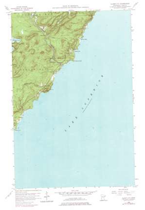
Illgen City Topo Map Minnesota
To zoom in, hover over the map of Illgen City
USGS Topo Quad 47091c2 - 1:24,000 scale
| Topo Map Name: | Illgen City |
| USGS Topo Quad ID: | 47091c2 |
| Print Size: | ca. 21 1/4" wide x 27" high |
| Southeast Coordinates: | 47.25° N latitude / 91.125° W longitude |
| Map Center Coordinates: | 47.3125° N latitude / 91.1875° W longitude |
| U.S. State: | MN |
| Filename: | o47091c2.jpg |
| Download Map JPG Image: | Illgen City topo map 1:24,000 scale |
| Map Type: | Topographic |
| Topo Series: | 7.5´ |
| Map Scale: | 1:24,000 |
| Source of Map Images: | United States Geological Survey (USGS) |
| Alternate Map Versions: |
Illgen City MN 1956, updated 1958 Download PDF Buy paper map Illgen City MN 1956, updated 1968 Download PDF Buy paper map Illgen City MN 1956, updated 1978 Download PDF Buy paper map Illgen City MN 2010 Download PDF Buy paper map Illgen City MN 2013 Download PDF Buy paper map Illgen City MN 2016 Download PDF Buy paper map |
1:24,000 Topo Quads surrounding Illgen City
Isabella Station |
Isabella |
Cabin Lake |
Cramer |
Schroeder |
Cloquet Lake |
Doyle Lake |
Finland |
Little Marais |
|
Silver Bay Sw |
Silver Bay |
Illgen City |
||
Split Rock Point |
Split Rock Point Ne |
|||
> Back to 47091a1 at 1:100,000 scale
> Back to 47090a1 at 1:250,000 scale
> Back to U.S. Topo Maps home
Illgen City topo map: Gazetteer
Illgen City: Bays
Belmore Bay elevation 184m 603′Crystal Bay elevation 184m 603′
Illgen City: Capes
Shovel Point elevation 200m 656′Illgen City: Falls
Illgen Falls elevation 283m 928′Illgen City: Lakes
Nipisiquit Lake elevation 376m 1233′Illgen City: Parks
Baptism River State Park elevation 226m 741′Palisade Head Historical Marker elevation 218m 715′
Illgen City: Populated Places
Illgen City elevation 225m 738′Illgen City: Streams
Baptism River elevation 184m 603′Crystal Creek elevation 196m 643′
Kennedy Creek elevation 202m 662′
Palisade Creek elevation 183m 600′
Williams Creek elevation 184m 603′
Illgen City: Summits
Palisade Head elevation 284m 931′Illgen City digital topo map on disk
Buy this Illgen City topo map showing relief, roads, GPS coordinates and other geographical features, as a high-resolution digital map file on DVD:


