Toimi Topo Map Minnesota
To zoom in, hover over the map of Toimi
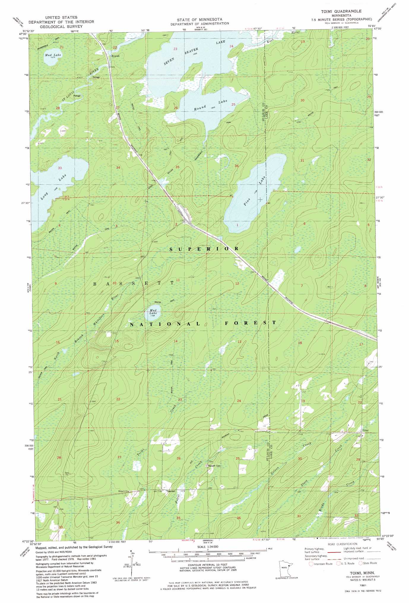
USGS Topo Quad 47091d7 - 1:24,000 scale
| Topo Map Name: | Toimi |
| USGS Topo Quad ID: | 47091d7 |
| Print Size: | ca. 21 1/4" wide x 27" high |
| Southeast Coordinates: | 47.375° N latitude / 91.75° W longitude |
| Map Center Coordinates: | 47.4375° N latitude / 91.8125° W longitude |
| U.S. State: | MN |
| Filename: | o47091d7.jpg |
| Download Map JPG Image: | Toimi topo map 1:24,000 scale |
| Map Type: | Topographic |
| Topo Series: | 7.5´ |
| Map Scale: | 1:24,000 |
| Source of Map Images: | United States Geological Survey (USGS) |
| Alternate Map Versions: |
Toimi MN 1981, updated 1982 Download PDF Buy paper map Toimi MN 1981, updated 1985 Download PDF Buy paper map Toimi MN 2011 Download PDF Buy paper map Toimi MN 2013 Download PDF Buy paper map Toimi MN 2016 Download PDF Buy paper map |
| FStopo: | US Forest Service topo Toimi is available: Download FStopo PDF Download FStopo TIF |
1:24,000 Topo Quads surrounding Toimi
Isaac Lake |
Babbitt |
Babbitt Ne |
Slate Lake West |
Slate Lake East |
Allen |
Babbitt Sw |
Babbitt Se |
Greenwood Lake West |
Greenwood Lake East |
Bird Lake |
Skibo |
Toimi |
Mount Weber |
Whyte |
Harris Lake |
Fairbanks |
Brimson |
Kane Lake |
Legler Lake |
Boulder Lake Reservoir Ne |
Pequaywan Lake |
King Lake |
Highland |
Two Harbors Ne |
> Back to 47091a1 at 1:100,000 scale
> Back to 47090a1 at 1:250,000 scale
> Back to U.S. Topo Maps home
Toimi topo map: Gazetteer
Toimi: Lakes
Black Mallard Lake elevation 511m 1676′Butterball Lake elevation 506m 1660′
Mud Lake elevation 521m 1709′
Pine Lake elevation 521m 1709′
Round Lake elevation 509m 1669′
Toimi: Populated Places
Bassett elevation 524m 1719′Toimi elevation 533m 1748′
Toimi: Post Offices
Toimi Post Office (historical) elevation 515m 1689′Toimi: Streams
East River elevation 509m 1669′Toimi digital topo map on disk
Buy this Toimi topo map showing relief, roads, GPS coordinates and other geographical features, as a high-resolution digital map file on DVD: