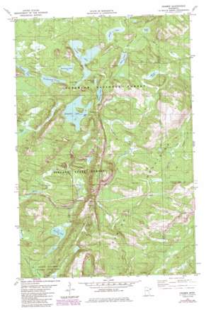
Cramer Topo Map Minnesota
To zoom in, hover over the map of Cramer
USGS Topo Quad 47091e1 - 1:24,000 scale
| Topo Map Name: | Cramer |
| USGS Topo Quad ID: | 47091e1 |
| Print Size: | ca. 21 1/4" wide x 27" high |
| Southeast Coordinates: | 47.5° N latitude / 91° W longitude |
| Map Center Coordinates: | 47.5625° N latitude / 91.0625° W longitude |
| U.S. State: | MN |
| Filename: | o47091e1.jpg |
| Download Map JPG Image: | Cramer topo map 1:24,000 scale |
| Map Type: | Topographic |
| Topo Series: | 7.5´ |
| Map Scale: | 1:24,000 |
| Source of Map Images: | United States Geological Survey (USGS) |
| Alternate Map Versions: |
Cramer MN 1981, updated 1982 Download PDF Buy paper map Cramer MN 1981, updated 1985 Download PDF Buy paper map Cramer MN 2011 Download PDF Buy paper map Cramer MN 2013 Download PDF Buy paper map Cramer MN 2016 Download PDF Buy paper map |
| FStopo: | US Forest Service topo Cramer is available: Download FStopo PDF Download FStopo TIF |
1:24,000 Topo Quads surrounding Cramer
> Back to 47091e1 at 1:100,000 scale
> Back to 47090a1 at 1:250,000 scale
> Back to U.S. Topo Maps home
Cramer topo map: Gazetteer
Cramer: Lakes
Artlip Lake elevation 509m 1669′Bonanza Lake elevation 534m 1751′
Cramer Lake elevation 425m 1394′
Crooked Lake elevation 523m 1715′
Echo Lake elevation 507m 1663′
Goldeneye Lake elevation 529m 1735′
Hare Lake elevation 512m 1679′
Kowalski Lake elevation 434m 1423′
Meme Lake elevation 523m 1715′
Morris Lake elevation 498m 1633′
Ninemile Lake elevation 492m 1614′
Paccini Lake elevation 468m 1535′
Pearl Lake elevation 511m 1676′
Shoepack Lake elevation 529m 1735′
Thunderbird Lake elevation 520m 1706′
Cramer: Parks
George H Crosby Manitou State Park elevation 424m 1391′Cramer: Populated Places
Cramer elevation 427m 1400′Cramer: Streams
Amenda Creek elevation 442m 1450′Martin Creek elevation 423m 1387′
Ninemile Creek elevation 415m 1361′
Cramer digital topo map on disk
Buy this Cramer topo map showing relief, roads, GPS coordinates and other geographical features, as a high-resolution digital map file on DVD:


