Babbitt Se Topo Map Minnesota
To zoom in, hover over the map of Babbitt Se
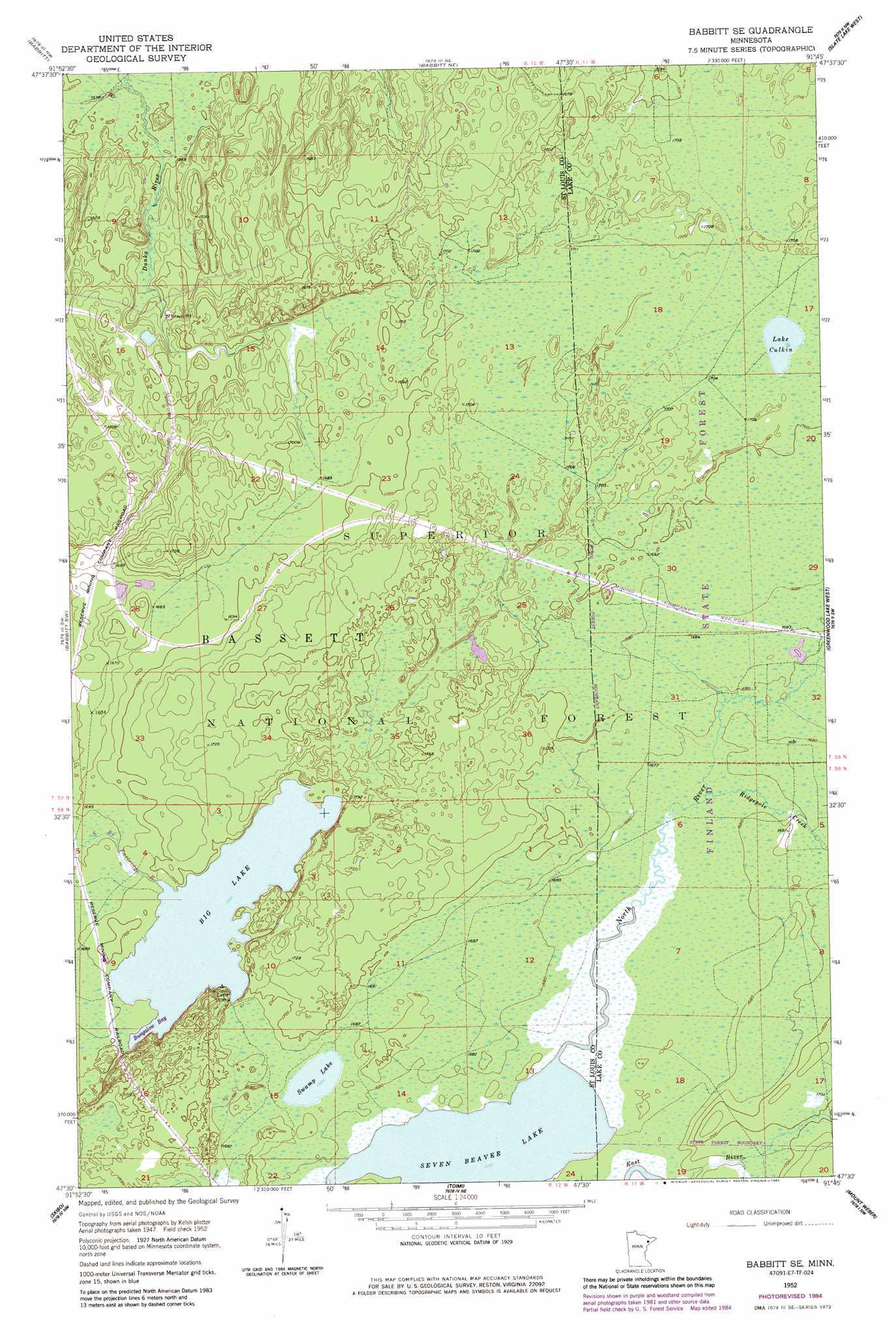
USGS Topo Quad 47091e7 - 1:24,000 scale
| Topo Map Name: | Babbitt Se |
| USGS Topo Quad ID: | 47091e7 |
| Print Size: | ca. 21 1/4" wide x 27" high |
| Southeast Coordinates: | 47.5° N latitude / 91.75° W longitude |
| Map Center Coordinates: | 47.5625° N latitude / 91.8125° W longitude |
| U.S. State: | MN |
| Filename: | o47091e7.jpg |
| Download Map JPG Image: | Babbitt Se topo map 1:24,000 scale |
| Map Type: | Topographic |
| Topo Series: | 7.5´ |
| Map Scale: | 1:24,000 |
| Source of Map Images: | United States Geological Survey (USGS) |
| Alternate Map Versions: |
Babbitt SE MN 1952, updated 1954 Download PDF Buy paper map Babbitt SE MN 1952, updated 1963 Download PDF Buy paper map Babbitt SE MN 1952, updated 1971 Download PDF Buy paper map Babbitt SE MN 1952, updated 1985 Download PDF Buy paper map Babbitt SE MN 2011 Download PDF Buy paper map Babbitt SE MN 2013 Download PDF Buy paper map Babbitt SE MN 2016 Download PDF Buy paper map |
| FStopo: | US Forest Service topo Babbitt SE is available: Download FStopo PDF Download FStopo TIF |
1:24,000 Topo Quads surrounding Babbitt Se
Eagles Nest |
Bear Island |
Kangas Bay |
Bogberry Lake |
Gabbro Lake |
Isaac Lake |
Babbitt |
Babbitt Ne |
Slate Lake West |
Slate Lake East |
Allen |
Babbitt Sw |
Babbitt Se |
Greenwood Lake West |
Greenwood Lake East |
Bird Lake |
Skibo |
Toimi |
Mount Weber |
Whyte |
Harris Lake |
Fairbanks |
Brimson |
Kane Lake |
Legler Lake |
> Back to 47091e1 at 1:100,000 scale
> Back to 47090a1 at 1:250,000 scale
> Back to U.S. Topo Maps home
Babbitt Se topo map: Gazetteer
Babbitt Se: Bays
Bungalow Bay elevation 515m 1689′Babbitt Se: Lakes
Big Lake elevation 515m 1689′Lake Culkin elevation 520m 1706′
Seven Beaver Lake elevation 509m 1669′
Swamp Lake elevation 513m 1683′
Babbitt Se: Streams
North River elevation 509m 1669′Ridgepole Creek elevation 511m 1676′
South Branch Partridge River elevation 511m 1676′
Babbitt Se digital topo map on disk
Buy this Babbitt Se topo map showing relief, roads, GPS coordinates and other geographical features, as a high-resolution digital map file on DVD: