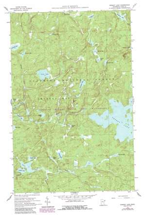
Perent Lake Topo Map Minnesota
To zoom in, hover over the map of Perent Lake
USGS Topo Quad 47091g2 - 1:24,000 scale
| Topo Map Name: | Perent Lake |
| USGS Topo Quad ID: | 47091g2 |
| Print Size: | ca. 21 1/4" wide x 27" high |
| Southeast Coordinates: | 47.75° N latitude / 91.125° W longitude |
| Map Center Coordinates: | 47.8125° N latitude / 91.1875° W longitude |
| U.S. State: | MN |
| Filename: | o47091g2.jpg |
| Download Map JPG Image: | Perent Lake topo map 1:24,000 scale |
| Map Type: | Topographic |
| Topo Series: | 7.5´ |
| Map Scale: | 1:24,000 |
| Source of Map Images: | United States Geological Survey (USGS) |
| Alternate Map Versions: |
Perent Lake MN 1960, updated 1962 Download PDF Buy paper map Perent Lake MN 1960, updated 1966 Download PDF Buy paper map Perent Lake MN 1960, updated 1986 Download PDF Buy paper map Perent Lake MN 2011 Download PDF Buy paper map Perent Lake MN 2013 Download PDF Buy paper map Perent Lake MN 2016 Download PDF Buy paper map |
| FStopo: | US Forest Service topo Perent Lake is available: Download FStopo PDF Download FStopo TIF |
1:24,000 Topo Quads surrounding Perent Lake
> Back to 47091e1 at 1:100,000 scale
> Back to 47090a1 at 1:250,000 scale
> Back to U.S. Topo Maps home
Perent Lake topo map: Gazetteer
Perent Lake: Lakes
Albino Lake elevation 490m 1607′Andek Lake elevation 497m 1630′
Baskatong Lake elevation 505m 1656′
Calamity Lake elevation 493m 1617′
Chickadee Lake elevation 511m 1676′
Comfort Lake elevation 480m 1574′
Ferne Lake elevation 486m 1594′
Fool Hen Lake elevation 492m 1614′
Fungus Lake elevation 509m 1669′
Harica Lake elevation 478m 1568′
Nuthatch Lake elevation 521m 1709′
Orchid Lake elevation 483m 1584′
Peerless Lake elevation 499m 1637′
Perent Lake elevation 492m 1614′
Placid Lake elevation 477m 1564′
Pompous Lake elevation 477m 1564′
Powwow Lake elevation 489m 1604′
Small Lake elevation 480m 1574′
Snusbox Lake elevation 483m 1584′
Sumpet Lake elevation 486m 1594′
Tomahawk Lake elevation 508m 1666′
Warbler Lake elevation 489m 1604′
Whittler Lake elevation 508m 1666′
Perent Lake: Streams
Comfort Creek elevation 480m 1574′Dumbbell River elevation 481m 1578′
Ferne Creek elevation 477m 1564′
Fool Hen Creek elevation 483m 1584′
Powwow Creek elevation 473m 1551′
Perent Lake digital topo map on disk
Buy this Perent Lake topo map showing relief, roads, GPS coordinates and other geographical features, as a high-resolution digital map file on DVD:


