Canyon Topo Map Minnesota
To zoom in, hover over the map of Canyon
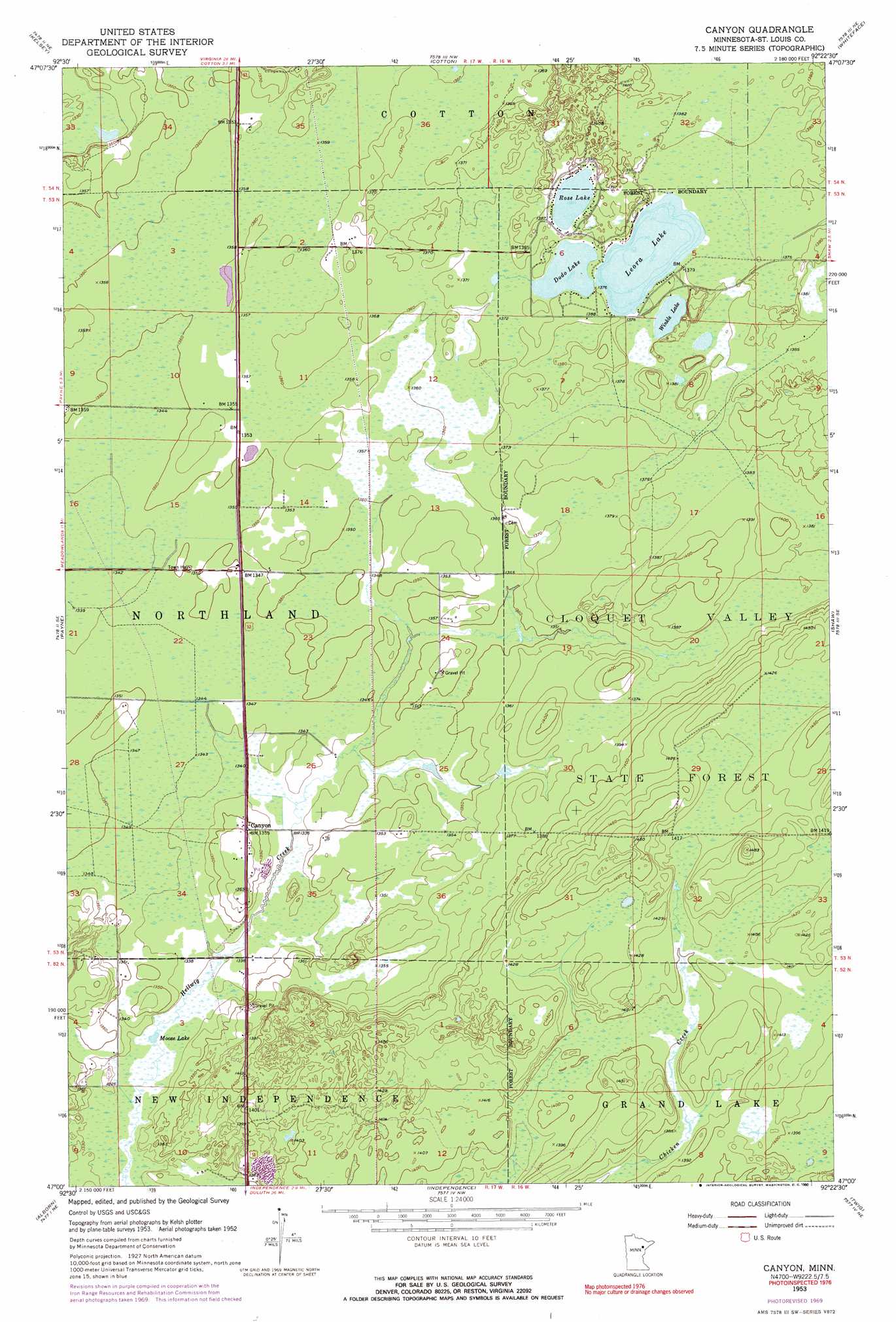
USGS Topo Quad 47092a4 - 1:24,000 scale
| Topo Map Name: | Canyon |
| USGS Topo Quad ID: | 47092a4 |
| Print Size: | ca. 21 1/4" wide x 27" high |
| Southeast Coordinates: | 47° N latitude / 92.375° W longitude |
| Map Center Coordinates: | 47.0625° N latitude / 92.4375° W longitude |
| U.S. State: | MN |
| Filename: | o47092a4.jpg |
| Download Map JPG Image: | Canyon topo map 1:24,000 scale |
| Map Type: | Topographic |
| Topo Series: | 7.5´ |
| Map Scale: | 1:24,000 |
| Source of Map Images: | United States Geological Survey (USGS) |
| Alternate Map Versions: |
Canyon MN 1953, updated 1954 Download PDF Buy paper map Canyon MN 1953, updated 1964 Download PDF Buy paper map Canyon MN 1953, updated 1971 Download PDF Buy paper map Canyon MN 2010 Download PDF Buy paper map Canyon MN 2013 Download PDF Buy paper map Canyon MN 2016 Download PDF Buy paper map |
1:24,000 Topo Quads surrounding Canyon
Casco |
Zim |
Central Lakes |
Makinen |
Whiteface Reservoir |
Meadowlands Nw |
Kelsey |
Cotton |
Whiteface |
Comstock Lake |
Meadowlands |
Payne |
Canyon |
Shaw |
Boulder Lake Reservoir |
Brookston Nw |
Alborn |
Independence |
Twig |
Fredenberg |
Martin Lake |
Brookston |
Saginaw |
Adolph |
Duluth Heights |
> Back to 47092a1 at 1:100,000 scale
> Back to 47092a1 at 1:250,000 scale
> Back to U.S. Topo Maps home
Canyon topo map: Gazetteer
Canyon: Lakes
Dodo Lake elevation 418m 1371′Leora Lake elevation 418m 1371′
Moose Lake elevation 405m 1328′
Rose Lake elevation 421m 1381′
Winkle Lake elevation 420m 1377′
Canyon: Populated Places
Canyon elevation 413m 1354′Canyon: Post Offices
Canyon Post Office elevation 413m 1354′Canyon digital topo map on disk
Buy this Canyon topo map showing relief, roads, GPS coordinates and other geographical features, as a high-resolution digital map file on DVD: