Dewey Lake Nw Topo Map Minnesota
To zoom in, hover over the map of Dewey Lake Nw
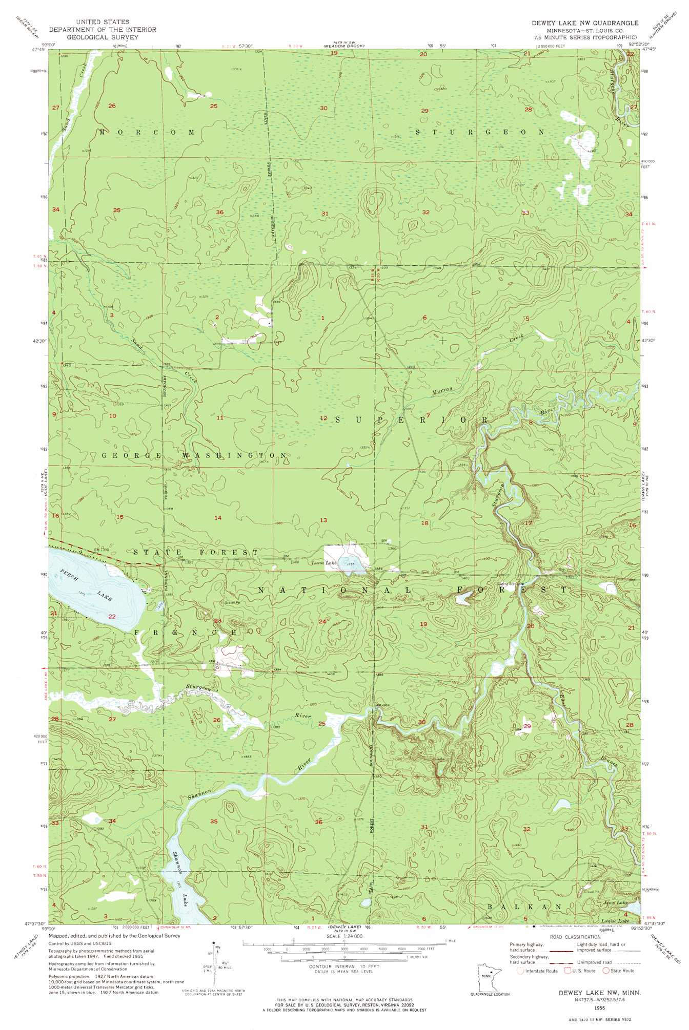
USGS Topo Quad 47092f8 - 1:24,000 scale
| Topo Map Name: | Dewey Lake Nw |
| USGS Topo Quad ID: | 47092f8 |
| Print Size: | ca. 21 1/4" wide x 27" high |
| Southeast Coordinates: | 47.625° N latitude / 92.875° W longitude |
| Map Center Coordinates: | 47.6875° N latitude / 92.9375° W longitude |
| U.S. State: | MN |
| Filename: | o47092f8.jpg |
| Download Map JPG Image: | Dewey Lake Nw topo map 1:24,000 scale |
| Map Type: | Topographic |
| Topo Series: | 7.5´ |
| Map Scale: | 1:24,000 |
| Source of Map Images: | United States Geological Survey (USGS) |
| Alternate Map Versions: |
Dewey Lake NW MN 1955, updated 1956 Download PDF Buy paper map Dewey Lake NW MN 1955, updated 1974 Download PDF Buy paper map Dewey Lake NW MN 1955, updated 1985 Download PDF Buy paper map Dewey Lake NW MN 2011 Download PDF Buy paper map Dewey Lake NW MN 2013 Download PDF Buy paper map Dewey Lake NW MN 2016 Download PDF Buy paper map |
| FStopo: | US Forest Service topo Dewey Lake NW is available: Download FStopo PDF Download FStopo TIF |
1:24,000 Topo Quads surrounding Dewey Lake Nw
Rauch |
Silverdale |
Gheen Nw |
Gheen |
Haley |
Togo |
Bear River |
Meadow Brook |
Linden Grove |
Cook |
Sherry Lake |
Side Lake |
Dewey Lake Nw |
Dark Lake |
Idington |
O'Leary Lake |
Stingy Lake |
Dewey Lake |
Dewey Lake Se |
Kinney |
Nashwauk |
Keewatin |
Hibbing |
Buhl |
Kirk |
> Back to 47092e1 at 1:100,000 scale
> Back to 47092a1 at 1:250,000 scale
> Back to U.S. Topo Maps home
Dewey Lake Nw topo map: Gazetteer
Dewey Lake Nw: Lakes
Jean Lake elevation 428m 1404′Luna Lake elevation 414m 1358′
Perch Lake elevation 419m 1374′
Shannon Lake elevation 416m 1364′
Dewey Lake Nw: Streams
East Branch Sturgeon River elevation 401m 1315′Shannon River elevation 417m 1368′
Dewey Lake Nw digital topo map on disk
Buy this Dewey Lake Nw topo map showing relief, roads, GPS coordinates and other geographical features, as a high-resolution digital map file on DVD: