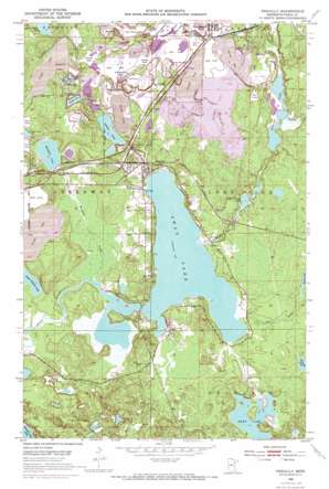
Pengilly Topo Map Minnesota
To zoom in, hover over the map of Pengilly
USGS Topo Quad 47093c2 - 1:24,000 scale
| Topo Map Name: | Pengilly |
| USGS Topo Quad ID: | 47093c2 |
| Print Size: | ca. 21 1/4" wide x 27" high |
| Southeast Coordinates: | 47.25° N latitude / 93.125° W longitude |
| Map Center Coordinates: | 47.3125° N latitude / 93.1875° W longitude |
| U.S. State: | MN |
| Filename: | o47093c2.jpg |
| Download Map JPG Image: | Pengilly topo map 1:24,000 scale |
| Map Type: | Topographic |
| Topo Series: | 7.5´ |
| Map Scale: | 1:24,000 |
| Source of Map Images: | United States Geological Survey (USGS) |
| Alternate Map Versions: |
Pengilly MN 1952, updated 1954 Download PDF Buy paper map Pengilly MN 1952, updated 1971 Download PDF Buy paper map Pengilly MN 1952, updated 1973 Download PDF Buy paper map Pengilly MN 2010 Download PDF Buy paper map Pengilly MN 2013 Download PDF Buy paper map Pengilly MN 2016 Download PDF Buy paper map |
1:24,000 Topo Quads surrounding Pengilly
> Back to 47093a1 at 1:100,000 scale
> Back to 47092a1 at 1:250,000 scale
> Back to U.S. Topo Maps home
Pengilly topo map: Gazetteer
Pengilly: Dams
Butler Taconite Initial Tailings Dike elevation 430m 1410′Charter Dam elevation 414m 1358′
Patrick Stilling Dike elevation 428m 1404′
Pengilly: Lakes
Hart Lake elevation 409m 1341′Lammon Aid Lake elevation 398m 1305′
Little O'Brien Lake elevation 409m 1341′
Little Sucker Lake elevation 423m 1387′
Moose Lake elevation 411m 1348′
Nameless Lake elevation 418m 1371′
O'Brien Lake elevation 412m 1351′
Ox Hide Lake elevation 411m 1348′
Snowball Lake elevation 413m 1354′
Swan Lake elevation 407m 1335′
Pengilly: Mines
Ann Mine elevation 443m 1453′Draper Annex Mine elevation 425m 1394′
Harrison Mine elevation 444m 1456′
Helen Mine elevation 454m 1489′
Kevin Mine elevation 448m 1469′
Langdom Mine elevation 423m 1387′
North Harrison Mine elevation 454m 1489′
Patrick Annex Mine elevation 432m 1417′
Patrick Mine elevation 458m 1502′
Snyder Mine elevation 444m 1456′
South Ann Mine elevation 448m 1469′
Sullivan Mine elevation 438m 1437′
West Patrick Mine elevation 433m 1420′
Pengilly: Parks
Snowball Lake Wayside Park elevation 417m 1368′Swan Lake Wayside Park elevation 430m 1410′
Pengilly: Populated Places
Cooley elevation 441m 1446′Cort elevation 426m 1397′
Jurgenson elevation 418m 1371′
Kevin elevation 433m 1420′
Pengilly elevation 416m 1364′
Pengilly: Post Offices
Cooley Post Office elevation 435m 1427′Cort Post Office (historical) elevation 425m 1394′
Pengrilly Post Office elevation 418m 1371′
Pengilly: Reservoirs
Butler Taconite Initial Tails BA elevation 430m 1410′Patrick Stilling Basin elevation 428m 1404′
Swan Lake elevation 414m 1358′
Pengilly: Streams
Hay Creek elevation 407m 1335′O'Brien Creek elevation 407m 1335′
Oxhide Creek elevation 407m 1335′
Pickerel Creek elevation 407m 1335′
Snowball Creek elevation 407m 1335′
Welcome Creek elevation 413m 1354′
Pengilly digital topo map on disk
Buy this Pengilly topo map showing relief, roads, GPS coordinates and other geographical features, as a high-resolution digital map file on DVD:


