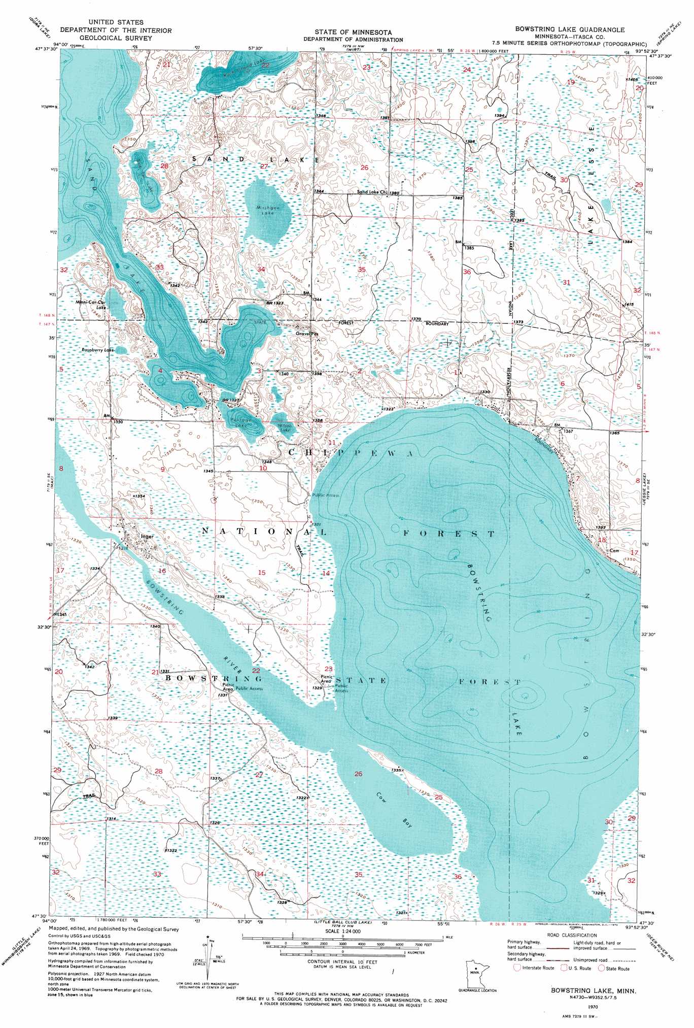
Bowstring Lake Topo Map Minnesota
To zoom in, hover over the map of Bowstring Lake
USGS Topo Quad 47093e8 - 1:24,000 scale
| Topo Map Name: | Bowstring Lake |
| USGS Topo Quad ID: | 47093e8 |
| Print Size: | ca. 21 1/4" wide x 27" high |
| Southeast Coordinates: | 47.5° N latitude / 93.875° W longitude |
| Map Center Coordinates: | 47.5625° N latitude / 93.9375° W longitude |
| U.S. State: | MN |
| Filename: | o47093e8.jpg |
| Download Map JPG Image: | Bowstring Lake topo map 1:24,000 scale |
| Map Type: | Topographic |
| Topo Series: | 7.5´ |
| Map Scale: | 1:24,000 |
| Source of Map Images: | United States Geological Survey (USGS) |
| Alternate Map Versions: |
Bowstring Lake MN 1970, updated 1973 Download PDF Buy paper map Bowstring Lake MN 1996, updated 1998 Download PDF Buy paper map Bowstring Lake MN 2011 Download PDF Buy paper map Bowstring Lake MN 2013 Download PDF Buy paper map Bowstring Lake MN 2016 Download PDF Buy paper map |
| FStopo: | US Forest Service topo Bowstring Lake is available: Download FStopo PDF Download FStopo TIF |
1:24,000 Topo Quads surrounding Bowstring Lake
Elmwood Island |
Coddington Lake |
Pomroy |
Wildwood Se |
Effie |
Squaw Lake |
Dora Lake |
Wirt |
Spring Lake |
Bigfork |
Pigeon Dam Lake |
Max |
Bowstring Lake |
Jessie Lake |
Marcell |
Bena Nw |
Little Winnibigoshish Lake |
Little Ball Club Lake |
Deer River Ne |
Little Bowstring Lake |
Bena |
Nushka Lake |
Ball Club |
Deer River |
Cohasset West |
> Back to 47093e1 at 1:100,000 scale
> Back to 47092a1 at 1:250,000 scale
> Back to U.S. Topo Maps home
Bowstring Lake topo map: Gazetteer
Bowstring Lake: Bays
Cow Bay elevation 403m 1322′Bowstring Lake: Forests
Chippewa National Forest elevation 418m 1371′Bowstring Lake: Lakes
Birds Eye Lake elevation 403m 1322′Bowstring Lake elevation 403m 1322′
Minni-Car-Car Lake elevation 403m 1322′
Mushgee Lake elevation 405m 1328′
Portage Lake elevation 403m 1322′
Raspberry Lake elevation 404m 1325′
Rush Island Lake elevation 403m 1322′
Wilson Lake elevation 403m 1322′
Bowstring Lake: Populated Places
Inger elevation 406m 1332′Bowstring Lake: Post Offices
Inger Post Office (historical) elevation 407m 1335′Bowstring Lake: Ranges
Mesabi Range elevation 403m 1322′Bowstring Lake digital topo map on disk
Buy this Bowstring Lake topo map showing relief, roads, GPS coordinates and other geographical features, as a high-resolution digital map file on DVD: