Horsehead Lake Topo Map Minnesota
To zoom in, hover over the map of Horsehead Lake
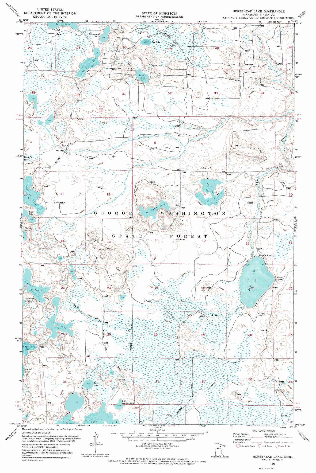
USGS Topo Quad 47093f3 - 1:24,000 scale
| Topo Map Name: | Horsehead Lake |
| USGS Topo Quad ID: | 47093f3 |
| Print Size: | ca. 21 1/4" wide x 27" high |
| Southeast Coordinates: | 47.625° N latitude / 93.25° W longitude |
| Map Center Coordinates: | 47.6875° N latitude / 93.3125° W longitude |
| U.S. State: | MN |
| Filename: | o47093f3.jpg |
| Download Map JPG Image: | Horsehead Lake topo map 1:24,000 scale |
| Map Type: | Topographic |
| Topo Series: | 7.5´ |
| Map Scale: | 1:24,000 |
| Source of Map Images: | United States Geological Survey (USGS) |
| Alternate Map Versions: |
Horsehead Lake MN 1971, updated 1973 Download PDF Buy paper map Horsehead Lake MN 2010 Download PDF Buy paper map Horsehead Lake MN 2013 Download PDF Buy paper map Horsehead Lake MN 2016 Download PDF Buy paper map |
1:24,000 Topo Quads surrounding Horsehead Lake
Craigville |
Deer Lake Nw |
Deer Lake Ne |
Rauch |
Silverdale |
Effie Se |
Deer Lake West |
Deer Lake East |
Togo |
Bear River |
Coon Lake |
Anderson Lake |
Horsehead Lake |
Sherry Lake |
Side Lake |
Clubhouse Lake |
Balsam Lake |
Hartley Lake |
O'Leary Lake |
Stingy Lake |
Wabana Lake |
Lawrence Lake West |
Lawrence Lake East |
Nashwauk |
Keewatin |
> Back to 47093e1 at 1:100,000 scale
> Back to 47092a1 at 1:250,000 scale
> Back to U.S. Topo Maps home
Horsehead Lake topo map: Gazetteer
Horsehead Lake: Lakes
Bass Lake elevation 419m 1374′Bear Lake elevation 411m 1348′
Eve Lake elevation 429m 1407′
Klingenpiel Lake elevation 424m 1391′
Little Bear Lake elevation 413m 1354′
Little Wasson Lake elevation 421m 1381′
May Lake elevation 422m 1384′
Napoleon Lake elevation 422m 1384′
Otter Lake elevation 421m 1381′
Pickle Lake elevation 422m 1384′
Rat Lake elevation 426m 1397′
Tuber Lake elevation 423m 1387′
Walters Lake elevation 422m 1384′
Wasson Lake elevation 419m 1374′
Wilson Lake elevation 425m 1394′
Horsehead Lake: Trails
Wasson Lake Trail elevation 419m 1374′Wilson Lake Trail elevation 424m 1391′
Horsehead Lake digital topo map on disk
Buy this Horsehead Lake topo map showing relief, roads, GPS coordinates and other geographical features, as a high-resolution digital map file on DVD: