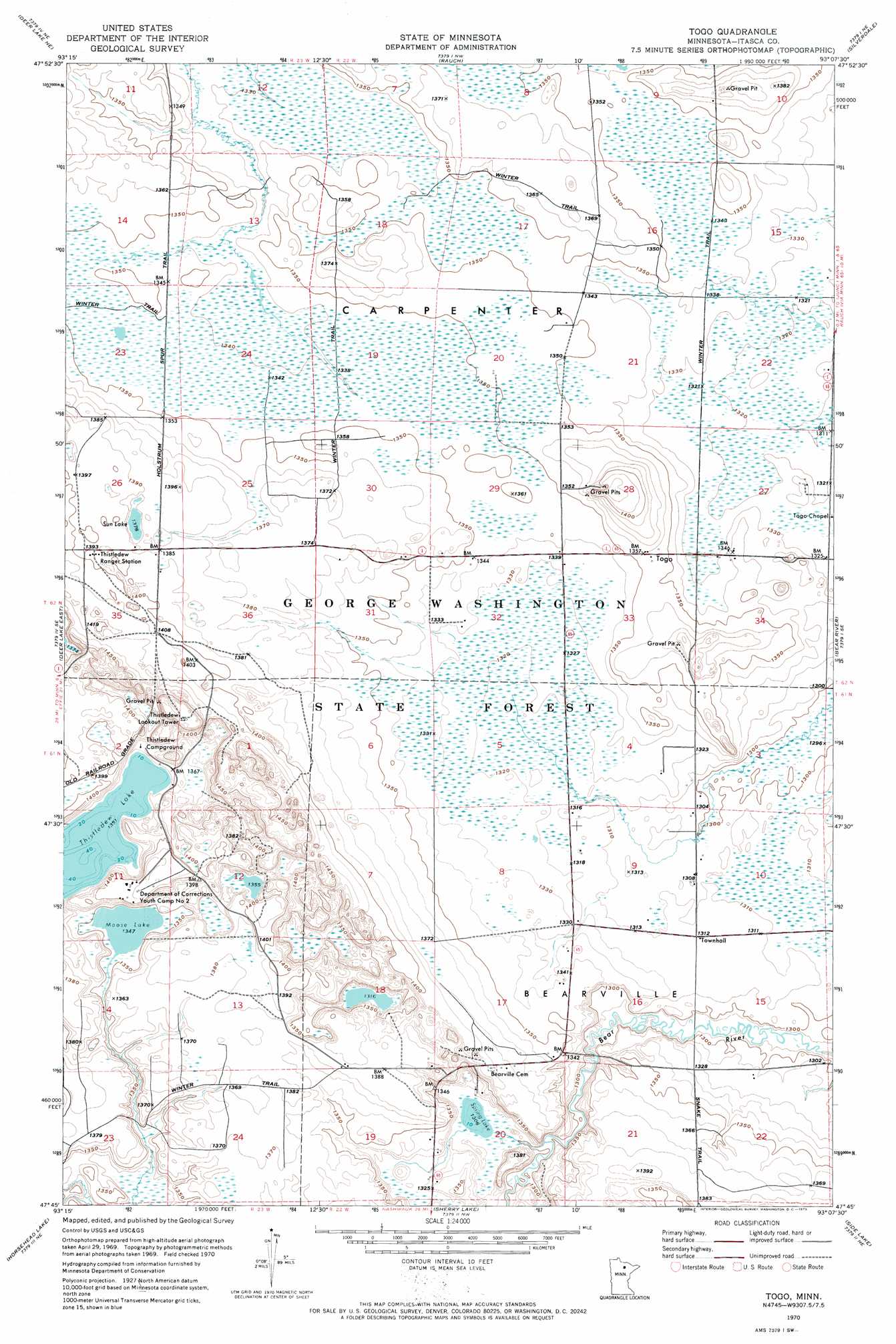
Togo Topo Map Minnesota
To zoom in, hover over the map of Togo
USGS Topo Quad 47093g2 - 1:24,000 scale
| Topo Map Name: | Togo |
| USGS Topo Quad ID: | 47093g2 |
| Print Size: | ca. 21 1/4" wide x 27" high |
| Southeast Coordinates: | 47.75° N latitude / 93.125° W longitude |
| Map Center Coordinates: | 47.8125° N latitude / 93.1875° W longitude |
| U.S. State: | MN |
| Filename: | o47093g2.jpg |
| Download Map JPG Image: | Togo topo map 1:24,000 scale |
| Map Type: | Topographic |
| Topo Series: | 7.5´ |
| Map Scale: | 1:24,000 |
| Source of Map Images: | United States Geological Survey (USGS) |
| Alternate Map Versions: |
Togo MN 1970, updated 1973 Download PDF Buy paper map Togo MN 2010 Download PDF Buy paper map Togo MN 2013 Download PDF Buy paper map Togo MN 2016 Download PDF Buy paper map |
1:24,000 Topo Quads surrounding Togo
Nett Lake River Sw |
Nett Lake River Se |
Nett Lake Sw |
Nett Lake |
Orr Sw |
Deer Lake Nw |
Deer Lake Ne |
Rauch |
Silverdale |
Gheen Nw |
Deer Lake West |
Deer Lake East |
Togo |
Bear River |
Meadow Brook |
Anderson Lake |
Horsehead Lake |
Sherry Lake |
Side Lake |
Dewey Lake Nw |
Balsam Lake |
Hartley Lake |
O'Leary Lake |
Stingy Lake |
Dewey Lake |
> Back to 47093e1 at 1:100,000 scale
> Back to 47092a1 at 1:250,000 scale
> Back to U.S. Topo Maps home
Togo topo map: Gazetteer
Togo: Lakes
Moose Lake elevation 412m 1351′Spring Lake elevation 398m 1305′
Sun Lake elevation 420m 1377′
Thistledew Lake elevation 412m 1351′
Togo: Populated Places
Togo elevation 414m 1358′Togo: Post Offices
Togo Post Office elevation 414m 1358′Togo digital topo map on disk
Buy this Togo topo map showing relief, roads, GPS coordinates and other geographical features, as a high-resolution digital map file on DVD: