Deer Lake West Topo Map Minnesota
To zoom in, hover over the map of Deer Lake West
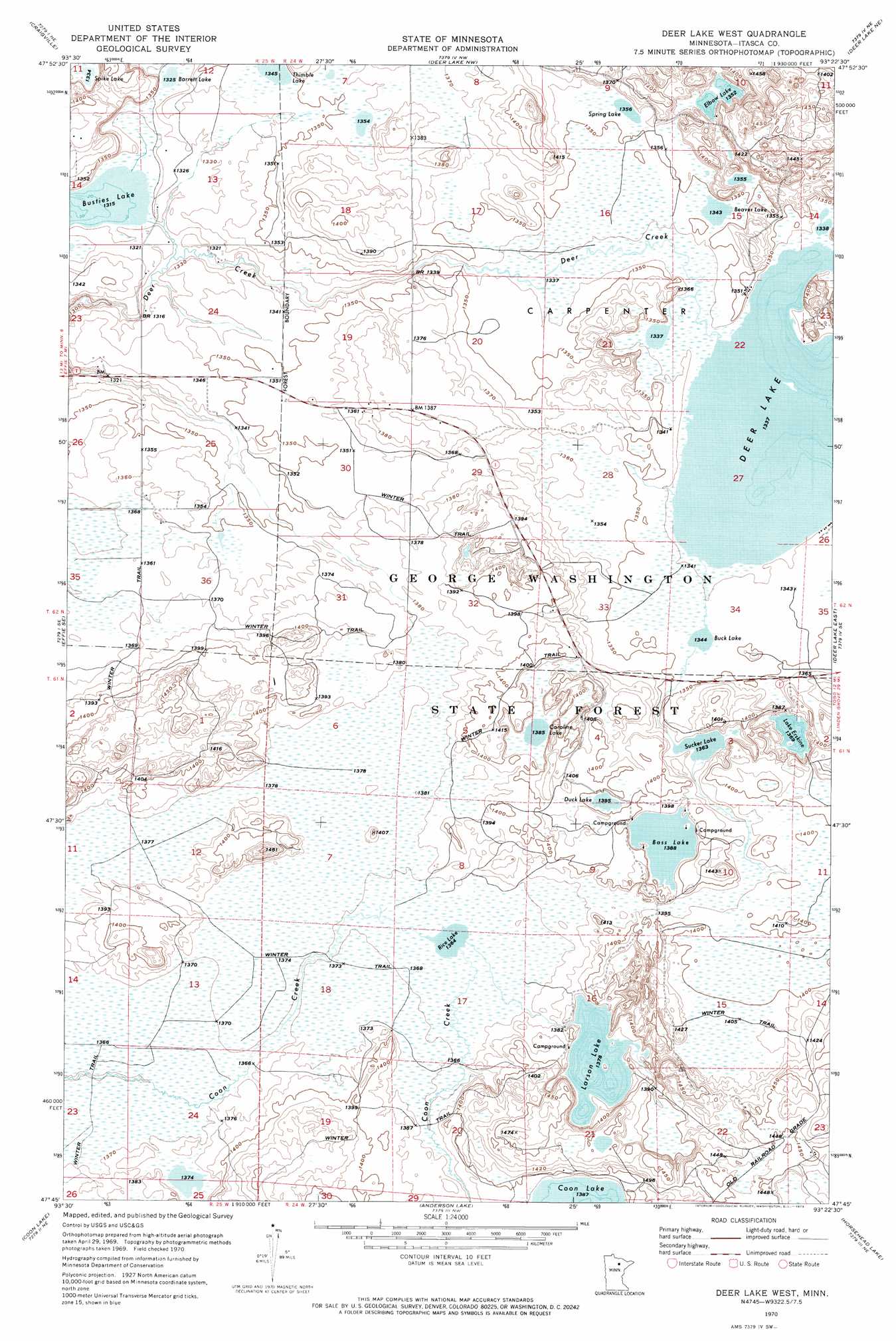
USGS Topo Quad 47093g4 - 1:24,000 scale
| Topo Map Name: | Deer Lake West |
| USGS Topo Quad ID: | 47093g4 |
| Print Size: | ca. 21 1/4" wide x 27" high |
| Southeast Coordinates: | 47.75° N latitude / 93.375° W longitude |
| Map Center Coordinates: | 47.8125° N latitude / 93.4375° W longitude |
| U.S. State: | MN |
| Filename: | o47093g4.jpg |
| Download Map JPG Image: | Deer Lake West topo map 1:24,000 scale |
| Map Type: | Topographic |
| Topo Series: | 7.5´ |
| Map Scale: | 1:24,000 |
| Source of Map Images: | United States Geological Survey (USGS) |
| Alternate Map Versions: |
Deer Lake West MN 1970, updated 1973 Download PDF Buy paper map Deer Lake West MN 2010 Download PDF Buy paper map Deer Lake West MN 2013 Download PDF Buy paper map Deer Lake West MN 2016 Download PDF Buy paper map |
1:24,000 Topo Quads surrounding Deer Lake West
Johnson Landing |
Johnson Landing Se |
Nett Lake River Sw |
Nett Lake River Se |
Nett Lake Sw |
Effie Nw |
Craigville |
Deer Lake Nw |
Deer Lake Ne |
Rauch |
Effie |
Effie Se |
Deer Lake West |
Deer Lake East |
Togo |
Bigfork |
Coon Lake |
Anderson Lake |
Horsehead Lake |
Sherry Lake |
Marcell |
Clubhouse Lake |
Balsam Lake |
Hartley Lake |
O'Leary Lake |
> Back to 47093e1 at 1:100,000 scale
> Back to 47092a1 at 1:250,000 scale
> Back to U.S. Topo Maps home
Deer Lake West topo map: Gazetteer
Deer Lake West: Dams
Busties Lake Dam elevation 403m 1322′Deer Creek Dam elevation 410m 1345′
Deer Lake West: Lakes
Barrett Lake elevation 404m 1325′Bass Lake elevation 423m 1387′
Beaver Lake elevation 410m 1345′
Buck Lake elevation 410m 1345′
Busties Lake elevation 401m 1315′
Caroline Lake elevation 422m 1384′
Deer Lake elevation 408m 1338′
Duck Lake elevation 425m 1394′
Elbow Lake elevation 413m 1354′
Lake Erskine elevation 418m 1371′
Larson Lake elevation 420m 1377′
Rice Lake elevation 416m 1364′
Spike Lake elevation 407m 1335′
Spring Lake elevation 414m 1358′
Sucker Lake elevation 416m 1364′
Deer Lake West: Reservoirs
Busties Lake elevation 403m 1322′Deer Lake West digital topo map on disk
Buy this Deer Lake West topo map showing relief, roads, GPS coordinates and other geographical features, as a high-resolution digital map file on DVD: