Effie Topo Map Minnesota
To zoom in, hover over the map of Effie
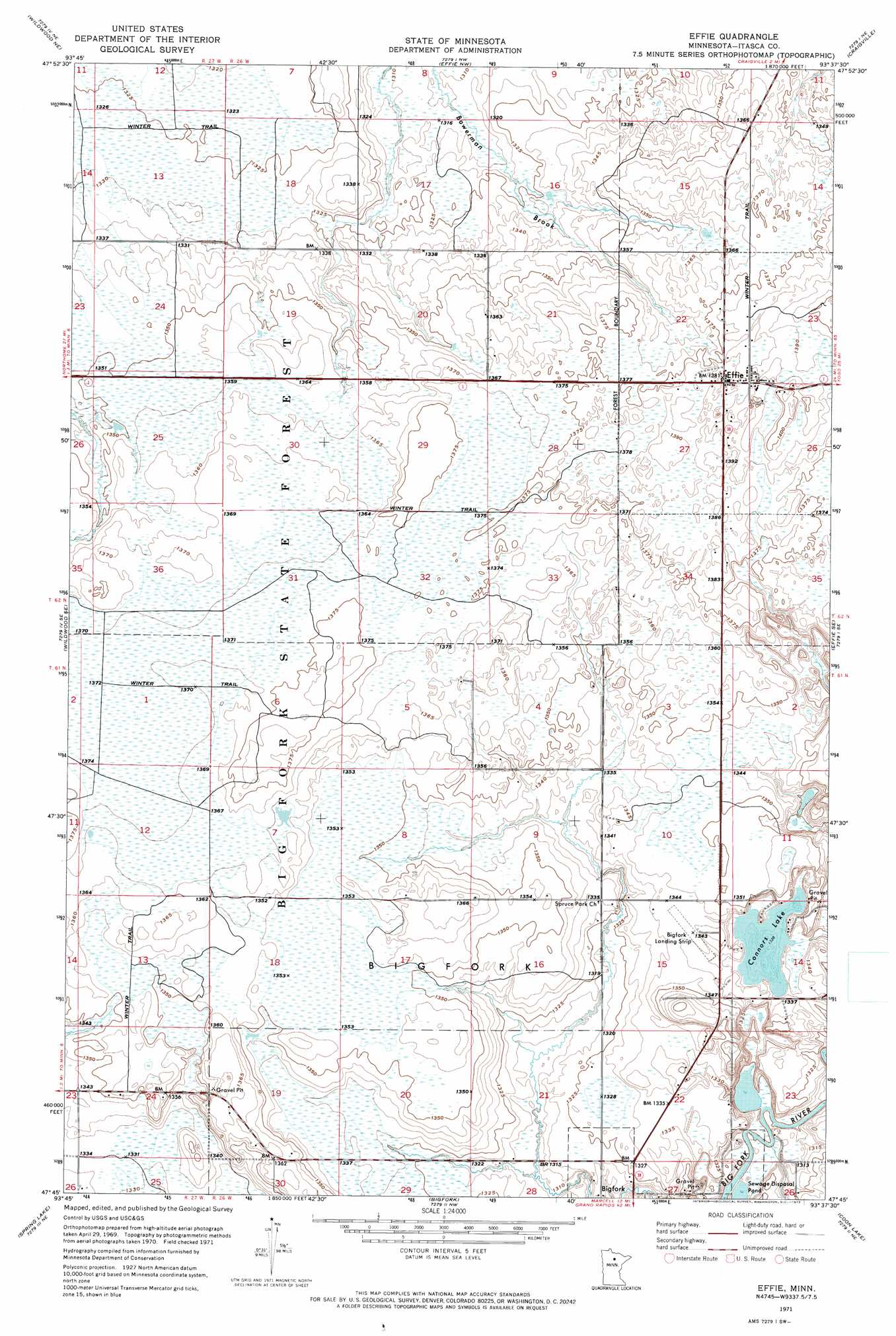
USGS Topo Quad 47093g6 - 1:24,000 scale
| Topo Map Name: | Effie |
| USGS Topo Quad ID: | 47093g6 |
| Print Size: | ca. 21 1/4" wide x 27" high |
| Southeast Coordinates: | 47.75° N latitude / 93.625° W longitude |
| Map Center Coordinates: | 47.8125° N latitude / 93.6875° W longitude |
| U.S. State: | MN |
| Filename: | o47093g6.jpg |
| Download Map JPG Image: | Effie topo map 1:24,000 scale |
| Map Type: | Topographic |
| Topo Series: | 7.5´ |
| Map Scale: | 1:24,000 |
| Source of Map Images: | United States Geological Survey (USGS) |
| Alternate Map Versions: |
Effie MN 1971, updated 1973 Download PDF Buy paper map Effie MN 2010 Download PDF Buy paper map Effie MN 2013 Download PDF Buy paper map Effie MN 2016 Download PDF Buy paper map |
1:24,000 Topo Quads surrounding Effie
Margie |
Big Falls Se |
Johnson Landing |
Johnson Landing Se |
Nett Lake River Sw |
Wildwood |
Wildwood Ne |
Effie Nw |
Craigville |
Deer Lake Nw |
Pomroy |
Wildwood Se |
Effie |
Effie Se |
Deer Lake West |
Wirt |
Spring Lake |
Bigfork |
Coon Lake |
Anderson Lake |
Bowstring Lake |
Jessie Lake |
Marcell |
Clubhouse Lake |
Balsam Lake |
> Back to 47093e1 at 1:100,000 scale
> Back to 47092a1 at 1:250,000 scale
> Back to U.S. Topo Maps home
Effie topo map: Gazetteer
Effie: Airports
Bigfork Municipal Airport elevation 409m 1341′Effie: Lakes
Connors Lake elevation 405m 1328′Effie: Populated Places
Effie elevation 423m 1387′Effie: Post Offices
Effie Post Office (historical) elevation 421m 1381′Evergreen Post Office (historical) elevation 412m 1351′
Effie digital topo map on disk
Buy this Effie topo map showing relief, roads, GPS coordinates and other geographical features, as a high-resolution digital map file on DVD: