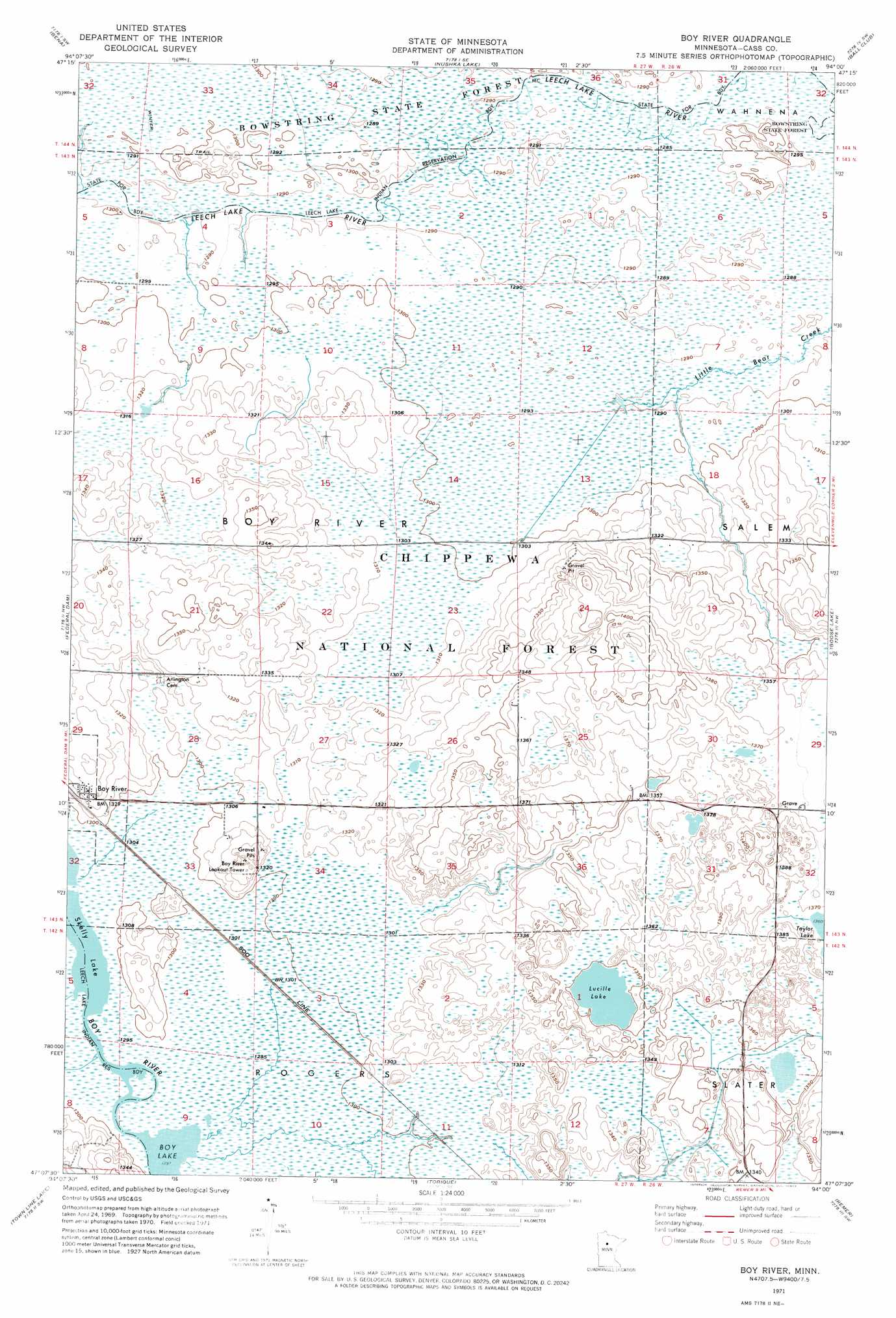
Boy River Topo Map Minnesota
To zoom in, hover over the map of Boy River
USGS Topo Quad 47094b1 - 1:24,000 scale
| Topo Map Name: | Boy River |
| USGS Topo Quad ID: | 47094b1 |
| Print Size: | ca. 21 1/4" wide x 27" high |
| Southeast Coordinates: | 47.125° N latitude / 94° W longitude |
| Map Center Coordinates: | 47.1875° N latitude / 94.0625° W longitude |
| U.S. State: | MN |
| Filename: | p47094b1.jpg |
| Download Map JPG Image: | Boy River topo map 1:24,000 scale |
| Map Type: | Orthophoto |
| Topo Series: | 7.5´ |
| Map Scale: | 1:24,000 |
| Source of Map Images: | United States Geological Survey (USGS) |
| Alternate Map Versions: |
Boy River MN 1971, updated 1974 Download PDF Buy paper map Boy River MN 1996, updated 1998 Download PDF Buy paper map Boy River MN 2011 Download PDF Buy paper map Boy River MN 2013 Download PDF Buy paper map Boy River MN 2016 Download PDF Buy paper map |
| FStopo: | US Forest Service topo Boy River is available: Download FStopo PDF Download FStopo TIF |
1:24,000 Topo Quads surrounding Boy River
Raven Lake |
Bena Nw |
Little Winnibigoshish Lake |
Little Ball Club Lake |
Deer River Ne |
Portage Lake |
Bena |
Nushka Lake |
Ball Club |
Deer River |
Sugar Point |
Federal Dam |
Boy River |
Goose Lake |
Sugar Lake |
Whipholt |
Town Line Lake |
Tobique |
Remer |
Shingle Mill Lake |
Woman Lake |
Longville |
Laura Lake |
Thunder Lake |
Shovel Lake |
> Back to 47094a1 at 1:100,000 scale
> Back to 47094a1 at 1:250,000 scale
> Back to U.S. Topo Maps home
Boy River topo map: Gazetteer
Boy River: Lakes
Lucille Lake elevation 410m 1345′Boy River: Populated Places
Boy River elevation 406m 1332′Boy River: Post Offices
Boy River Post Office elevation 406m 1332′Gould Post Office (historical) elevation 396m 1299′
Boy River digital topo map on disk
Buy this Boy River topo map showing relief, roads, GPS coordinates and other geographical features, as a high-resolution digital map file on DVD: